
Manthey's Isle Royale Journal
This is an excerpt from my Isle Royale journal. Parts have been removed and/or added from my original handwritten text to aid readability. At this point I have already flown via commercial air to the town of Houghton, Michigan, located in the Keweenaw Peninsula (part of Michigan's Upper Peninsula).
This text is Copyright 1997 by David Manthey. All rights reserved.
For more information on the island, see this excellent Isle Royale site.
 Friday - The ship boarded at quarter to nine, and set sail promptly at nine. All of 17 passengers today in a ship whose capacity is 120 or so. The ship's length is 153 feet, which is the largest vessel I think I have ever been in that was moving. The ship first travels up a canal/waterway from Houghton to the Lake. This is very pretty, but it began to rain. After about an hour, we entered the Lake, and an hour more and we were out of sight of land (the rain helped with that). We spotted Isle Royale at 1:30 or 2:00, and were at Mott Island at 2:45. This was a 15 minute cargo transfer stop while the Park residence area was resupplied. A short 30 minute passage brought us then to Snug harbor (a.k.a., Rock Harbor Lodge, et al.).
While still on the boat, I got my backcountry permit. This was a simple form asking where I would spend each night. The purser described the trails as hard and to expect them to be much rougher than I'm used to (we'll see). I filed an itinerary which had everything from 6 to 14 mile days. He thought it was a bit much. Ah, well, it is not fixed down.
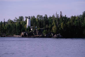
 Rock Harbor is actually a passage between a group of islands and the Island which is very beautiful. We entered this waterway right near a lighthouse which was picturesque. Snug Harbor (usually referred to as Rock Harbor) is fairly typical as far as park lodge areas go. There is a convenience store and a set of docks (including a big one for the M. V. Ranger III). I obtained white gas from the dock attendant, then set off to hike. Actually, before I started I was approached by a grad student from U. Minnesota asking if I would fill out a questionnaire on my hike. I consented, despite the weight penalty (it's a thick questionnaire).
The trail to Three Mile campground is the Rock Harbor Trail. This is a wide, easy path with pleasant rocks and roots which meanders along the shoreline. It passes by Rock Harbor campground (a hive of activity), then heads west. Once past Rock Harbor, I didn't see anyone on the trail. A side trail called Suzy's Cave looked inviting, and I ran a few hundred feet up it.
Three Mile campground has a huge dock, a half dozen shelters, and three or four campsites. I chose an empty campsite. My tent took the usual 5 minute setup. The campsite has a picnic table (at which I currently sit) from which I have a nice view of the eastern tip of Mott Island. Power boats keep zooming back or forth, which is sort of irritating. The questionnaire is a fairly well designed one, but too volumous (not too many questions, just too much paper). I am kind of tired and will likely retire as soon as it gets dark (8:30ish).
Saturday - It rained intermittently overnight and up to about 11:30 a.m. I had left some flaps on the tent open half the night, so got some dampness inside. I made my lovely oatmeal breakfast around 7:30 or 8, then went back to my tent to wait out the rain.
I finally packed up the tent (very wet) and set out on the trail just before ten. I made fantastic time, averaging better than 2 mph. Easy trail with a nice view of Rock Harbor (though I had my glasses off much of the time due to the rain). The trail passes Siskiwit Mine, which is mainly a collection of old pits. It was raining, so I didn't investigate. I passed 3 groups of 2 people on the way to Daisy Farm campground.
I lunched at Daisy Farm. There is a group picnic area which I availed myself of. Lunch was (and will be for the rest of this trip) Ritz crackers and peanut butter. Not interesting, but reasonably filling. Some of the crackers didn't make it, but in general things were in reasonable shape.
I went down to the campground dock, mainly to fill my water bottle. Saw two very nice ducks swimming there, and wished I had the camera (which has been in my pack), but didn't bother to get it.
I started up on the Daisy Farm Trail. Despite easy going, I am still somewhat hesitant about final speed based on what the purser said. I saw M. Renard on the trail - just a flash of red and he's gone. I also startled a moose, which upon nearing beat a hasty retreat.
 The Daisy Farm Trail went over a small rise, down a little dell, then up to the Greenstone Ridge Trail. At the junction there were four guys, whom I passed at speed. Later I stopped for a snack, and they passed me. Almost as soon as I left my snack spot, I passed them again. Excellent vistas of distant islands, the Lake, and lovely boreal scenes.
Before long, I came to the side trail to East Chickenbone Lake (a terrible sounding name). I am making very good time, the trail being pretty flat and about like the AT in Massachusetts. I proceeded on to West Chickenbone Lake campground, not looking at too much. My boots are damp from the morning rain, and I am eager to camp. I arrive at the campground at 4 p.m. and pitch my tent.
Sometime later, I prepare a mediocre meal. A cold wind is blowing off the lake, which, although drying my tent, is still cold. I sit in my tent until my hand cramps from writing, whereupon I go to sleep.
Sunday - A good, if late, morning. The tent is dry (and now tight as a drum, perfectly pitched). The oatmeal is okay. I'm packed and READY! to go at 9:30. The sole other denizen (an old man) of the campground is heading out just when I am. He came from where I'm heading tonight. We both tell the other that fine trail lines ahead, and set out.
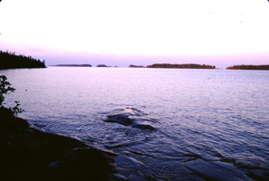
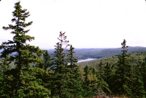
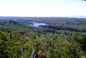
It has yet to be sunny on this trip (except in Houghton), but I am still happy. My pack feels good, and I woke and left to the trill of loons. After a short jaunt, I stop for a granola bar and to take out my camera. Here the trail is on top of a (comparatively) high ridge with excellent views of Siskiwit Lake and Ryan Island (the largest island on the largest lake on the largest Island on the largest Lake).
 As I hike along, I spot a giant bird unfold itself - a great blue heron. I am wearing my camera on my chest, and, after a moment of awe, take two pictures of the mighty animal. Around 11:45, I stop for another delectable lunch, whereupon I put the camera away. It looks too much like rain.
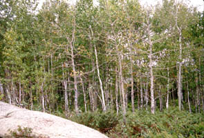
The birch forest is the loveliest I have ever seen, and is a sheer joy just to walk through. I stop and examine everything from birch trees to the dried husks of two dead insects. I proceed on down the path. At the junction for Malone Bay is a fire tower/ranger station. This is but one flight of stairs above the ground, and is an enclosed room in good repair with a catwalk on all sides. Clearly a functional antenna protrudes from the roof, and a chain prohibits entrance. Kind of cool and an eyesore all at once.
It is but an hour and a half to Lake Desor, of which various body subsystems are glad. No sooner am I sitting at my campsite, taking a breather before setting up, than an older fellow stops by. He's staying a group site #1, which has a beach. We talk for a bit. He's from Duluth, and has been here at least three years in a row. I set up camp, fetch water, etc. Lake Desor looks cleaner and is warmer than Chickenbone Lake.
 Monday - Rain! I woke around 5, answered nature, and noticed that it was still overcast. No concern yet. I returned to the tent until sevenish, had a leisurely breakfast (oatmeal again), and started packing. When all I had left to do was strike the tent, fill the canteens, and roll the Thermarest, it began to rain.
I retreated to the tent (leaving only the water bottles outside) to wait it out. I read. It did not let up for quite some time. The tent is now filthy-filthy from the spatter. 'Round about 11, 12, and 2, I poked my head out, whereupon it began raining again. I ate my almonds, finished the book, and took a nap. At this point the rain stopped, but too late to make it to Windigo (my theoretical destination for the day, had I been hiking). Alas.
I decided to stick it out here for another night. After all, the rest was pleasant, and the loon calls were unmatched. I'm changing my planned itinerary to exclude Windigo and to include some of Minong Ridge.
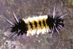 I saw several different caterpillars, and photographed an exceptionally fuzzy one with black and gold trim and silver spikes at the head and tail.
I cooked some clam chowder for dinner, which brought M. Renard to my site. He cocked his head and asked for a handout, but I explained the park policy of no mendicants, and he went on his way. Too quick for me to get my camera, it was all very civilized.
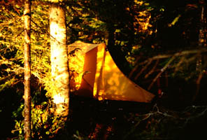
It was getting dark around 8, so I thought I'd prepare for the night. To my delight, it suddenly became three to four stops brighter. Down at the lake, the sun had emerged from behind the clouds and was a streak of fire upon the water. I watched until she hid again, then came and tidied up the tent. To bed soon, but I hope for clear skies.
Tuesday - An overcast start, with promise to the west. I woke before seven, ate my usual breakfast (am tired of it, but it is filling and compact), prepped everything for hiking, then struck the tent. Very wet - it rained during the night, so no drying occurred - and very filthy. It's a good thing I have a lake near by, or fastidious me wouldn't be able to tolerate it.
I set off a bit past nine, deciding to go to Todd Harbor today. No sense in just backtracking along most of what I've done. Still, the first 7.something miles today will be repeat. All the bushes and grasses are very wet, and before long so are my boots. Either (a) these boots suck or (b) this batch of waterproofing doesn't work. Personally, I think it is (a). Either way, it is unpleasant.
Around noon, I walk a not-quite-trail to the north to a wide rocky ledge area. Here are wonderful views of the Lake, the distant shore (Minnesota or Canada, I'm not sure which), and a fantastic vista of Hatchet Lake (where I will soon be walking). I sat for half an hour, just enjoying the sun (at long last) and the view, plus eating lunch.
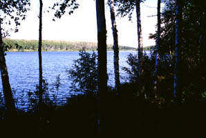
I turned off the Greenstone Ridge Trail and on to the Hatchet Lake Trail. Lovely - the lake is a deep blue streak beyond the birches. Actually reaching the lake is even prettier. I think the nicest view of the trip. Not very photogenic, as it requires the lake-scented breeze, the smell and sound of the birches, the warmth of the sun, the feel of the trail, etc. I savored it for a good long while, then proceeded.
The trail here is the closest to a "real" trail that I have found. I must occasionally look where I step. I see woodpeckers and other birds and daisies, black-eyed susans, and other flowers. I cross over small streams (always one of my favorites) and walk crosswise on wooded hills. The birches range from thin and spindly to 1 1/2 feet dbh (diameter at breast height). The air is 60�ish - perfect.
After a while - too soon - I come to the junction with the Minong Ridge Trail. This is similar, but not quite as nice. Very quickly I am at the Todd Harbor campground. After some deliberation (and a bunch of walking back and forth), I decide to set up my tent in site #1 instead of taking the single shelter. This lets my tent dry, gives more privacy, and gets me closer to the lake. The tent is ever-so-wet. Yuck.
 Along a trail from the lake access, I spot a rabbit, who lets me watch him for some time before leaving. In the lake I see fish which dart back and forth, snails, and small guppy-like fish.
I repack my pack (transferring the old used clothes to the bottom and the remaining food to the top) and then fix dinner. After this I take the canteen, my camera, and my notepad and sit in the sun on the campground dock. Eventually the sun retreats behind a cloud. I return to my campsite in time for a 2 minute rain shower, a fantastic sunset (over the Lake) including crepuscular rays up in the clouds and a distant rainstorm (hopefully not heading this way). I refill my canteens while watching the sun set, fill out the questionnaire, and retire to the tent to finish this up.
Wednesday - It either rained heavily overnight (despite it being crystal clear at two a.m. (no aurora)), or it rained lightly and there was a very heavy dew. Either way, the tent is wet again (after getting so close to drying out). A cold wind (pleasant) was blowing off the Lake, making impressive sounding breakers and a moderate surf.
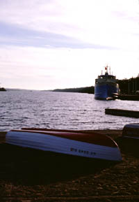
I had a leisurely morning, hoping the sun would hit the tent and dry it. It didn't, and I was on the trail by ten. Around eleven or so, I stopped at a fantastic overlook with good views of the Lake, some small islands, and some distant ships. One ship had four white booms, a white building in the back, and something dark in the front. I could see it despite miles of intervening distance.
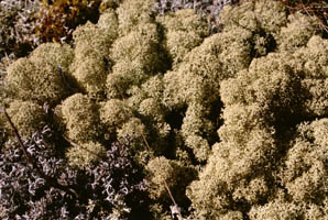
 I took pictures of lichen and of a grasshopper. The grasshopper posed very nicely for me, and I took quite a few pictures.
Almost at McCargoe Cove is a turnoff for Minong Mine. Here I ate lunch, then, leaving my pack, went to look at the mine. All I see are excavation pits and tailings piles. I don't know enough to look for something further.
McCargoe Cove is a pleasant stretch of water with a dock and shelters clustered around. A woman was fishing from the dock, but she didn't even acknowledge my presence. I proceeded on, saw two people in a canoe, either just done portaging or just turning around. At this point I was on the Indian Portage Trail, heading up to Chickenbone Lake.
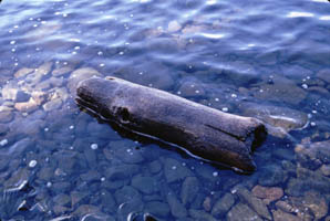
 Along the lake were many downed logs partly in the water. The first such log had five turtles, a group of three and a group of two. As soon as they heard (saw?) me, the two dove into the water, shortly followed by the other three. I kept my camera handy and got a distant picture of another turtle.
Snakes galore. Today I saw everything from a 6" pencil-thin snake to a 30", 1" diameter brute. For the most part, they just slither off out of sight as soon as I'm near.
I am camping at the Lake Richie campground. The sun has mostly dried my tent (which makes amusing creaks as it tightens). Down in the lake I saw some cool snails, including one that practically looked like it had ears. By sunset the lake is mirror smooth. This campsite is the furthest I've been from the water, but it has more to do with the campground than anything else. I am very glad I altered my proposed itinerary. This is ever more interesting.
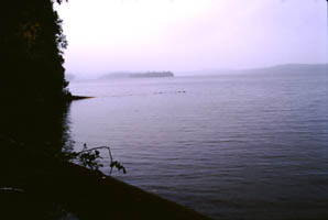
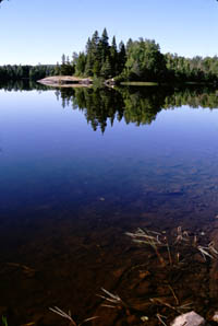 Thursday - This morning dawned wet sounding and misty, but it was just dew dripping from the trees and mist from the lake. Still no aurora, at least not at three a.m. Lake Richie was positively sheet-of-glass. It makes last night look choppy. I took some photos, watched mist dissipate, looked for snails, and generally got a late start.
The trail to Moskey Basin was easy. Moskey Basin is pretty, but two people on the dock removed some of the charm (even if they were young women). The trail from Moskey Basin to Daisy Farm is by far the roughest I've found here, meaning it is still very nice.
Now for a rant: Either (a) the people who say what the trails are like are badly delusional, or (b) they lie to the extreme. For instance, the fellow on the boat (the purser) said that the trails here were tougher than those in Vermont, and took AT through hikers once and a third as long to traverse as the same length of trail on the AT. No way, no how. The trails here are reminiscent of the AT in Connecticut or southern Massachusetts with no elevation change at all. A second instance: the book I have says the northeastern end of the Minong Ridge Trail is rough on the feet. It was a pleasant walk on solid rock. How can I possible believe that the "boggy" part of the Minong Ridge Trail is at all difficult with sources like these? I figure that these people are all from the flatlands or have worse boots than me. End of rant.
 I ate lunch in a shady glen along the trail. Very pleasant as today is unrelentingly sunny. Daisy Farm appeared before long, and I filled one canteen. The hike up Ojibway was short, almost steep, and sweaty (the sun). The tower at the top is ugly, but provides a nice view and breeze.
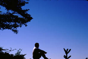
There is a very pleasant overlook at the top of Mount Franklin. Here I attempted some more pictures of myself.
The trail from the Greenstone Ridge down to Lane Cove is very nice. Not steep, but interesting. The campsite is very small, at least in terms of cleared space, but very spread out. I currently sit in the dining room area. The sunset hasn't been as spectacular as at Todd Harbor, owing to the clear skies. Can't have everything now.
I feel pretty good, but have only one more day of hiking left. I can either take it easy and get me a shelter tomorrow, or push it and have to strike camp early on Saturday.
Friday - Last night was perfectly clear. At around four a.m. or so the Lake was very still, almost glass, and the stars were reflected in it. I've never seen a natural 270�x360� arc of stars before. Wow. No aurora though.
On the trail just before nine. At the trail junction I had two options. I could either hike to Rock Harbor, rent a canoe, and possible climb Lookout Louise from the trail from Tobin Harbor, or I could walk to Lookout Louise and back, arriving in Rock Harbor kind of late. I chose to go directly to Rock Harbor, as this guaranteed me a shelter for the evening (and I have no desire to strike my tent if it is wet just before setting sail on the boat).
When I arrived in Rock Harbor, many people were milling about, waiting to board the ferry to Copper Harbor. I found a free shelter and ate lunch. After walking around the lodge area a bunch, I went over to the dock area and rented a canoe for Tobin Harbor for 1/2 day. 1/2 day cost just a little more than 2 hours, so, even though I had a maximum of 3 hours, it was worth it.
The canoes were in two racks, each stacked three high. The canoe I had been issued was in the middle of a full rack of three. Obnoxious to takedown and place in the water, but I did it. I paddled southwest, toward the inland side of Tobin Harbor and into the wind. It took me a few hundred yards to get the feel for the canoe, which was sluggish for one person.
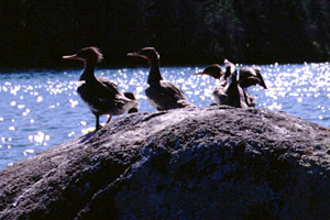 I saw a loon, which dove before I had a chance for a photo, staying down for longer than I imagined. I proceeded onward, until about ten minutes to three, whereupon I was at the far end of Tallman Island. Here was a largish rock with a gaggle or eight of mergansers on top. A small passage ran between the island and the rock, into which I guided the canoe. Alternately, I took photos, pulled the canoe ever closer via the grasses, and fended off the rocks on the shore.
The rewind sound, along with the alarming sound of the canoe drifting into old dead branches, caused the mergansers to take to the water. At last I got new film in the camera, the branches out of my back, and the canoe back to deeper water. I paddled in a wide sweeping arc, putting the canoe so that the wind and my residual motion would cause me to drift through the mergansers. This it did, and I photographed all the while.
Eventually they were out of range, and to get back in range would have been prohibitively alarming. I paddled back to the seaplane dock, arriving a bit before four. Here I had the joyous task of returning the canoe to the rack, which I did without grace, but successfully.
The next event on my schedule was to take a shower. Unfortunately, the showers closed at four p.m., and it was now half past. Darn. So, I bought an ice cream bar for 36 cents, then took a walk with my camera down to Scoville Point. Scoville Point was an easy trail with some pleasant informational signs along the way. The actual point was very nice - wind and waves, rocks and sun. A neat tidal pool (or whatever, probably rain fed) filled the crevice between some rocks.
On one side of the point is a small cabin. It later turned out that this is for the artist-in-residence. I returned, heard wolves howling and barking, became very hungry, and eventually reached the shelter.
 Dinner was a lousy can of chili. I think that it is off my list. Still hungry, I was working on my journal and munching (?) on raisins when an older fellow looked in. I told him I had the shelter, but if needed, he could join me. Eventually, he and his friend (brother-in-law?) did.
Saturday - Awoke, breakfasted with the two fellows who shared the shelter, then boarded the M. V. Ranger III. The ship set out. Had some excellent views of the Rock Harbor lighthouse, which I photographed until I used up the roll of film.
Homeward.
This RingSurf Isle Royale National Park Net Ring
owned by a Backpacker and Isle Royale supporter.

[
Previous Site
|
Next Site
|
Random Site
|
List Sites
]
[
Join This Web Ring
]
Return to Manthey Outdoors or the Site Map.