
Before starting, I would like to thank all of the kind and friendly people whom I encountered on this trip: the lockmasters along the Champlain Canal for always being friendly, Phil at the Schuylerville Yacht Basin for having a lovely facility and the morning conversation, Walter in Benson Landing for giving me permission to camp there, the couple from Pennsylvania at Crown Point for the conversation, grapes, and coffee, the people whom I sat with at the Bridge Restaurant for the company, Ann for giving me permission to camp in Meach Cove and for the offer of liquid refreshment, the fellows at the Burlington boat house and the various couples at Grand Isle State Park for being friendly, the Lebrun's at Monty's Bay for feeding me dinner, the folks at Gilbert Brook Marina for being so cheerful, and, most of all, Ted for helping me with transport.
Day 1 - Troy to Schuylerville
Wednesday, 12 September 2001
Although I've been wanting to canoe on Lake Champlain for a long while, I almost didn't leave on this trip. First, there is business to deal with - I haven't done as much as I would have liked. This caused some vacillation on my departure date, but ultimately, I decided on today.
This was not the biggest effect however. Yesterday, Tuesday, September 11, 2001, New York City and the Pentagon were attacked by terrorists. The devastation is horrible, with the World Trade Center's two towers collapsing. If there was any possible aid I could render, I would have stayed and done so. Various friends had their cars loaded with whatever they thought might be useful. Weapons were checked and loaded. We are at war, only the jerks haven't claimed responsibility. I spent most of yesterday following the news and didn't go to bed until well after 2 a.m. My heart aches.
I'm offended that terrorists can affect my life so. Thus, with a heavy heart, I set out anyway. Packing was easier this time, since I made a nice list last time. [Last year I did an 8 day trip from Troy to Lake Ontario. See here.] As I might be gone as long as twelve days, food and clothing need to match. The food is a bit squirrelly - I don't know if I have enough or not. Either way, what I have is ready by the evening, and after a long night of feeling ire at terrorists and pride at New Yorkers, I went to sleep.
I awoke around 7 a.m., which was later than I had intended. I drove to the Waterford boat ramp and left off my canoe, chaining it to a convenient tree. I then returned home and had my best friend Ted give my gear and myself a lift back to the canoe (thus cleverly leaving my car in its parking spot). The canoe is loaded easily, every bag having its place. My only change from previous packing conditions is to use a small duffel for the water bottles and fenders. Around 9 a.m., I slip off, heading north.
The first 3 miles up to Lock 1 is part of my normal stomping grounds. The weather is perfect and it remains so all day. In a scant hour, I'm at Lock 1 sounding my air horn. Naturally all of the flags are at half mast. Unsurprisingly I've seen no other boats, it being before 10 a.m., a week day, and after Labor Day. The lock empties and opens. As always, the lockmaster is very friendly and I'm quickly locked through. Throughout the course of the day I see a total of 10 boats, spaced reasonably equally apart from here to my campsite.
Above Lock 1 is relatively novel territory, and I use my camera on a few things. There is a swath of water lilies in bloom. There is the Mechanicville railroad bridge. Of course, the locks are picturesque. The water is clear and I can see six or eight feet down, including fish, plants, and shells. I don't photograph the water, as I would need a polarizing filter to make it come out.
The only other time I have been to Lock 4 was in a hard rainstorm (the sort where the water is whipped into a white froth that moves more sideways than down and the canoe collects water that is sensibly measured in gallons per minute). It is an attractive little lock, one side built into a rocky outcropping. I had shared Lock 3 with another boat, and, being 12 minutes slower in my trip to Lock 4, had to wait for it to cycle completely. This was the first time on a long trip that I have shared a lock; last year, I had them all to myself.
I haven't been more than a few miles above Lock 4 since a weekend trip last year, and the long fetch of open river is marvelous. I see herons, geese, and ducks. At times I watch my speed on the GPS, though generally I ignore it. Bemis Heights arrives on my port side (taking the Polynesian navigational view), canon standing sentinel over this historic spot. I cut on the inside of a small island where power boats would fear to tread.
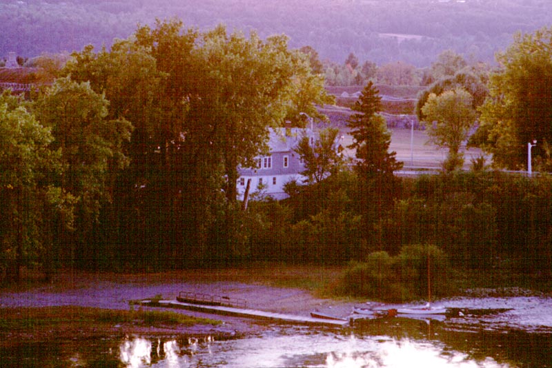
Shortly after 5 p.m., I see the Schuylerville Yacht Basin. A Canadian boat is slowly coming in, and a man from the marina meets them on the dock. I ask the fellow from the marina for a campsite and am given my choice of them. I'm in a lovely grassy field with picnic tables and fire rings. I can look out on a small creek and on the river. I'm the only camper, and the site is a very reasonable $8.
Dinner is beef and peas, plus pumpernickel bread. I also cook up some hard boiled eggs for tomorrow's breakfast. It is still light, though fading, and I am quite content with the day.
I took a walk around Schuylerville, stopping at a Stewart's to buy a small ice cream cone. It is a nice little town. There are many historical markers, one of which marks the place where the British army grounded their arms after the defeat at Saratoga in 1777. All of the flags are at half mast, which breaks my heart.
From the GPS: Distance: 24.4 miles. GPS Average Speed: 3.3 mph.
Day 2 - Schuylerville to Lock C-11, Comstock
Thursday, 13 September 2001
Slept intermittently but well. Awake and up around 6:45. The marina has lovely clean restrooms and showers. I meet Phil, the owner, on the way there. He is the man who I met at the dock yesterday. There is a small day room with free coffee, a coin-op washer and dryer, and a swath of reading material. There is also a small store selling charts and other sundries.
Phil has brought a morning paper, which I read inbetween talking with him. Normally I don't care a whit about the news. Today, I read and wonder what sort of retaliation is needed. I end up talking about this, plus about the marina, trees, the EPA, dredging, and other sundry items. We talk until 8 a.m., at which point I take my leave.
[Note for the uninformed reader: The EPA wants to dredge the Hudson River between Fort Edward and Troy to remove PCBs. The PCBs were dumped, legally, by the recommended disposal method of the time by the GE corporation. They are abating somewhat on their own, largely by being naturally covered in sediment. People are currently proscribed from eating fish from this area, and the zone is classified as a Superfund site.
The EPA is required under the Superfund law to periodically examine each site and decide what if any remedial action is required. In the past, the EPA has decided that leaving the river to its own natural recovery process is best. Recently, they want to dredge the river, trucking millions of cubic yards of spoils to places such as Texas or western New York State, and capping some of the dredged area. The GE corporation would have to foot the bill. All this, despite the fact that the EPA's own charts and figures show the same level of PCBs being reached only 10 years later by only carrying out the source control projects that are already under way.
The dredging would certainly disrupt the river, possibly re-lofting the PCBs that have already settled out (with all sorts of other exciting things), and may not do a bit of good. It seems that many of the people who like the idea of dredging primarily want GE to pay a half billion dollars for being a large company (and therefore, by their way of thinking, inherently evil).
I went to one of the EPA public hearings, where I felt that the EPA completely failed to make their case. Dredging may be the best course of action, but unless some better proof is provided, it is too potentially damaging to perform without at more certainty and support from environmental engineers. Disregarding those working for the EPA and GE, most of the environmental engineers at the public hearing were openly critical of the dredging plan. Those from GE can't be fully trusted as they have a conflict of interest; likewise those from the EPA may be required to cite party line. The entire approval process (or seeming lack of it) is disturbing.]
Camp packs up in 20 minutes. A few minutes more and I'm launched and on my way. The pull up to Lock 5 is an easy one, and the lock has been informed (by Phil) of my approach. I slip in and am soon locked upwards. After Lock 5 is new territory for me. I see herons and egrets, also turtles and fish. There is a large submerged dam which produces a siren's call in the current. It drags me closer as I eat my breakfast. The river banks vary from a few houses to plain woodlands. Often the trees are a thin screen between the river and farmland.
The Lock 6 operator warns me of impending rain, which nicely holds off until quite a bit later. After Lock 6, I am in a canal section for a few miles. This canal is not as bland as the one near Rome. It has numerous small creeks and isn't the same width for any duration. Naturally I pass a guard gate; this one has a single opening. The Champlain Canal is not designed for the traffic of the Erie.
At Lock 7 it begins to rain. I put away my camera and take out my rain jacket. This is also the true start of the Champlain Canal; that is, I have left the Hudson River. 200 years ago, this would have been a tedious portage across to Wood Creek. Now I cruise along at three and a half miles per hour. Somewhere between Lock 8 and Lock 9 is the heighth of land. A large concrete sluiceway leads west to a broad creek. From here on the canal more or less follows the old creek used along with the portage.
The place names all involve forts. Fort Miller, Fort Edward, Fort Ann. Both Fort Edward ad Fort Ann have small town docks - I like that.
I recognize a pleasant road I have bicycled along. I see various birds (never so many ducks).
I shared Lock 9 with a boat from Ohio. They had the same schedule as myself; that is, none to speak of. The lady asked me if I knew of interesting places on Lake Champlain. Naturally the Lake Champlain Maritime Museum and Valcour Island immediately presented themselves. I also mentioned Ticonderoga and Crown Point.
At almost exactly 2:30 p.m., my GPS lost all satellites. Normally, I would assume receiver error, but with the last few days, I didn't know. Ultimately the GPS seems to have kicked off when the internal temperature reached 40°C or so. Once I figured this out, I put the GPS on a wet bandanna to cool it, and it was fine. I'll have to read the manual when I get back.
The run between Lock 9 and Lock 11 is very pretty, with the canal winding quite a bit. The left side has train tracks which were occasionally used by Amtrak trains. The right side had short strong cliffs, punctured with little interesting creeks. I took longer to canoe this section, both because of the scenery and due to a headwind.
The lockmaster at Lock 9 had asked the lockmaster at Lock 11 if there was a good spot to camp. The reply was above the lock. Upon reaching the lock, the only sensible take out was 220 yards south of the lock wall. This take out is rough and rocky, and I banged up one foot getting out. Three trips later had my gear at the southern most picnic table on the grassy area along the lock wall.
As I was pitching my tent, the lockmaster stopped by in his car and I asked how I was doing. He was making a run to a nearby store and offered to get something for me, which I declined.
Dinner was a repeat of yesterday. I now sit under one of the lock streetlamps as I write. To the east of the lock I can see the lights of a prison and hear that they are playing a night football game. Oddly, I can only hear the downs being called. I'm nearly out of water, but I'll deal with that tomorrow.
Distance: 29.5 miles. GPS Average Speed: 3.3 mph. Total distance: 53.9 miles.
I saw a total of 7 boats today.
Day 3 - Comstock to Benson Landing, Navigational Marker 1, Lake Champlain
Friday, 14 September 2001
A long day, if only in spirit. I woke 6:45 or so, though I had been awaken many times by passing trains. The train tracks are just on the other side of a thin line of trees and a narrow paved road. Each time one would come by, the ground would shake and there would be a mighty rumbling. I would wake up, look out the tent at the rushing train (seen by the dim light of the lock streetlamps), and then go back to sleep. Also, I had stayed up to watch stars and walk about. I couldn't help but hear some of the football game.
I took two trips to bring my gear back to yesterday's take out. I then told the lockmaster I was ready, and he had the lock open and waiting. Under weigh a little before 8 a.m. Incidentally, there is no Champlain Canal Lock 10; I don't know why.
A screaming north wind all day made for very slow going. At times I was scarce making 1 1/4 mph and nosing through whitecaps. Overall, I averaged just over 2 mph. Aside from this, a wonderful trip.
Between Lock 11 and Lock 12 is lovely rocky scenery. Hawks wheeled overhead, enjoying the wind I was working against. Ducks had trouble staying on course, and even herons occasionally hit wind-shear pockets.
While paddling, I filtered water, ate breakfast, and took many opportunities to nose into small creeks and swampy areas. One section of the canal seemed extra long, but only because of the stiff wind. In general, Wood Creek constantly joined and departed from the canal. The sky ranged from almost completely overcast to bright and sunny with the clouds racing along.
Whitehall (or Skenesboro, if you prefer) appears as a collection of contrasting bridges. There are four in all. The first is a black railroad bridge, with standard triangular structure. The second and third are pale colored roadways of very different capacities, both concrete. The fourth is some odd museum of acting or some such. On the left, between the second and third bridges, are a few floating docks. They are small boat friendly, and I tied up at the first one. The wind is howling and half-mast flags snap and flutter.
This area has a lovely little picnic ground, a small amphitheater facing the water, a big picnic pavilion, and a building which turns out to be the Whitehall chamber of commerce. Downstream is a fenced in roofed area with the rotting remains of one of the ships called Ticonderoga, followed by a small engine or other railcar, and what I assume is the Skenesboro museum. All the place lacks is an obvious public restroom. I return to my canoe, cast off, and head to Lock 12.
Although the lock is open, I have to wait while a boat ships its antenna before it leaves. It takes a bit of effort to stay on station in the wind. One of the lock workers lets me know what the boat is doing (since they appear to be sitting still in a lock, contrary to the usual procedure of immediately departing). As I lock through, the lockmaster wishes me well, and I head out into Lake Champlain.
When locking through Lock 12, there were never so many tiny mussels adhered to the walls of the lock. This is not uncommon below the lower water level, but these mussels ranged up to three feet higher than low water (perhaps because Lake Champlain is frequently at a higher water level than now). As the mussels were exposed to the air, they would squirt water in small pin-point streams. Reminds me of quahogs.
It is easy to see the argument that this is not yet the lake. In some places it is narrower than the artificial canal, even though Wood Creek has been joined by the Poultney River. Depending on the source, this area is sometimes referred to as Lake Champlain and sometimes as Wood Creek, but almost never as the Poultney River. The Poultney River defines part of the boundary between New York State and Vermont, and the boundary continues up Lake Champlain. The eastern (or at times northern) shore is now Vermont.
Hawks circle overhead, and neat cliffs line the shores. I see fascinating water beetles.
Fairly swiftly I come across the opening to South Bay. This is a narrow body of water that juts off to the southwest. I look down its length, but do not enter. There is a railroad trestle across the opening, which would be more picturesque without the bass boat beneath it.
The wind is out of the north-northeast, and when I am heading northwest I make decent time. On the flip side, when I'm heading northeast I have to fight for distance. The lake meanders in a series of angled sections, alternating between northwest and northeast. Rather than having navigation buoys, for the most part the navigational markers are metal framework towers on brilliant white concrete footings. They are counting down to the `real lake', that is, where the lake is wide enough it is undeniably a lake and not a river.
On a long northeast fetch I encounter a small turtle swimming across the lake. As he is trying to travel the same direction as myself, after taking a few photographs, I give him a short ride. I don't know if he appreciates it at all; he didn't seem to mind. (Not that I can tell the gender of the turtle, but using `it' seemed to impersonal.)
I put to shore for lunch, choosing a nice beech tree to sit under. There are lots of beech nuts, but I lack the motivation to open them. A while later, I take the small channel around a marshy island. Halfway around is a small marina which advertises a campsite. It is only 2 p.m., so I push on.
The eastern shore is a series of rocky headlands. The western shore is usually gentler, always with a railway along it. The stout little hills are covered in trees, with only a very rare house to break them up. As I come to the Narrows of Dresden, the wind kicks the water into short but steep waves. This is a cool narrow passage between two rocky bluffs. I beat through it and into the wider and windier area beyond. Clearly the narrows were blocking some of the rushing air. I put to shore for a break (this happened a lot today), and decide that my best bet for the night is a ramp at Benson Landing.
As I proceed, I take a small less-choppy channel to the left. I see what I first assume is a railroad culvert (based solely on position). Upon nearing it, it is a small pontoon boat with a rectangular top structure the size of a small shed or a large privy, entirely covered in tarps. The boat is held in position with stakes. One partially loose tarp reveals a door leading into the structure.
I beat back across the lake (some 1/3 mile wide at this point). The land on the opposite shore looks like it would make a fine campsite, save for the "No Trespassing" signs every 50 feet. I often wonder about why people post their land. I can understand posting the land against hunting or specific uses, but entirely restricting access seems rude unless it has untold dangers or is one's home.
I pull into the teeth of the breeze. It is now after 5, and I am tired. Here at navigational marker 1 is an easy take-out - good for a rest at least. It turns out to be a small landing with a ramshackle house and barn set off at a distance. The house appears to have been transported to this site from another location, while the barn has been here for decades. The house looks like someone is slowly working on it - the type that will be done in years, if ever. I decide, as the house is unoccupied, to camp here.
I've just finished dinner when a pickup truck arrives along the dirt road. It is a pleasant middle-aged man named Walter checking on his neighbor's property. I'm granted permission to camp. Thank you.
I ask if there is any news. "No, sir, but the president ought to send some of them-there airforce jets and teach them A-rabs a lesson." Said in an earnest southern Vermont accent.
The fellow dubs around the house while I pitch my tent. He departs and I wave. As the light fades, so does the wind. The stars are out and the herons are arguing in the near distance. I watch the headlamp of a train wind along the opposite shore. Good day.
Distance: 20.9 miles. GPS Average Speed: 2.5 mph. Total distance: 74.8 miles.
Saw 11 boats today, not to mention a meteor set off against the Milky Way and many small spotted frogs near my campsite.
Day 4 - Benson Landing to Crown Point
Saturday, 15 September 2001
Another day of head winds, this time not so bad. I launched around 7:45 amid placid waters and mist rising from the lake. The scenery varied from rocky low cliffs to archetypal farmland. There were few boats aside from bass fishermen zooming around to find fish. Along the Vermont shore was an abandoned stone house with smartly made walls, missing its roof and with trees growing through the windows.
The lake is a series of ever widening bays clamped by wider and wider narrow sections. At times I simply enjoy the paddling without worrying about where I am or how far I'm travelling. At other times I watch the next point of land to see if I can gauge how far away it is located. This is not hard using a map and a GPS, and I'm getting better at it guessing without them.
There are hundreds of ducks, gulls, and herons, also hawks and little tweety birds. The train tracks sidle along the shore with an occasional train to give them life.
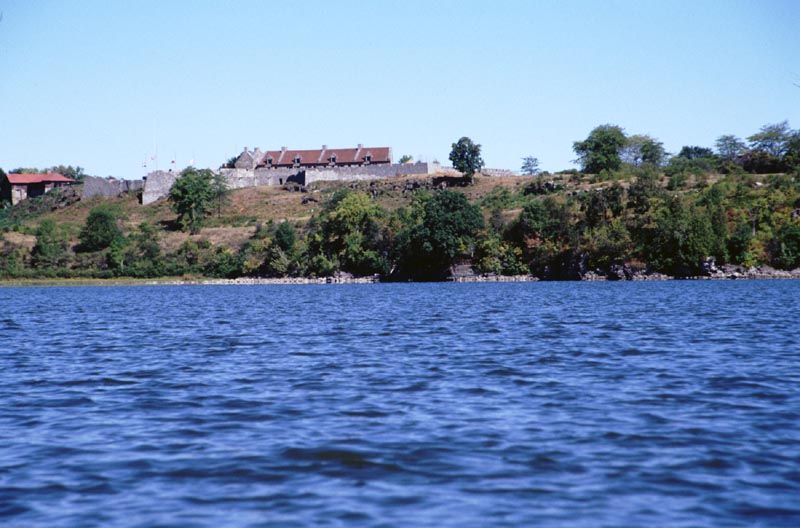
There is the inaccessible Mount Defiance, towering above a great swath of lake. And here is Fort Ticonderoga, low and menacing. Along side is the pleasantly wooded Mount Independence, of which I can see little. A hiker is walking its shores. I slip by and put in at Ticonderoga Ferry for a break and lunch.
[Historical note: During the French and Indian War (also called the Seven Years War), Fort Ticonderoga was called Fort Carillon. It had been built by the French but was eventually lost to the English. During the American Revolution, the fort was taken by the American forces, only to be lost to the British when they placed cannon on top of Mount Defiance and started shelling the fort. The American commander, General Horatio Gates, felt that since a map marked Mount Defiance as `inaccessible', no one could possible bring guns up to its summit. He felt this way despite the fact that a year earlier Colonel John Trumbull, Benedict Arnold (then loyal and a great hero), and Anthony Wayne had climbed the mountain to prove it to be accessible. If that wasn't enough, Thaddeus Kosciuszko, the great Polish military engineer, also recommended fortifying the summit with cannons. When shells began to fall, the current commander, General Arthur St. Clair, abandoned the fort with great haste across a causeway to Mount Independence.]
Onward for more of the same (paddling amidst the lovely lake). I encounter a row boat with a father and little girl, earnestly fishing. I see a sailboat tacking its way north; naturally I steer around its stern. I see the four odd cement pylons and approach them to see better. Here is a low piece of ground, right near water level. My guess is that there was some sort of manned tower here. I canoe around the pylons, stirring a great flock of birds. The north side is very shoal, and I get out and walk the boat a dozen yards.
I don't make very good speed, both because of the wind and also fatigue from yesterday. I pass the International Paper plant, innumerable farms, many houses, and only a few boats. At long last the limb of the Crown Point bridge rises into view. I beat to the north so that I can get a nice edge-on view, then pull past the Crown Point light and land at the Crown Point campground's boat launch.
No one is at the campground entrance station, so I set up camp at the closest site to the boat ramp. As I am getting ready for a shower, the fellow from the next campsite over comes by. He is a retired forest warden from Pennsylvania and a history buff. We talk at length, and eventually his wife and dog join us. The wife brings some fresh grapes and offers to share them with me. After a very pleasant conversation, I disengage and go for a shower.
After a shower I wander over to the Crown Point lighthouse and Samuel Champlain memorial. I take some photographs in the glooming light, talk with a few families and other visitors, and return to my campsite.
Having decided on the way here that I would eat the Bridge Restaurant, I walk across the bridge. This is a high arching bridge that connects Crown Point in New York with Chimney Point in Vermont. It has an elegant curve and is illuminated with attractive streetlamps. There is no sidewalk, and most cars scarcely slow as the go by. The restaurant is only a short distance from the bridge on the Vermont side.
At the restaurant there is a group of six people waiting. They have spent the afternoon at the Crown Point ruins and are wondering about historical reenactments. As I participate in the reenactments and have been to the ruins several times, I butt in. They invite me to sit with them in the restaurant. Talk ranges from canoeing, to history, to college, to the waitress (she joins in). It is pleasant and comfortable.
Distance: 23.7 miles. GPS Average Speed: 2.9 mph. Total distance: 98.5 miles.
Saw around 30 boats.
Day 5 - Crown Point to Meach Cove
Sunday, 16 September 2001
A quiet start. As I write this in the morning, I look forward to dawdling for an hour or so before leaving.
I'm standing around hoping my tent will dry in the morning sun. The man from the next site over walks over with a cup of coffee. Awfully kind. Eventually I pack up the tent, having abandoned the idea of it drying. As I am carrying down bags #0 and #3, the couple comes out, and the lady offers to carry my other two bags. I protest that I can get them, but she insists. While I am getting ready to launch, she relates that years ago (not clear how many), she built a wooden kayak in her apartment in Burlington. I asked if she had made sure that she would be able to remove it from the apartment (stories of people failing to do this are quite common), and she said that the window worked, but was snugger than initial measurements suggested it would be.
Another note. Yesterday, the gentleman next door related that he helped build a bateau in Gardener, Maine. I believe this to be the Fort Western bateau that my sister gets to row. He also said he did a non-reenactment retrace of part of the March to Quebec. His wife commented that he would say (based on Kenneth Roberts' two books), "now here is a bend in the river with a falls", and then they would see a dam and houses - very different from the journals and Arundel.
[Historical note: In 1775 during the beginnings of the conflict between the American colonies and Great Britain, Benedict Arnold lead an army up the Kennebec River in Maine, over the Heighth of Land, through dolorous swamps, and to the gates of Quebec. The purpose was to join up with troops coming down the Saint Lawrence River and lay siege to the city, convincing the local population to throw their fortunes in with the colonies. However, due to logistics problems and bad information, the army nearly starved (some of the men did). Those who arrived at Quebec did attack it, but Arnold was injured. Possibly, had he not been injured, the city would have been carried. Instead, the Americans met with defeat and Daniel Morgan and many troops were captured. The army eventually retreated up the Richelieu River, staying at Ile aux Noix for a time (which will figure later in my narrative).
Kenneth Roberts wrote two books about this. Arundel is a fictionalized account of the March to Quebec that is wonderfully written but very fatiguing to read. March to Quebec is a reprint of some of the primary source journals that Roberts used as a basis for Arundel, some written by the men as they marched and others written decades later as part of their pension applications.]
I launched a bit past 9 a.m. despite my best intentions. A glorious south wind lasted for two hours, during which time I screamed down the lake, at times up to 5 mph. Potash bay is depressingly built up. Mud Island is aflock with birds. I see a half dozen loons. Arnold's Bay has a strange windowless concrete building. To the west are the resplendent Adirondack Mountains.
I stop at Button Island (by this time my south wind has changed to a north wind - ugh). This has an odd stone wall at one end of the island. It doesn't seem to have much point. Not seeing any of the button mould formations, I re-embark and poke around the shelving beach of Button Mould Bay. I still don't think I see the famed rock formations. [The shore has some small rocks that are supposed to resemble molds for casting metal buttons. I have a nice little booklet explaining the geology of the place on my bookshelves at home.]
As I head back out into the main lake, I spot a man in a kayak. The kayak is a pretty CLC (Chesapeake Light Craft) 18' boat with a nicely finished woodgrain top and a yellow bottom. [Note: Any color references are deeply suspect, as I am badly colorblind.] It actually looks comfortable, which I almost never think when I see kayaks. Just prior to this trip I was corresponding with a friend of my brother's about CLC boats. We cruise and talk for a while. The man has been kayaking at the mouth of the Saint Lawrence River, and feels the ocean is where the boating is best. We discuss boating alongside dolphins and porpoises (he's done it in the Saint Lawrence estuary, whilst I've had the pleasure in the Gulf of Mexico). He sheers off to head to the cliffs on the New York shore while I pause to change GPS batteries.
A note on the GPS. This is the first extended trip I have taken with a GPS. It is a pleasant addition, as it tells me my speed, distance travelled, and location. Although I can record the exact path I follow reasonably exactly, it only has so much memory. As such, I am reducing each day's trip to a series of 30 or so waypoints using a built in function on the GPS (I have a Garmin 12 XL unit). I will make some sort of map of my actual travels once I return home.
In short order I pass Basin Harbor and enter North Harbor. Here I hail the Philadelphia II. Lenny answers, knowing I'm one of the sometimes-crew by my voice (certainly not by my outlandish attire).
[General note: The Philadelphia II is a replica of a gunboat that was built in 1776 to defend the American forts on Lake Champlain from the British. The American fleet was commanded by Benedict Arnold. The American and British fleets met in a battle in Valcour Bay between the New York shore and Valcour Island. Although the British significantly out-gunned the Americans, the Americans managed to hold on until night fall. During the night, they slipped past the British line, and the next day had a running gun-battle with the British. Benedict Arnold commanded a rear-guard action, ultimately ending in a landing in what is now known as Arnold's Bay. Here the Americans burned what remained of their ships and went by land to the American-held fort at Crown Point.
The Lake Champlain Maritime Museum is a wonderful facility located near Vergennes, Vermont. They build replicas of historically interesting boats, conduct diving and preservation efforts in Lake Champlain, and maintain an extensive set of exhibits at the museum.
I have become involved in 18th century French and Indian War and Revolutionary War reenactments. 4 or 5 weeks ago we fully manned the Philadelphia II with a crew of 44 people, all dressed in 18th century clothing. We rowed the 29-ton vessel to the south a few miles (in a south wind), then sailed her back to North Harbor. We then spent the night on board. Lenny was one of the lieutenants for this event, and usually mans the ship when the museum is open (dressed in 18th century clothing).
The museum can be found here, and a website about the overnight trip on the Philadelphia II can be found here.]
I set out again in a now gentle north wind. When I get to the sharp cliffs of Kingsland Bay, I steer toward Thompson Point. Two dozen sailboats have sprung up like so many children's toys. Halfway to the point, I see three sailboats' sails suddenly go slack. A few minutes later, I'm in a dead calm. I watch as boat after boat is becalmed, with only the ones close to the New York shore escaping. My ash breeze still blows, and I continue onward.
Garden Island is another neat cliffy place. On the far shore I see a lighthouse. On a closer point, the tops of the cliffs have expensive houses with manicured trees. Rather than being pretty, it looks like a high browse line in a forest that has exceeded carrying capacity - those poor landscapers, it's going to be a rough winter.
I'm debating where to go for the night. Lenny had suggested Red Rocks Park, which would be a bit of a reach before dark and mean a 33+ mile day. As I canoe along Meach Island (which I read as March Island at first), I see in the corresponding cove a little picnic area. I examine it through my telephoto lens (the closest thing I have to a binocular); it is a grassy area with picnic tables, playground equipment, and a restroom facility. I weigh the pros and cons - I don't know that there are campsites at Red Rocks. Hunger wins, and I put in.
As I debate where to take out and camp, I meet two lady kayakers. One of them works as a caretaker at a local huge estate. She tells me I should camp at the private picnic area just to the south of the public area. This is a nicely manicured grassy field with a single picnic table. I noticed it on the way in as being an inviting spot to picnic, except that it was clearly private property. She tells me that if the fellow who patrols the area stops by, just tell him that she said it was okay. Shortly after I have eaten dinner, the lady shows up with her dog and reports that she has told the security person that I'll be here and everything is approved. Amazingly good people. She also offered me a beer, which I declined.
In sorting my gear, I can't find film roll #2. I hope I haven't lost it. If so, it probably fell out of my dry bag at Crown Point while I was packing. It may be wrapped in a piece of clothing somewhere. It would vex me to lose my pictures of the weird pylons, Mount Defiance, and such. [Post trip note: I have indeed lost this roll.]
I now have set up camp, supped, watched a sunset over the Adirondacks, and am content. Earlier, a small schnauzer on the public beach was barking, producing amazing complex echoes. The last echo was some 6 or 7 seconds after I heard him directly, and he is at least 150 yards distant. The public picnic area has a flush toilet, which is nice. The area I'm in has luxuriant grass surrounding its sole picnic table, plus a killer view.
Distance: 26.6 miles. GPS Average Speed: 3.4 mph. Total distance: 125.1 miles.
Saw at least 100 boats, including half a dozen kayaks and two canoes.
Day 6 - Meach Cove to Grand Isle State Park
Monday, 17 September 2001
Launched around 7:15. This turned out to be my longest day ever (at least in terms of miles), though I am not that tired at the end of it.
Shelburne Point is another strong cliff, this one without the ubiquitous houses on it. Upon rounding the point, there is a good view of the city of Burlington. I turned south into Shelburne Bay. So far there has been a light south wind and a lumpy quartering sea. It makes for good time, but one has to pay attention. Shelburne Bay is comparatively placid, only now I have a head wind. I beat south.
There is part of an old marine motor from some ancient wreck jutting from the water. It is corroded and obviously only a small fragment of a larger apparatus. Just beyond this is the Shelburne shipyard. It has a mammoth set of unused ways, plus all the standard modern items of a yacht yard. They are hoisting a small sailboat out of the water as I go by.
I don't go much past the shipyard before coming about and flying with the wind toward Red Rocks Point. This was the theoretical reach I could have done yesterday. Good I didn't. The park is all neat striated cliffs, on either side of which are private lands. I don't see a clear place to land that is public.
I follow the shore north to Burlington. Oak Ledges Park looks like a splendid place to spend an afternoon. I see people with dogs, a business man, cyclists, and others, all happily spread out, and most loitering on the rock ledges along the water line.
Burlington harbor isn't very busy. I see a Coast Guard ship, some car ferries, and a few sailboats. There is no real commercial traffic, though there are a few barges tied to the wharves. I cruise past a boat house at the end of a dock, notice it is owned by the city Parks and Recreation department, and return to it. I tie up along their dock, disembark, and talk with two young men there. They tell me that Law Island is available for camping (though it is too close to be a good spot for the night), as is some land near the northern end of Missisquoi Bay. I thank them and slip off.
Outside the harbor's breakwater, the seas are lumpy and uncomfortable. I take forever weathering Apple Tree Point, then I race up to Colchester Point with a gentle following sea. Just beyond is the aforementioned Law Island.
Due to the relatively low water, Law Island is currently connected to an old railroad causeway. The causeway is a strange narrow strip of land running from just east of Colchester Point to the end of South Hero Island (which is also known as Grand Isle). The railroads were abandoned years ago, but several of these causeways still exist. All of the causeways were built on natural elevations in the lake floor. It didn't take much material to make these areas into land, which is why Law Island is temporarily joined to the causeway. I'm sure the usual spring floods will once again isolate the island.
I circle Law Island. The south side is wooded, and an old house is on the north side. The house is obviously abandoned. I stop a bit beyond the house for lunch. I can see people on the nearby causeway. It is some form of bike path, and from a distance far enough away that one can't see the bicycles, the people have the peculiar gliding motion.
There is a gap in the causeway (at least on the map) at the north end. There is a bridge fairly near to where I have stopped for lunch. I paddle under the bridge. The water is instantly calm; the causeway is a fantastic breakwater.
I cruise southeast to Porter Point, then east to Mallets Head. I poke my bow into Mallets Bay, but don't venture any significant distance. Next I follow the eastern shore north. Here the lake shoals. In a few miles the Lamoille River enters through a swampy wetland. I skirt the shallows. At this point, my goal is to go under a bridge in an automobile causeway that runs from just north of the Lamoille River to Grand Isle. The lake is low, and I have been warned that it may be too low for even my slight draft. Indeed, I do run aground, but just barely. I retrim the boat a bit more forward (knowing that I have an inch less draft under my bow due to a slight rocker in the keel), and free myself. I pole along until I get to the bridge. Here the water is plenty deep, and I slip through.
The sun is powerfully hot, and I feel myself burning, despite repeated applications of sunscreen. I loiter in the shade of the bridge as I choose my campsite. I can reach the campground at Grand Isle State Park before 6 p.m. I strike forward.
I work my way up the sometimes-shady western shore of Grand Isle. There are houses galore, many overbuilt, but some small. I cross Keeler Bay, and shortly arrive at the state park's boat ramp. I figure that there must be some campsites near the water, so work around Cooper Point, landing on a ridiculously manicured beach. I walk across the prim grass and walk through the pin-neat picnic grounds until I find two couples setting up tents. I ask where the park office or entrance station is located. Ultimately, I return to my canoe, return to the boat ramp, get a $14 campsite some distance from the water, and prepare to lug my gear up to the site.
The people I saw at the other campsite are out for a walk. One fellow helps me carry my gear (not necessary, but appreciated). I am camped next to a mobile home with a couple from Milwaukee. They are travelling to visit friends in Maine. I have a nice chat with them.
I'm fed, read for the night, and showered. It is after 9 p.m., and I write by the actinic light of a streetlamp near the park office.
Distance: 32.7 miles. GPS Average Speed: 3.3 mph. Total distance: 157.8 miles.
Saw about 30 boats, including one row boat.
Day 7 - Grand Isle to Campbell's Bay in Missisquoi Bay
Tuesday, 18 September 2001
As I got ready, another couple strolls by. Like the ones from the next site over, these people have a golden retriever. I talk briefly, then go back to eating breakfast. I launch at 8 a.m. There is a mild north wind, and it lasts most of the day, keeping my speed down.
I clip up the coast of Grand Isle. The island is largely built up with summer houses. Halfway between Hyde Point and Ladd Bay, at a point not labelled on my charts, I veer off to the northeast to visit Ball Island. This is a mile and a half of open water, rewarded by the rocky shores of the island. I track up the west side of the island, then reach the southern point of Burton Island.
Burton Island, along with Wood Island to the north and Knight Island to the northwest, is a state park. I skirt along the southern shore, heading decidedly east. The island is fairly bland - neither rocky nor flat, neither populated nor wild looking. There are a series of low stony points which I occasionally brush across. Since leaving Grand Isle, I have been seeing signs of the reviled spirogyra. Here it blankets the surface in an oily layer. As I reach the eastern end of the island, I can see partly into the mouth of St. Alban's Bay. This is the first bay I will pass that I won't look the length of.
I cut between Burton Island and St. Alban's Point and head up the east coast of Wood Island. The area between Burton Island and the point is shallow and gravelly with scarce enough depth for my canoe in the spot I transited. There is a boat ramp on St. Alban's Point, so, despite Burton Island being only accessible by water, one doesn't have to go more than 1/2 mile on the water.
When I reach the north end of Wood Island, I head sharply west to go between Knight Island and Butler Island. I had vague ideas of reaching Canada before dark today, but at this rate, it doesn't look likely. Throughout the passage, I am plagued by tiny flies - perhaps the early form of something else or a form of aphid. I also see pairs of loons and hear them call to each other. Unlike other birds which flee my arrival, loons are completely indifferent.
The other animal I see a great deal of are a type of gull with a black mark behind each eye and a relatively small curved body. The bottom of the wing is a plain white, whilst the top has black edging on a field of grey with a white semicircle near the inboard leading edge.
Of course, what day would be complete without a minor disaster. The pawl which holds the camera back closed has busted. Duct tape fixes it for now, but I probably lost 6 frames of exposed film. This is the same problem my other camera body had before it committed suicide.
I reach the tip of Butler Island after what seems ages. There is a barn-like house on the southern tip of the island. The shore or Butler Island is choked with summer houses. I follow northward along the west shore until I judge I am due south of Holiday Point (which I guess to have once been called Long Point). I strike northward. It will be close to 3 miles to Holiday Point.
During passage to the point, I pass along Gull Island, a low blighted cone without vegetation and completely covered in birds. I reach Holiday Point without incident, but am now tired. The slight north wind and yesterday's long paddle combine to make me tuckered. Also, I suspect I haven't been eating enough (I've been full enough, just I know I'm burning more calories than I'm eating).
I pass what looks like a public boat launch (I'm now working up the east side of North Hero Island), then reach Stephanson Point at the north end of the island. Here is another state park. I stop to eat a late lunch. There is an amusingly badly concealed duck blind. For the unperceptive, a sign identifies it.
I push on, up into the passage between the Alburg Tongue and Hog Island. Hog Island doesn't look at all like an island, either in person or on my charts. Up ahead are two bridges (so sayeth the chart), one railroad and one automobile. I can see semis transiting one bridge, but the exact nature of the bridges is incomprehensible from this distance. They eventually resolve to a railroad trestle with a small swing bridge at its center and an automobile causeway with a water passage covered by a bascule (draw) bridge. The bascule bridge looks nice from a distance, but shabby close up.
Hugging the southeast shore, I work past Donaldson Point, feeling dog tired. Here there is supposed to be a campground, but not liking the summer cottage look, I push due north. This brings me to the Missisquoi National Wildlife Refuge, where tiny signs state "unauthorized entry prohibited." I come about and return to the boat launch on the north side of Donaldson Point.
There are piles of dogs lounging on the beach and a bunch of people gathered around what looks like a small store. I land, pet the half dozen dogs, and walk up the sandy beach to the store. This is a trailer park, beach house, campground, general store, boat livery, and probably other things, all rolled into a single facility. The proprietor charges me $14 for a campsite woefully distant from the water. I later return and buy a dozen eggs and some potato chips (from a limited set of options). The store does have 20 kinds of beer and a variety of fishing gear.
It is only a little past 8 p.m. as I write this, but I am contemplating bed already.
Distance: 27.8 miles. GPS Average Speed: 3.2 mph. Total distance: 185.6 miles.
Saw perhaps 15 boats.
I failed to mention the day's leaden skies and blunted sun, the spot of rain, the joy of crossing 45° North (only to return back when I came away from the wildlife refuge), the sight of lights on the Canadian shore, or the surreal campsite I have.
A note more on the campsite. My tent is atop a hill a dozen yards from a narrow paved road and at least 800 yards from the lake shore. On one side are beech trees loaded with nuts and crabapple trees loaded with apples. On the other are mounds of dirt (big barren piles of it). Across the road is what happens when mobile homes are made using RVs. They have ossified and grown porches, roofs, outbuildings, and flagged walks. They are the worst of the RVs and not the best of a trailer park. I walked through, and no one is outside. Eerie.
Day 8 - Missisquoi Bay to halfway between Alburg and Windmill Point
Wednesday, 19 September 2001
A cold north wind is blowing this morning. At least the tent is as dry as it has ever been since starting. I launch around 7:30, accompanied to the water by dogs. The north wind makes the going slow and the water choppy. I proceed north-northeast, veering around the wildlife refuge and a large mat of floating vegetation.
When I can say I'm in Canadian waters (beyond any doubt) and when I can see the length of Missisquoi Bay, I come about and start back to the southwest, meaning to follow the western shore back. There are two dark angular objects to the far east, probably two miles distant. I don't investigate.
Naturally, a short time after pointing my bow to the south, the north wind lessens and stops. The gentle running sea still helps though as I run south. To either side I can see a notch in the land. Here is the United States - Canadian border. The Canadian shore looks the same as the United States', not unexpected, but still disappointing.
Back underneath the odd pair of bridges, but now I cut southwest, following the Alburg Tongue. I look back to see a train crossing the bridge. If one were further away, the bridge would be hull-down on the water, and the train would appear as if travelling on the surface of the lake. I saw tractor trailers in this manner yesterday.
In an hour or so, I am to the direct west of where I lunched yesterday. "Oh, that's a big bluff." [There is a point of land to the west called Big Bluff. The quote pokes fun at a friend named Tracy.] Now I enter the Alburg Passage between the Alburg Tongue and North Hero Island. Both shores are littered with vacation and fancy homes, each one as full of ticky-tacky as the next.
A bridge connects the Alburg Tongue to North Hero Island. This one allows passage along most of its length, rather than being a causeway with a single opening like many of the other bridges I have passed through. There are three bass boats loitering in the lee of the bridge. Somewhere about this point, a light south wind begins to blow. It is a deficit here, but a slight advantage later. Also back is the revolting spirogyra.
The southern point of the Alburg Tongue was once connected to North Hero Island by one of the numerous railroad causeways. I slip through under an old railway bridge. Beneath the bridge a bass boat is moored, held in place by two lines attached to the bridge. A bit further south there is a complete gap in the causeway. After ducking under the bridge, I am in the wide part of the Le Motte Passage with Isle Le Motte before me.
I run to the north, staying near the Alburg Tongue for a while, then crossing to the Isle Le Motte side of the channel. I eat lunch while barely maintaining weigh. The sun is hot and I feel a little peaked.
Under another road causeway and I'm north of Isle Le Motte. The island appears mostly residential anyway. I land on the Alburg Tongue for a needed break from the sun, and am rewarded with interesting shells including several snails. I continue, I can't say with much vigor. I need a light day or a day of rest as my shoulders are tired. That has never happened before.
I can now see the New York shore, and, in the distance, the bridge at the northern end of the lake. The water clears up. I come up the Vermont shore, greeting a couple sitting on their deck down by the water. My vague goal is a wide roadless area between Windmill Point and the town of Alburg. There is a lumpy following sea. As I approach I see that the chosen landing has an irregular line of white boulders. A bit closer and I suspect the reason - it is another abandoned railroad causeway.
The lake shoals, and I have to wade the last 10 yards. Sure enough, an old railroad causeway, now with a dirt road on it and a plethora of weeds. The causeway is built on lovely marble blocks, as if the leavings from a marble quarry were the handiest hard fill available. There are also more of the little frogs I saw back on the third night, plus assorted dead fish in various states of decay, providing a mild unpleasant bouquet.
I choose a tent site off the dirt road but still on the berm of the causeway. I choose a kitchen. I find myself a block of marble for a table, another for a chair, and a third for a sideboard. Living high. I'm tired, so I spend a while taking photographs of the absurdly nice rocks used for such a mundane purpose. I also try a few pictures of the frogs. A few boats are moored offshore, otherwise I have the place to myself. The other side of the causeway is a swamp, and I think either end runs into private land.
A strong south wind now blows. Tomorrow I will go partway down the Richelieu River and either return here or not as weather, fatigue, and distance warrant. It is glooming and I'm fairly done for the evening. I would stargaze as I have on other nights, only the sky is overcast.
Distance: 26.4 miles. GPS Average Speed: 3.1 mph. Total distance: 212.0 miles.
Saw around 20 boats, also some new (to me) species of gulls.
I walked to the far end of the causeway (in the dark), which leads to what looks to be a trailer house and a sign posting some portion of the causeway (possibly the whole thing) as no trespassing. Too bad.
Day 9 - Northwestern Vermont to Lacolle, Quebec
Thursday, 20 September 2001
Howling south wind and light rain. White caps on the water. I'm slow getting ready. I pack up and wait until what seems to be a lull in the wind, then put out. The wind is fierce, coming is swirling gusts. I question the wisdom of proceeding as I beat to windward. I work my way southwest, trying to make enough westing to weather Windmill Point. I beat to windward. I continue to beat to windward. And so on.
At last I come about and race on the lumpy following sea to the northwest. Although the wind is from the south-southeast, occasionally gusts come from any point. I spend most of my effort keeping control, and only a little moving. Up ahead is an old railroad trestle. There is only one viable opening through it, west of the center. After I run through this, the waves moderate for a spell. Rouse's Point is on the left, and the northern highway bridge is before me.
The following sea is worse than before. It comes from the starboard quarter. If I paddle on the right, I travel with rapidity, but have a tendency to slew to the right. If I paddle of the left, I go half the forward speed but stay on course. I suspect a different trim might solve the problem. It is very fatiguing.
Here on the west bank is Fort Montgomery, otherwise known of Fort Blunder. Built over budget and on the wrong side of the United States - Canadian border, it was a terrible fiasco. Treaties later moved the border so it is now in the United States. It stands overgrown and gone to seed. I was hoping for a tourist attraction as I could take a break. Instead, I loiter in the rushes along the shore. The waves gently push me through the tall grasses.
I now pull for the Canadian customs house, which is a small building at the end of a 1/3 mile jetty. It is around a mile distant and takes a long time to reach. In other weather conditions, a mile is inconsequential. The waves are especially large at the customs house itself. I loop into the lee of the jetty, then beat back to the indifferent mooring wall. Fenders deployed. Painter secured. Aft painter secured. Shoes on. And a custom agent peers down from above. I tell him I'm going to Ile aux Noix and then coming back. He looks at my driver's license and asks is I go to see St. Paul. I agree, thinking to myself that perhaps St. Paul is the town on the shore near Ile aux Noix, or maybe a famous chapel on the island, or ... Either way, I find things always go more smoothly if you agree with the customs agent.
Continuing downstream is a much work as getting to the customs shed. I gradually arrive at Ile aux Tetes, across which is the first bridge on the Canadian side of the border. There is a railroad swivel bridge that is swiveled open and a high arching automobile bridge that is being repaired. I note what looks to be a campground just beyond the bridge on the western bank.
I proceed down the river, seeing more things that might be campgrounds, or trailer parks, or I don't know what. My chart ends at 45° 05' 30" North, and Ile aux Noix isn't on it. I don't rightly recall where it is, only I hope it to be not too distant. I recall looking at a map before leaving and thinking it was a `reasonable' distance down the river, but I don't remember what that means. Indeed, I'm vacillating on turning back whilst there is still enough daylight to recover my previous campsite. I push on. Up ahead is a broad island with neat buildings on it. There, on the west bank of the river, is a town. Here is a dock with a sign announcing For Lennox. It is raining and the dock is a tall one; I put to shore.
Ile aux Noix. Nut Island. Eel Ox Nox. There is a handsome pavilion near the dock for those waiting for a boat. A sign announces that the cost of admission is a trivial $2,75 Canadian and that there are a few rules, such as that pets are unwelcome and one must wear shoes in the canteen. I put on my shoes (as opposed to my sandals; the sandals, while barely tolerable for water use, are dreadful for any extended walking), don a jacket (it is raining), grab my camera, and go ashore.
Ile aux Noix is perhaps 2 1/2 times as long as it is wide, with the length running along the direction of the river. Fort Lennox spans its width, but is all at the southern end. I follow a nice gravel path around to the northern end of the fort to the main gate. The fort occupies the southern third of the island with a long picnic sward occupying the middle third. I didn't venture to the northern third, but it looks like trees.
Fort Lennox was built after the War of 1812 and was actively garrisoned until 1870. It is in immaculate shape, at least as far as the buildings are concerned. The ground has grown in and softened, with the fort walls now mere mounds with trees on them. The fort is the classic star shape, in this case with four sides and a ravelin on the south. It has a long Federal-style barracks on the west of the parade, two very handsome buildings for the officers' quarters and the fort's store, two squarish buildings for warehouses, the obligatory powder magazine, plus assorted casements and other bombproofs. None of the buildings were open, which was disappointing since the officers' barracks are reputed to house a nice museum. At the southeast corner of the parade were a row of short 32 pounders and odd hot shot ovens (portable, no less). I meandered about in the not-quite-rain for a few hours. Had things been open, I would have stayed longer.
[Historical note: Ile aux Noix was a French base during the French and Indian War. During the American Revolution, after the March to Quebec, the American army was repulsed from Quebec when fresh supplies and troops reached the city from across the Atlantic Ocean and up the Saint Lawrence River. The army withdrew up the Richelieu River (which is also called the Chambly River depending on which account one reads). Some of the army engaged in a rear guard action just before the Chambly rapids, but this was only to cover the retreating men. Benedict Arnold was good to his word of being the last American out of Quebec. The army retreated back to Ile aux Noix, where they built a fort to help slow and stop the British. The next island to the south, Ile de l'Hopital, was used as a hospital (as its name implies) for soldiers suffering from smallpox and other diseases. Eventually the army withdrew from Ile aux Noix and returned to Crown Point. The British fortified the island against the Americans. They felt the Americans could invade Canada at any time; after all, the War of 1812 was started over shipping rights, and the British empire seemed to think that a fledgling nation willing to attack over something so trivial might do almost anything.]
Returning upstream was a huge chore. The rain was a minor inconvenience. The headwinds blew the water into a froth. At times I scarce made one and a quarter miles per hour. I never felt unsafe, but there certainly were moments when I had a feeling of futility. Just before 5 p.m., I reached the previously noticed campground. It has an odd appearance - a row of RVs, with sheds and outbuildings, along a muddy canal. Alongside this is a grassy field with a few sets of plastic patio furniture, then another muddy waterway with docked boats, then a field. The second waterway is the Lacolle River.
I let the wind blow me into the muddy waterway between the trailers and the picnic ground. I landed on the picnic ground, climbed out in shin-deep mud, and wandered inland. I met an older fellow who told me that his son ran the place and to go to a house off yonder to find his son. After failing to find the son (since he had gone off to get a truck), the man tells me to pitch my tent anywhere that takes my fancy, and that the son will settle up when he gets back. I have pitched my tent midway along the picnic field next to one of the sets of cheap patio furniture. There is a nice-enough restroom, but the water is marked unpotable. I eventually learn that currently the whole town has unpotable water.
Ultimately, it costs me $5 in United States currency for the site. I've now eaten dinner. All my remaining food now fits in the main food box, and all remaining fuel for my stove fits in the primary fuel bottle. I sit in my tent as it rains outside.
Distance: 17.6 miles. GPS Average Speed: 2.8 mph. Total distance: 229.6 miles.
Saw five boats today. Also more frogs.
I was very warm and decided to go for a walk in the rain. The `campground' is located at the end of a short residential district. While no one thing is especially different, one can tell one is in Canada and not the United States. I walk a long block, perhaps a half mile, to where there is some sort of pizzeria, then walk back.
I also should note that this is the only campsite I've stayed at where mosquitoes are a bother.
Day 10 - Lacolle, Quebec to Monty Bay, New York
Friday, 21 September 2001
Up well before 6, but didn't launch until after 7. It had rained heavily last night, and the tent fly is wet. With the minimum of mud, I set out. Once more I'm pulling into the wind, only it isn't gusty today. I still go slower than I would like. I paddle under the automobile bridge, then the new-closed railway bridge. When I am 2/3 of a mile upstream, I hear and then see a CN train cross the bridge behind me.
I bypass the small bay where the Canadian customs shed is located. Ere long I pass the last Canadian buoy. Canadian buoys are different than United States buoys. They aren't shaped differently based on color. There may be some slight difference at the top, but I'm not certain. They definitely aren't as easy to differentiate as U.S. buoys. Nor do I find them as easy to spot.
Soon I know I'm in United States waters. I see two bass boats around Fort Montgomery and actively steer to avoid getting in their way. The second bass boat has two men in it, one of whom asks where the Canadian border is located. I explain, but I find it so odd that he doesn't even have a firm grasp of north-south-east-west, that I don't know if I succeeded in helping him.
I take a few photographs of Fort Montgomery, then head back under the automobile bridge. In theory I'm supposed to report to U.S. customs on my way in. I travel a short distance into the first marina, but there is no obvious customs location, and I slip back out. As I clear the old railway trestle-cum-breakwater, I realize the relatively smooth water is only due to it. Suddenly I'm busy.
I claw my way through rough water to the far side of the town of Rouse's Point. I land for a brief spell on a soft beach. I can't face the boiled eggs that are supposed to be my breakfast, and instead eat granola bars. I steel myself for some hard work, then relaunch.
There is a southern breakwater at Stony Point which I must pass. This means getting far from the relative calm of shore, swinging clear of the breakwater, and returning toward shore (keeping the bow within at least four points of the wind). My next near-land is Catfish Point; everything between it and the Stony Point breakwater would be most difficult to reach without risking broaching.
Following the shore I near Point au Fer. Here I must cross King Bay, a distance I estimate to be 2 miles. I land and eat a brief lunch of peanut butter, psyche myself to do it, and proceed. The waves are the largest I have ever encountered, at least 2 feet, probably 3. Three times my bow arcs up a crest, crashes down, and dips into the next wave. Scary stuff, yet I feel vital and competent. Insert Wolf Larsen laugh here. The second half of the crossing is less rigorous, and I find my distance estimate is long by a tenth of a mile.
The wind continues to retard progress, but with less ferocity. I follow the New York shore, Isle Le Motte to the far left. All of the land appears to be private homes. It is somewhat early, but I look for possible campsites.
After I pass Wool Point, I see a marina in the distance on the western side of Monty Bay. I decide I will stop there and ask if either they have camping or know where camping is to be had. It is quite a large marina, and I take some time with a beam sea to approach it.
What luck. Not only is there a campground across the street from the marina, but there is a campsite open within a hundred yards of my landing place. It costs $18, which is the highest amount I have paid on this trip. The campground is full of seasonal residents, complete with out buildings, improved trailers, and the whole rigging. I'm camped next to a friendly couple from Plattsburgh (the city is all of 10 miles distant).
As I set off to take a shower, the man at the next site over tells me which shower is best. His advice is sound. Afterwards, he offers me dinner that his wife has prepared. I get a plate full of pasta and meat sauce plus some garlic bread. Awfully kind. Very filling.
Fed, showered, watered, I sit and write while there is still daylight. The wind seems to have largely died, which I hope bodes well for tomorrow.
Distance: 18.5 miles. GPS Average Speed: 2.3 mph. Total distance: 248.1 miles.
Saw 8 boats today.
I had a pleasant talk with the campground and marina owner's husband. Regretfully, I can't recall his name. He knows a reenactor that I have occasionally mustered with (I think they work together). Our talk ranged from various trips on the lake, to septic systems, to the EPA.
Day 11 - Monty Bay to Cumberland Bay State Park
Saturday, 22 September 2001
Up around six, but didn't launch until close to 8. Rain, but light south winds. The tent is a bit damp, but it has been worse on other trips.
I strike southeast across Monty Bay leaving the pleasant Gilbert Brook Marina behind. For a while it rains hard and visibility is down to a fifth of a mile, but it lightens up and proceeds to have sparse, if large, drops. I round North Point and proceed into the light headwind along Point Au Roche. The northern end of Point Au Roche is typical houses, most ostentatiously huge. Further south the shore is high sheer cliffs with nary a house to be seen.
As I cross Mooney Bay, a sailboat under power departs a marina there. At first I fear they were going to try to dodge in front of me. Some power boats are convinced that they must be going faster than my canoe. Here the wind had nearly abated, and I was running strong. It looks like the sailboat might become quite personal with a breakwater on the southern side of the bay, but they do veer off.
The sky is overcast with occasional glimpses of sun, usually as crepuscular rays highlighting distant points. Off to my left if North Hero Island, Isle Le Motte having been passed early this morning. Soon I should theoretically be able to see into the Gut, the bay between North Hero Island and Grand Isle. It is too dim, and the islands are mere dark outlines.
After coming down Long Point, I enter Treadwell Bay, named after someone from the War of 1812 I think. I sight off of a tower and proceed across the bay. The wind is light, and I hope it continues so - I've heard ill tales of Cumberland Head.
I spot only a few boats, most long distance travellers working their way up the lake. I get near land at Colligan Point and begin to head south on the outside of Cumberland Head. It doesn't seem so bad. Currently, almost any distance seems possible. This changes when I pass the appropriately named Gravelly Point. A lumpy sea is running and a light wind blows from the south. From here on in, it only gets worse.
Located most of the way down Cumberland Head there is a car ferry that runs back and forth to Grand Isle. As I beat past the ferry landing's breakwater, a ship is ready to depart. I put on all-power in the nasty choppy sea, half fearful that the ferry may not see me, and half concerned with managing the rough waters. The waves are at least a foot and a half high here, and they'll only get bigger. In passing in front of the ferry, I had made sure that they were busy loading and that I had a clear view of ferry's bridge. It was quite disconcerting when the ferry stopped pushing against its dock and began drifting outward.
Here are surging waves, breaking and hissing. Up ahead is Cumberland Head and a pretty stone lighthouse. Here the waves tumble on to the shore, growling and frothing. I beat south, trying to clear the point before coming about.
I wait for a batch of lesser waves, then come about. I am now screaming north at 5 mph, fearing I came about too soon. I hum along at 4 1/2 mph, working to stay off shore. Occasionally a few big waves push me to faster speeds. I figure I can ride this up Cumberland Bay to the state park of similar name.
It is an odd mix of exhilarating speed (sometimes in excess of 7 mph in bursts) and huge muscular effort to stay off shore and before the wind. I rush up the bay. It rains some, and the wave size increases. When I'm still a half mile or more from the end of the bay, a huge set of waves sizzles past, the center one so full of foam, that water enters amidships. Yikes - I look ahead wondering just where the state park is located.
One of those golden beams of light suddenly appears, shining on a lovely sandy beach - clear and bold, that's the state park.
I run on, riding, nay, surfing each wave. I plow through actual surf, landing at the far eastern edge of the beach. The crashing surf is amazing. I never thought to see such breakers on Lake Champlain.
Although I would like to get to Valcour Island, I feel that I have done enough. I wander in to Cumberland Bay State Park, find I am diametrically opposite the entrance station, walk there, learn nothing of use, phone Ted so I can get a ride home, and eat lunch. I move my gear and canoe in stages until they are within easy sight of the entrance station.
Above the bay I hear the whine of a small prop plane. It is a monoplane performing aerobatics. A nice inside loop, a figure 8, some great stall turns, an outside loop. I watch, fascinated. I get my camera, only in time to watch the plane fly off towards Plattsburgh. What a neat end show.
Now I sit at a picnic table, awaiting going home.
Distance: 15.6 miles. GPS Average Speed: 3.2 mph. Total distance: 263.7 miles.
Saw around 15 boats today. Also lots of loons and some gulls doing some sort of ritual dance.
End Notes
Although I would have liked to canoe further south along the New York shore, I have been along it in the past. I decided that the galloping ride into Cumberland Bay State Park was a lovely ending, and did not relish fighting the wind for another day.
Cumberland Bay is also referred to as Plattsburgh Bay and was the site of one of the most important battles in the War of 1812. Neither the American nor the British fleet was especially well fitted out or ready. The Americans anchored in the bay and let the British come to them. Maneuvering was done by having each ship use two anchors and by pulling on the anchors' lines. The Americans shot off one of the British flagship's anchors (the British ship was the Confiance), leaving her mostly helpless before the American cannons. A few years ago the Confiance's anchor was found at the bottom of the bay. It was briefly at the Lake Champlain Maritime Museum for preservation work, and is now in the Plattsburgh town hall.
Just to the south of Plattsburgh is Valcour Island. This is a delightful wooded island, perhaps 3 miles in length, with a nice little hiking trail about its perimeter. There are some marvelous campsites which I have stayed at many a time. Between the New York shore and the island is Valcour Bay, site of the famous naval battle in 1776 which was mentioned earlier.
To the south of Valcour Island is Ausable Point, where the Ausable River enters the lake. This river is regarded as one of the very best trout streams in the world. Additionally, it flows through a sharp gorge, which, although fenced in and turned into a tourist trap, is still impressive. To the south of this is Willsboro Bay, which I have been to but briefly. Still further south, one could see the shore from the route I had taken (excepting Bulwagga Bay, another spot I have canoed in the past).
While I have not seen all of Lake Champlain (such a thing would take a lifetime), I have practically looked on its entire shores, save St. Alban's Bay. A fantastic trip.
Click on an image to see a larger version.
See below for comments on map construction and photography.
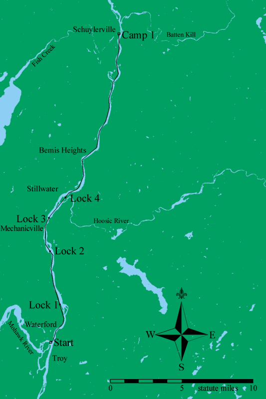
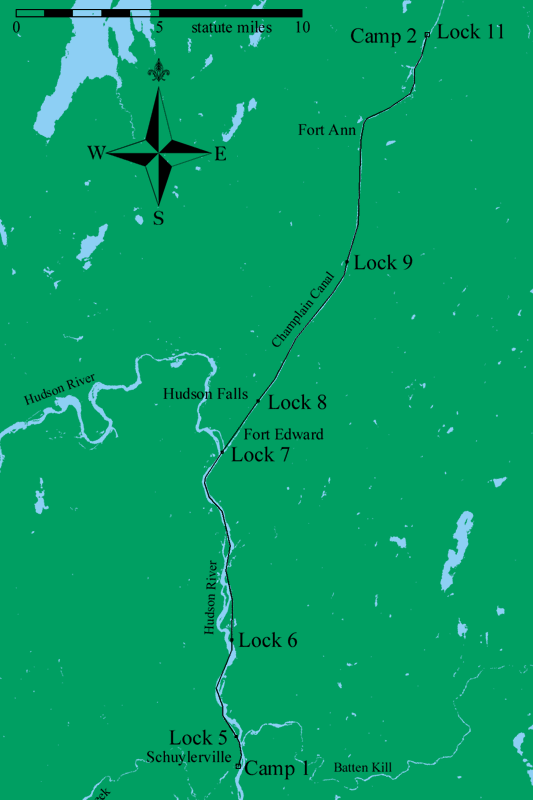
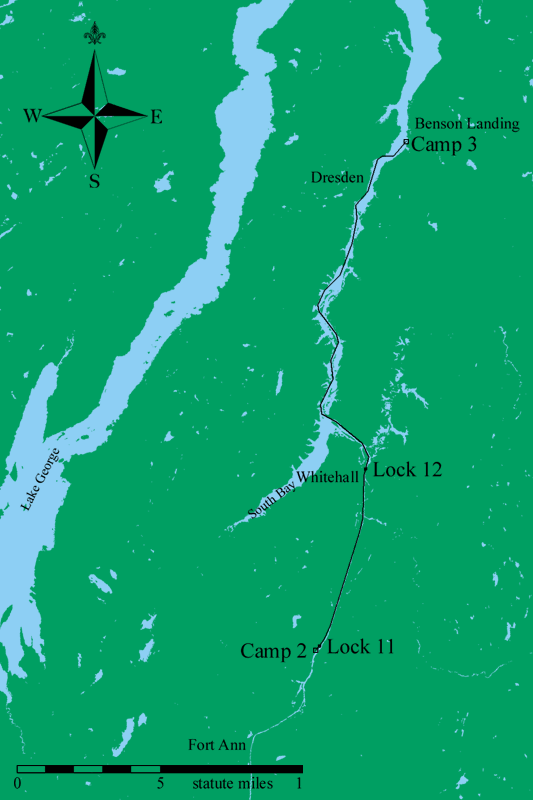
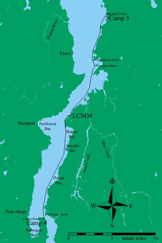
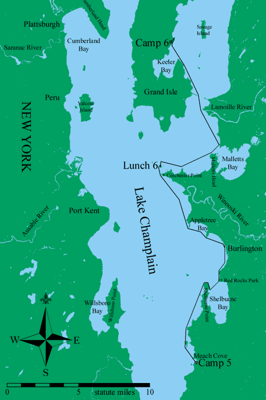
Map of Day 1, 12 September 2001.
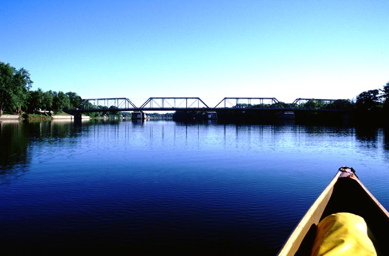
Just starting. This is the Route 4 bridge between Waterford and Troy.
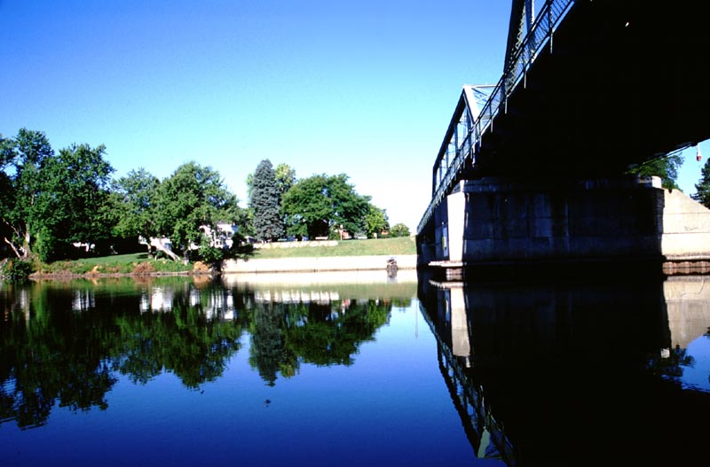
Underneath the Route 4 bridge looking at the Soldiers and Sailors Park in Waterford.
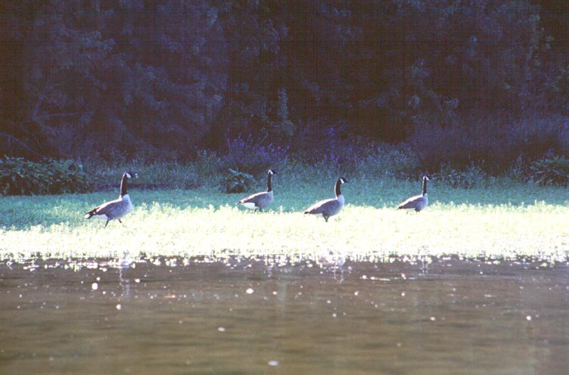
Canada geese along the shores of the Hudson River.
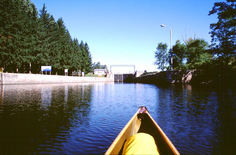
Approaching Lock C-1, the southern most lock on the Champlain Canal (which is also the Hudson River at this point).
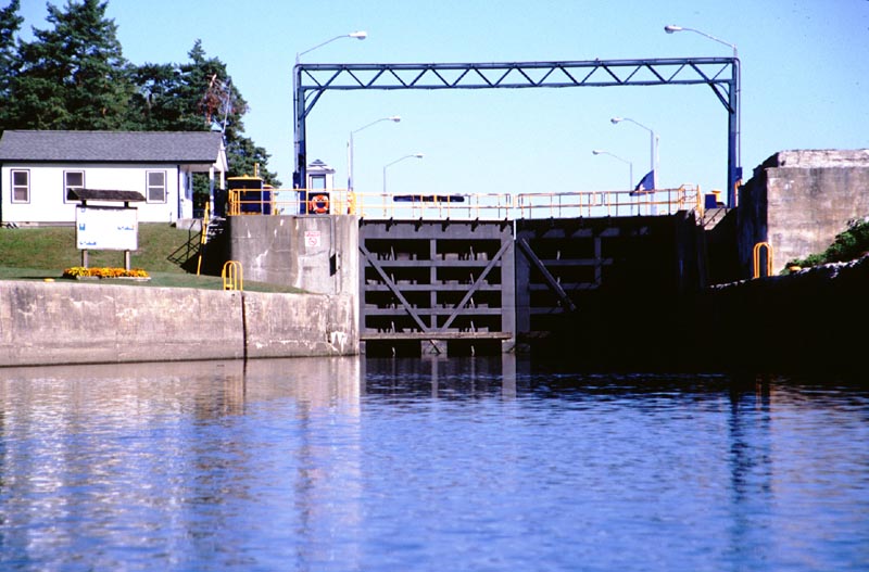
The lower gates of Lock C-1.
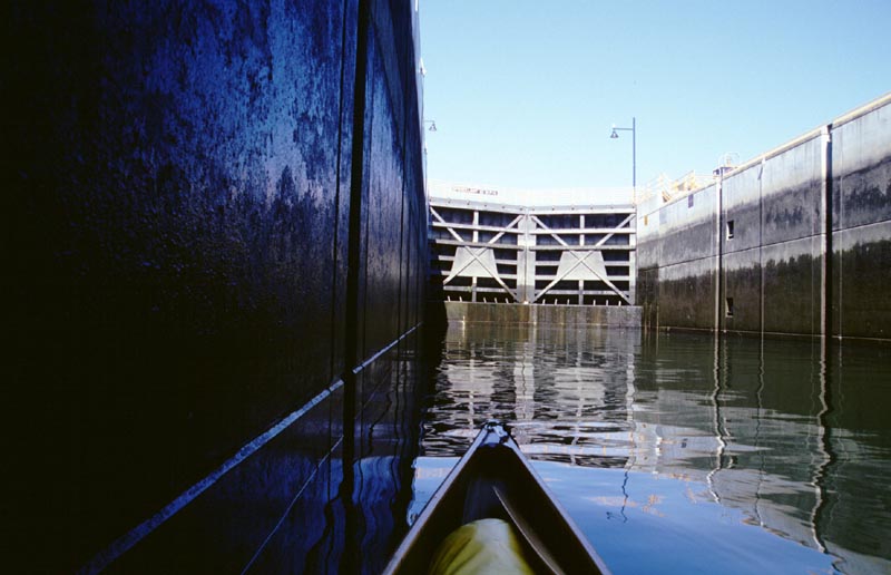
Inside the lock. The canoe is tiny compared to the capacity of the lock.
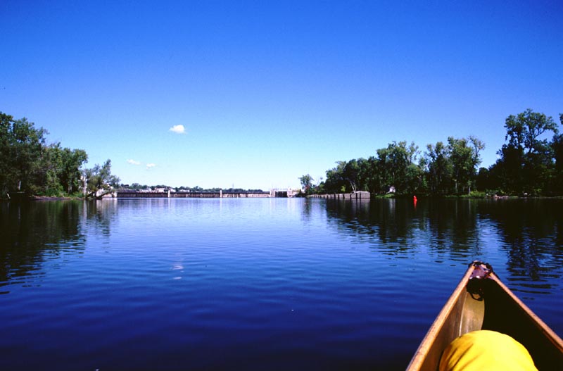
Approaching another lock. The Hudson is in a gentle mood; the last time I was here one could scarcely see through the driving rain.
The Mechanicville railway bridge.
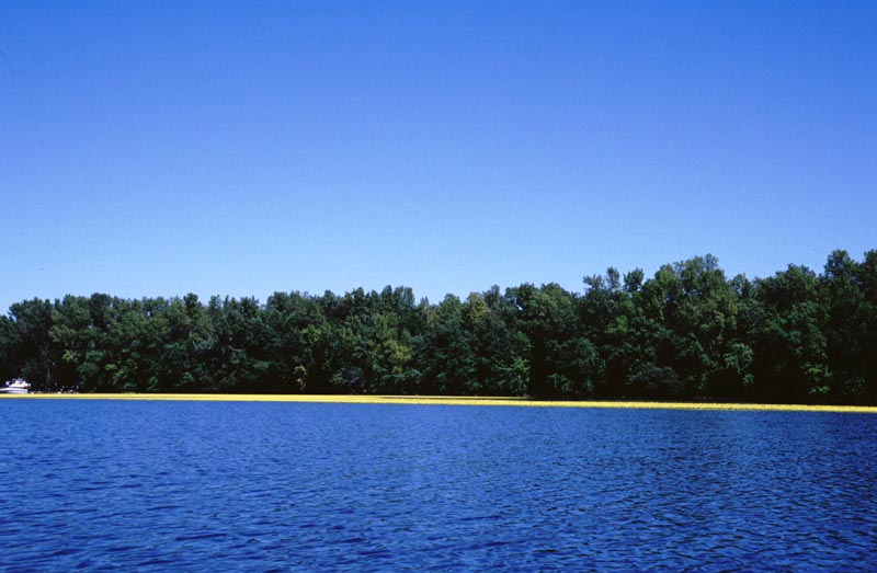
A swath of water lilies in bloom.

A closer view of the water lily flowers.
Map of Day 2, 13 September 2001.
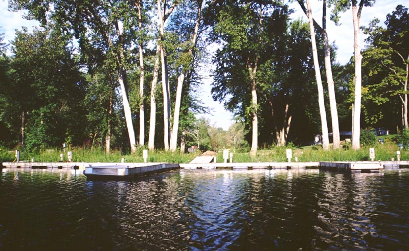
Part of the Schuylerville Yacht Basin. This was a very pleasant facility that I would recommend to any boat.
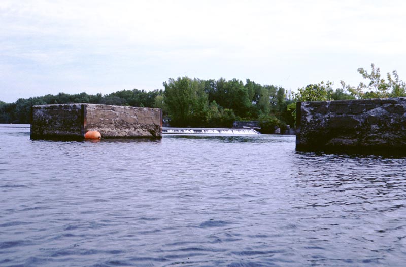
Cement blocks between the channel and a sunken crescent dam. The current was fairly strong here, encouraging the boat to head for the dam.
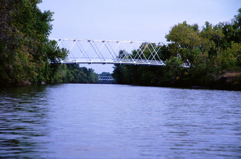
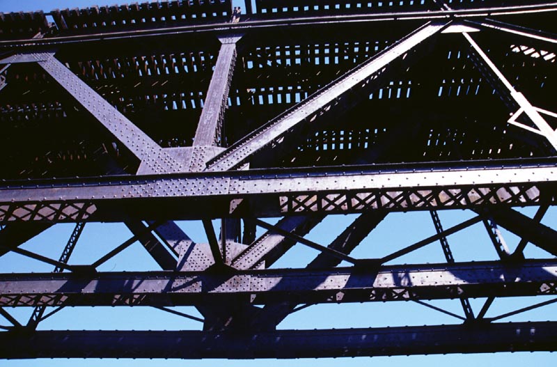
Bridges over the Champlain Canal. Some of these are abandoned.
A flag flying at half mast.
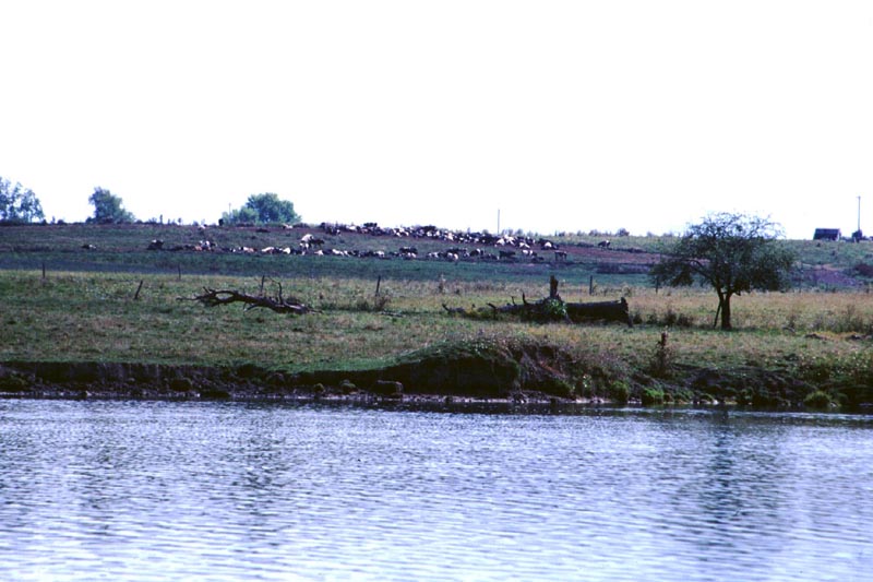
There are many dairy farms along the river.
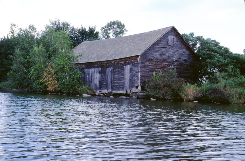
An old building along the river. The bottom edge of the building is quite decayed.
The canal between Lock C-9 and Lock C-11 is very pretty.
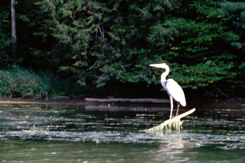
There were numerous herons along my entire route. I saw anywhere from half a dozen to fifty of them a day.
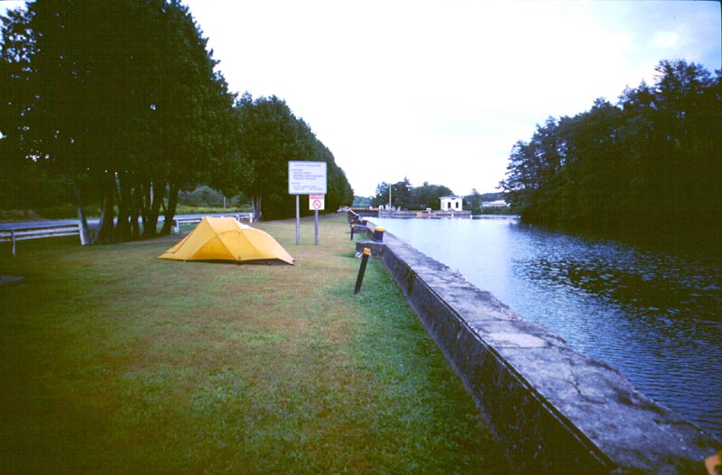
My campsite at the southern end of Lock C-11.
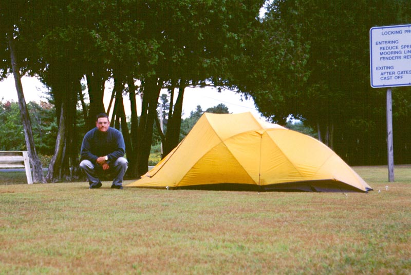
A picture of myself, crouching next to my tent at Lock C-11.
Map of Day 3, 14 September 2001.
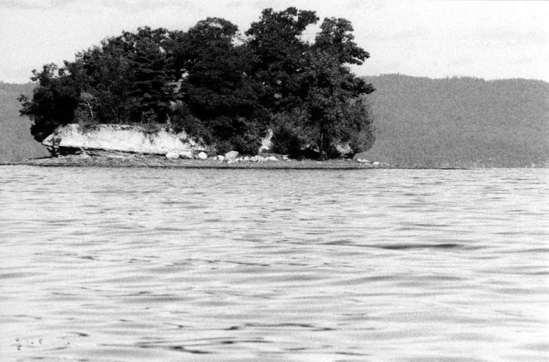
Regretfully, I managed to lose a roll of film, so I don't have any pictures from the third day of my trip. I had taken pictures of some hawks, a small turtle, and one of the navigational markers along the southern end of Lake Champlain. I still don't know how this occurred, as I am not prone to losing things.
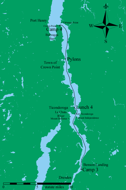
Map of Day 4, 15 September 2001.
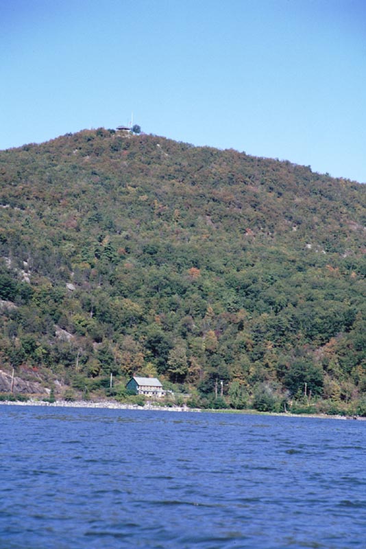
The inaccessible Mount Defiance. There is now a steep road up the mountain and a small picnic area on top.
Fort Ticonderoga. The fort protects the entrance to the La Chute River, which is the old water route between Lake Champlain and Lake George.
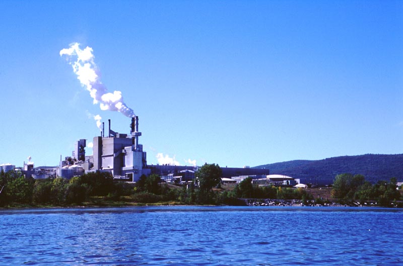
The International Paper plant in Ticonderoga. I had an old friend who helped put in some of the primary plumbing in this plant.
Most of the shoreline was pleasant trees or farmland. Occasionally, there were boat ramps and roads. This one looked particularly out of place with
its bone-white gravel surface.
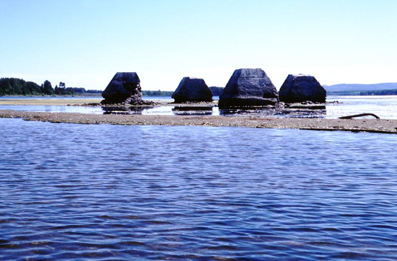
These four pylons are in a shallow section of the lake. I assume a tower once stood here, but I do not know for what purpose.
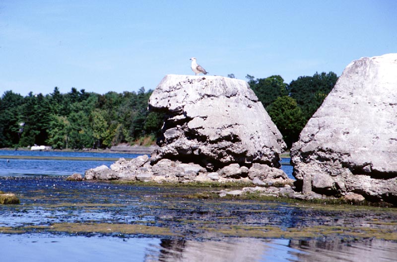
A closer view of one of the pylons. The concrete doesn't have any reinforcing rods and is being eaten away by the elements.
A pleasant bluff.
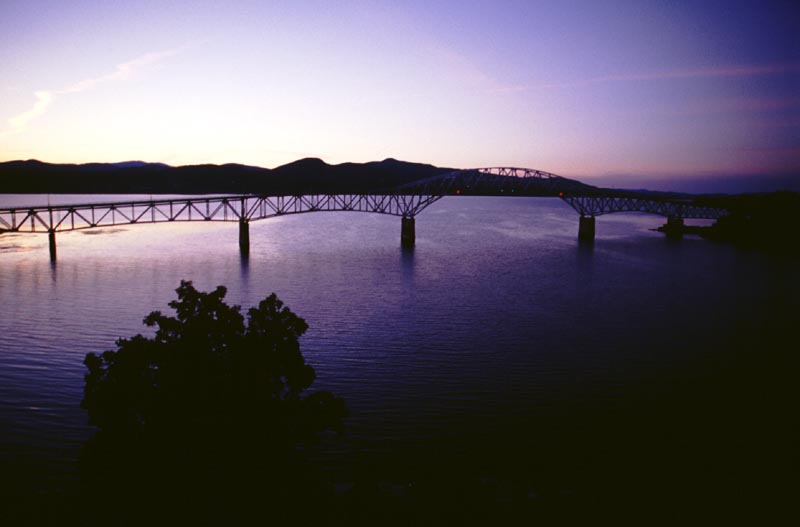
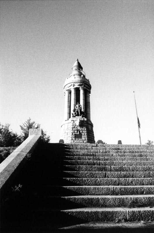
The Crown Point bridge in the twilight. I took this photograph from the Crown Point Light.
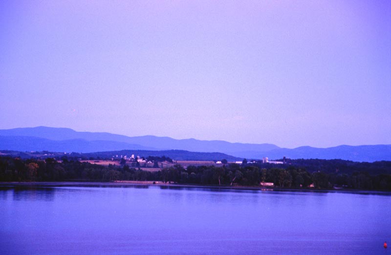
Farmland on the Vermont shore, as seen in the evening from the Crown Point Light.
This is the campground's boat launch. The dark item on the dock is my canoe.
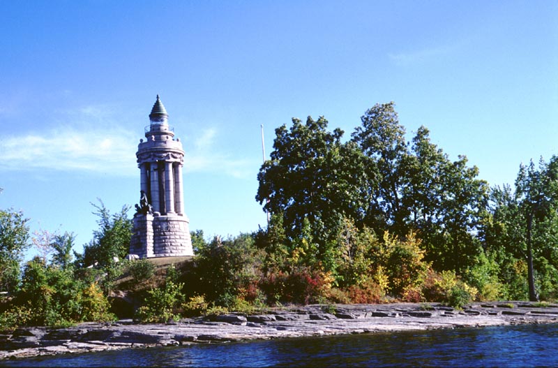
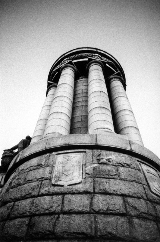
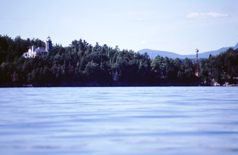
The Crown Point Light. This is also the Samuel Champlain memorial. It is one of the most elegant lighthouses I know of.
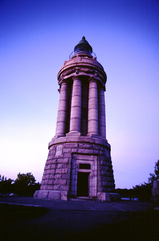
The southern side of the Crown Point Light. I took this picture in the twilight. This is the longest handheld exposure I have even done successfully.
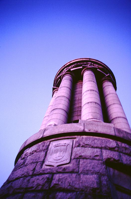
A better view of the columns.
At this point I switched to a roll of high-speed black and white film. Although somewhat grainy, I can take pictures in very dim light.
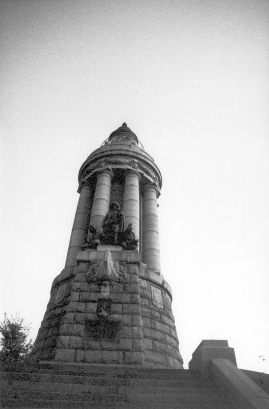
The northern side of the Crown Point Light. This statue portrays Samuel Champlain and some Indians.
The Light is at the top of a flight of steps. At the bottom (behind me) is a pavilion that juts out into the lake.
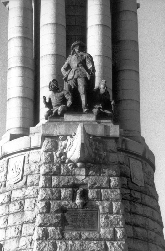
A closer look at Champlain and the Indians. I like the prow of the canoe.
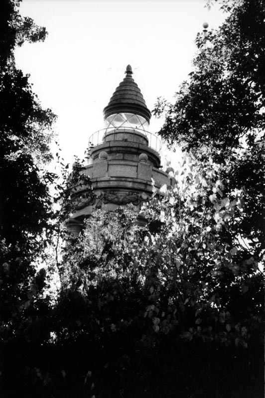
The Light is a working navigational beacon.
Map of Day 5, 16 September 2001.
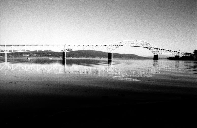
The Crown Point bridge. At this point if is full daylight, and I really don't need the high-speed film, but that's what is in the camera.
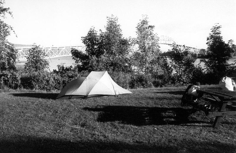
My campsite at Crown Point.
Mud Island.
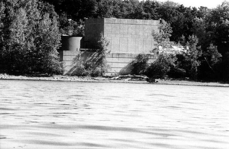
A windowless concrete building in Arnold's Bay.
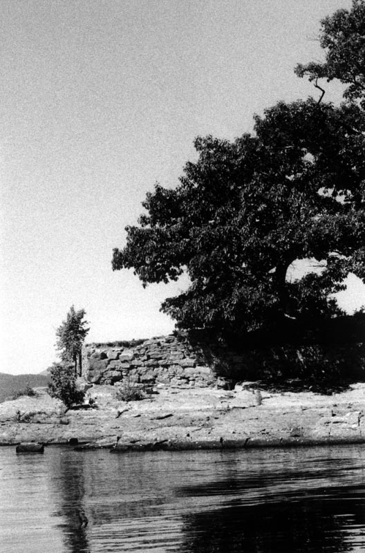
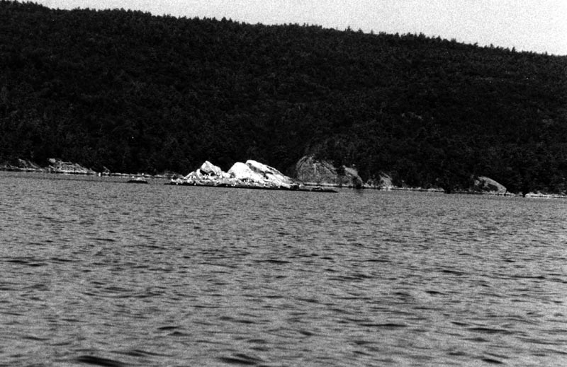
The southern point of Button Island. I don't know why there is a stone wall.
My canoe on the shore of Button Island.
The shore of Button Mould Bay. There is a nice state park just beyond this, and some gentle walking trails leading to the point.
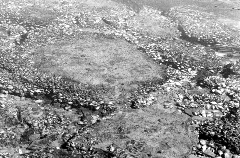
Under the water near the shore there are all sorts of small mussels.
Scotch Bonnet. This is a small bit of land between Button Mould Bay and Basin Harbor.
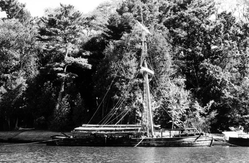
The Philadelphia II. I have had the pleasure of rowing stroke oar on this ship.
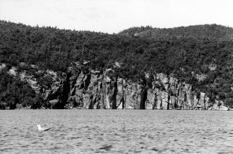
Cliffs along the New York shore. This section of Lake Champlain is called the Narrows, even though areas to the south are narrower.
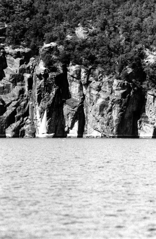
A sailboat in front of the New York cliffs.
Cliffs along the Vermont shore.
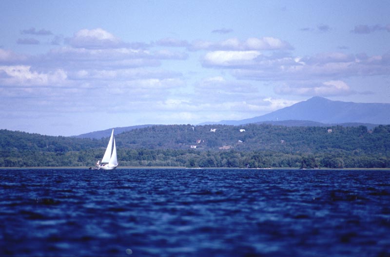
There were many sailboats out on this day.
Split Rock Point on the New York shore. My chart states that the lighthouse is abandoned.
Some of the fancier homes have a high browse line.
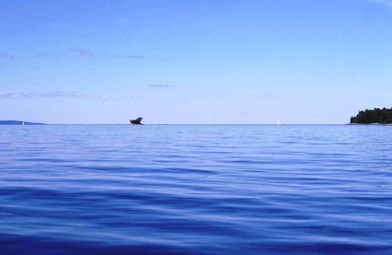
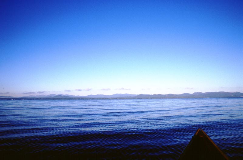
Lake Champlain is long enough to provide a good horizon.
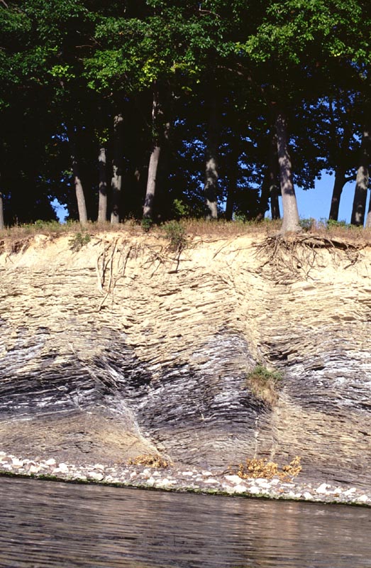
There are many cliffs along the water's edge. Some of them are relatively smooth granite, but there are also interesting layers like this.
Garden Island, just beyond Thompson Point.
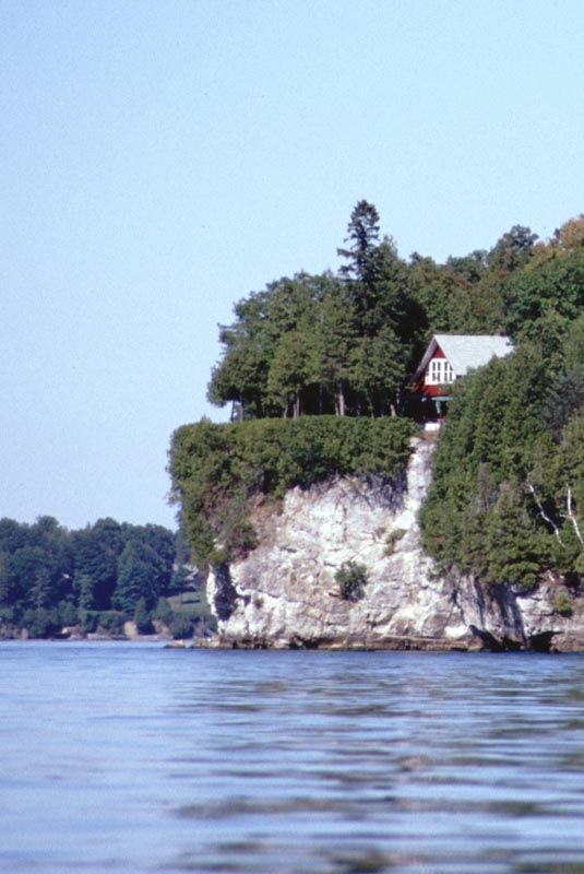
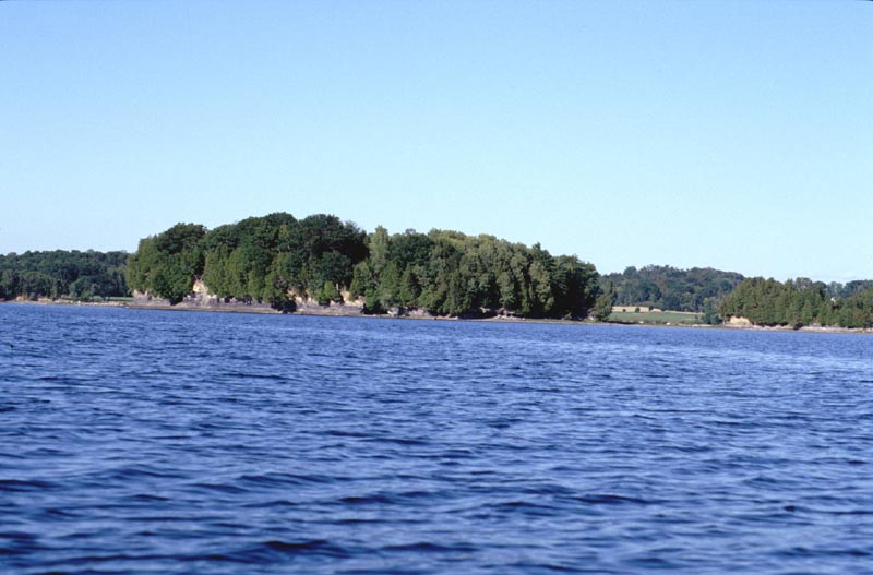
The picnic area at Shelburne Beach in Meach Cove. Some people were kind enough to give me permission to camp in the area to the right of this.
Map of Day 6, 17 September 2001.
The northern point of Meach Cove in the early morning.
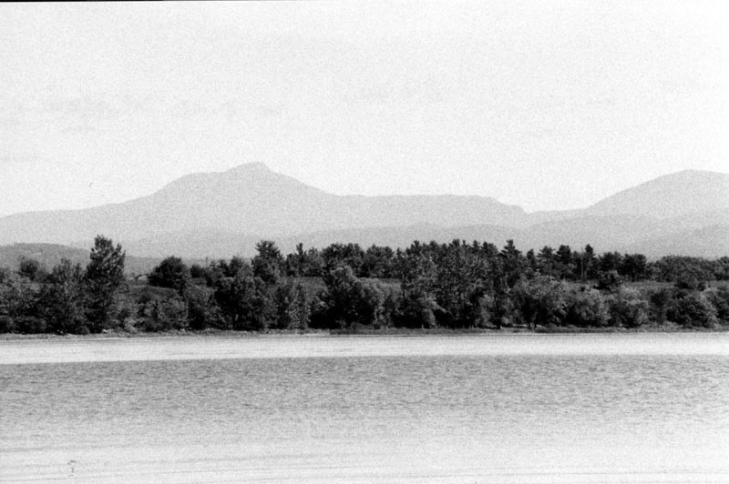
The Adirondack Mountains.
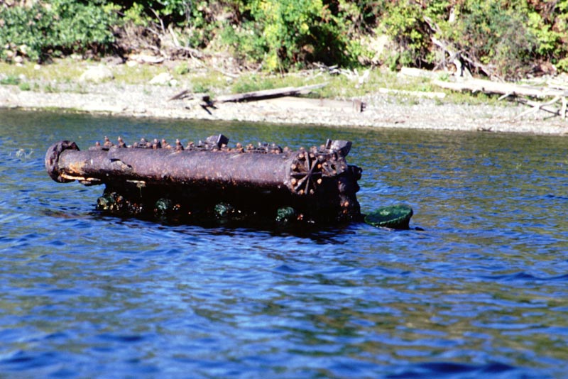
An old marine motor.
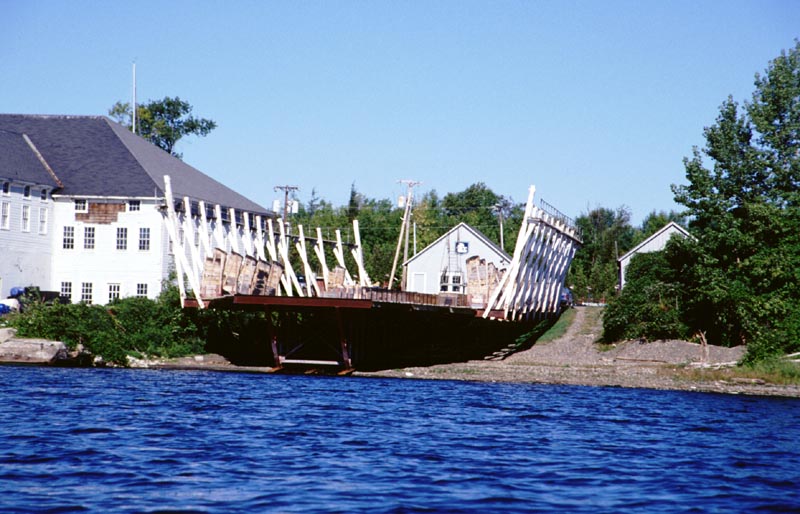
A set of ways at the Shelburne Shipyard.
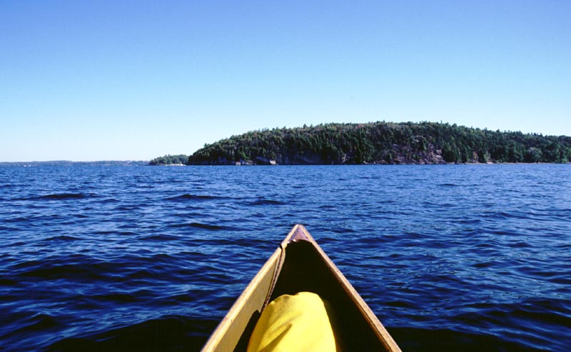
Heading toward Red Rocks Point.
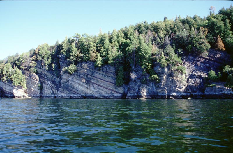
Some of the striated cliffs at Red Rocks Point. I don't know if any of them are red.
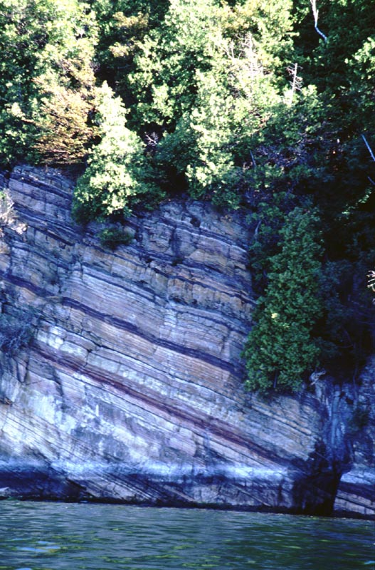
A closer view of the striated cliffs.
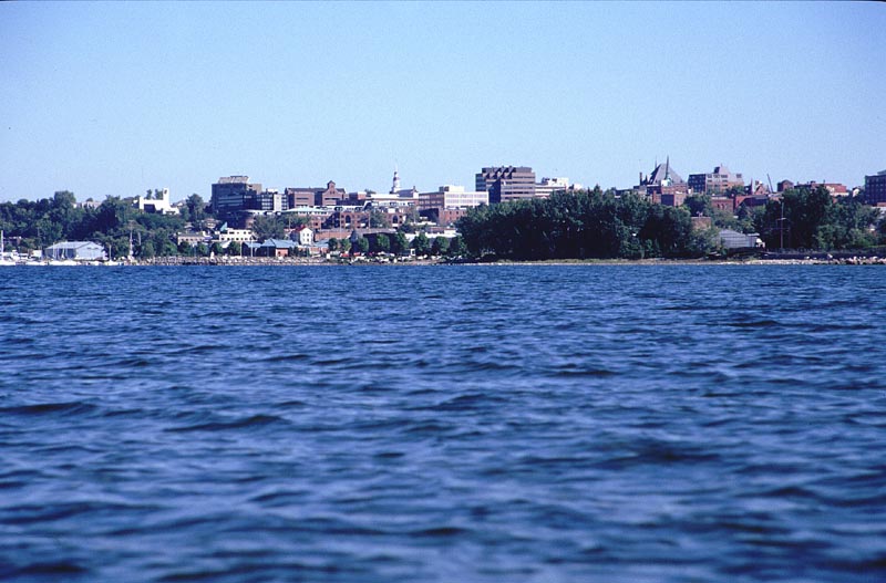
Burlington, as seen from the southwest.
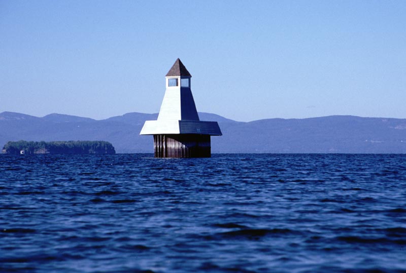
A small structure in south Burlington harbor. I think it has something to do with oil delivery, but I could be completely wrong.
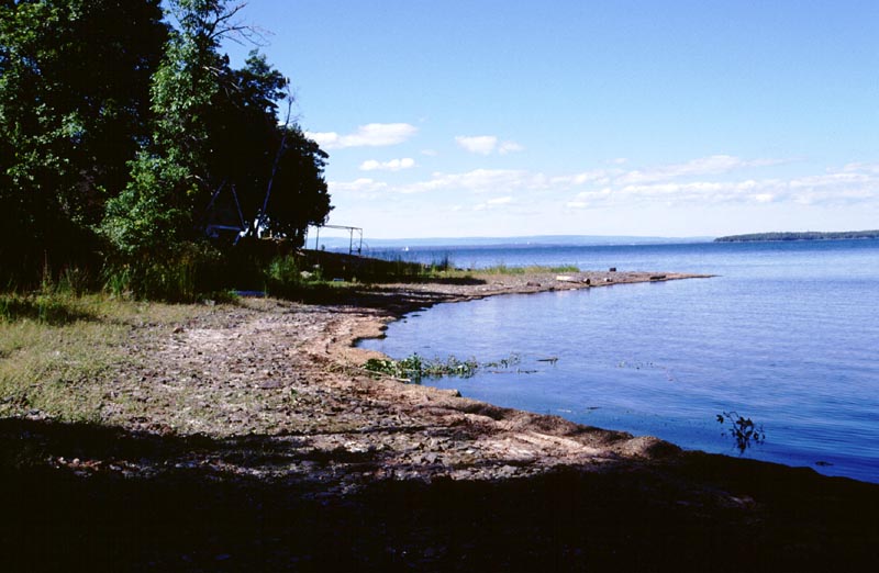
The shore of Law Island. An old abandoned house is in the shadows.
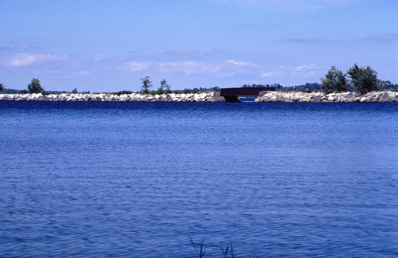
One of the old railroad causeways.
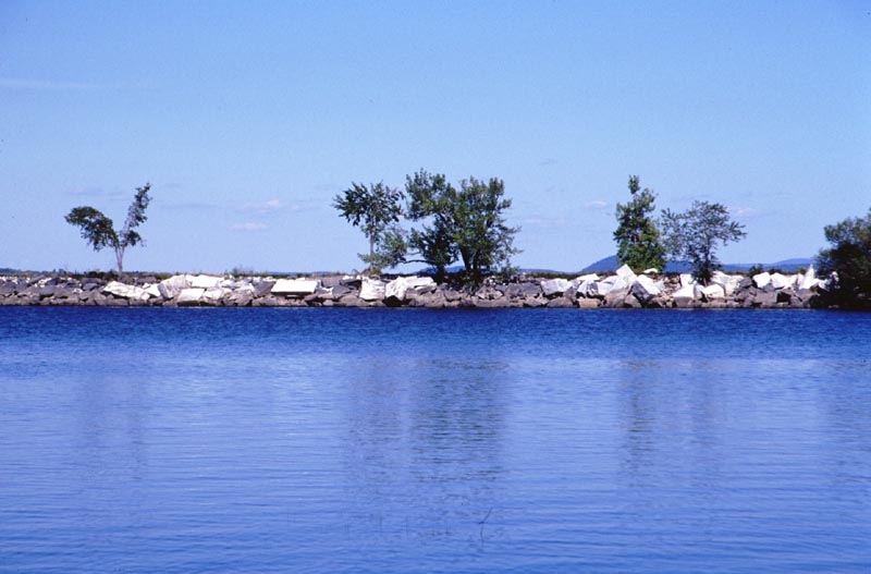
A closer look at the railroad causeway. In some ways it reminds me of the Florida keys.
Map of Day 7, 18 September 2001.
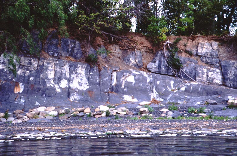
Interesting rocks along the Grand Isle shore.
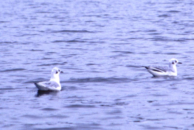
I saw many of these gulls.
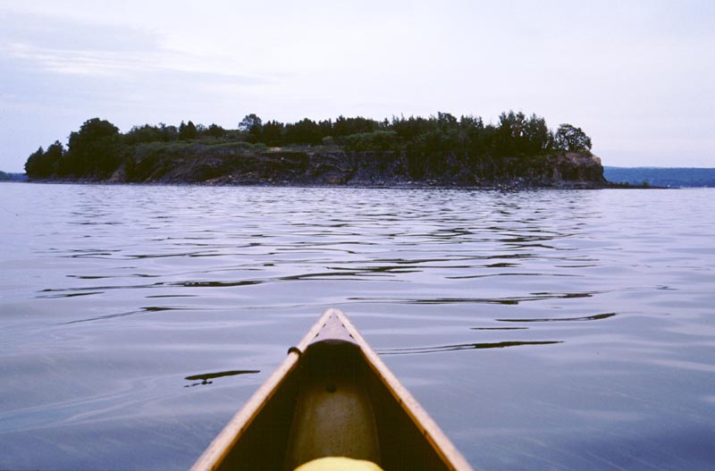
Approaching Ball Island, just southwest of Burton Island.
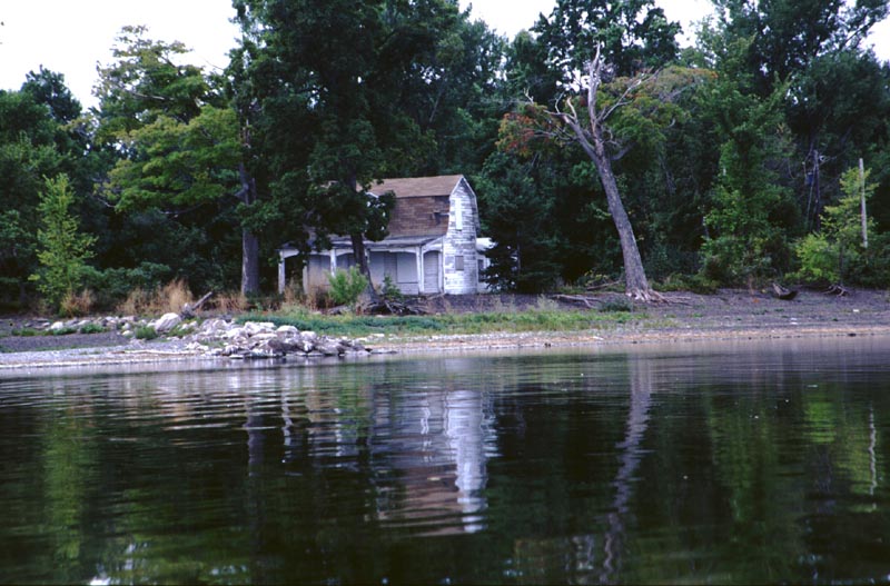
A boarded up house at the eastern end of Burton Island.
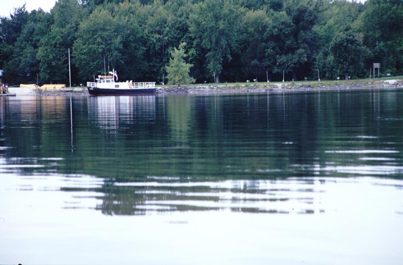
A boat moored in front of the headquarters of Burton Island State Park. During the summer, there are enough boats here that it looks like a regular marina.
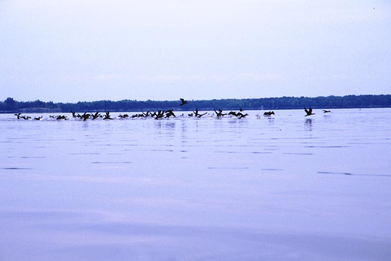
Lots of ducks along a gravelly spit that juts to the east of Wood Island.
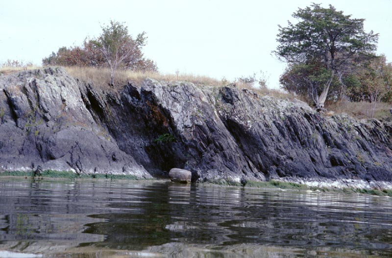
The southern end of Butler Island had short interesting cliffs.
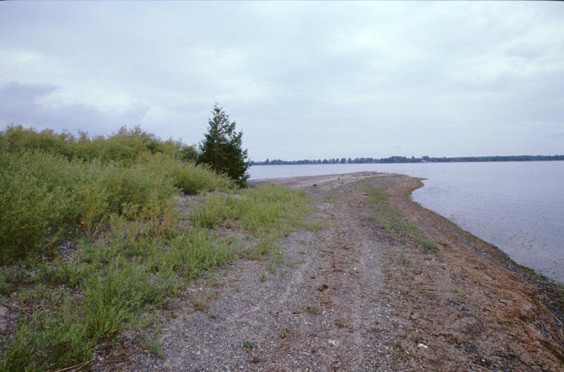
Stephanson Point at the northern end of North Hero Island.
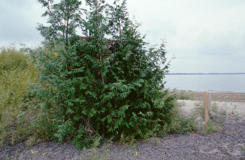
A duck blind.
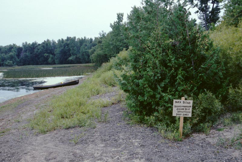
For those who couldn't identify it, here is a sign. The sign has the name and phone number of the person who has erected the blind, but I've effaced them
from the photograph.
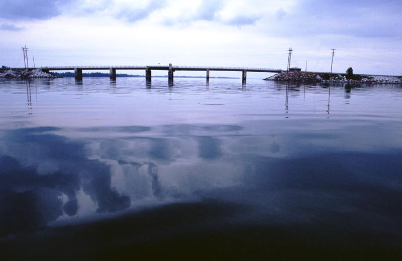
The Missisquoi automobile bridge. On either side is a lengthy causeway.
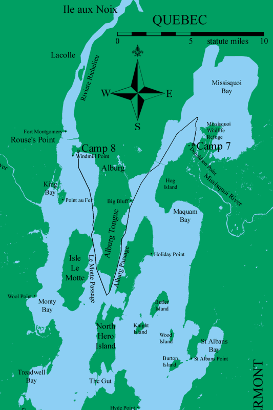
Map of Day 8, 19 September 2001.
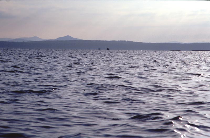
Looking east into Missisquoi Bay.
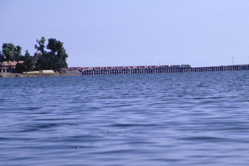
A train crossing the Missisquoi railway bridge.
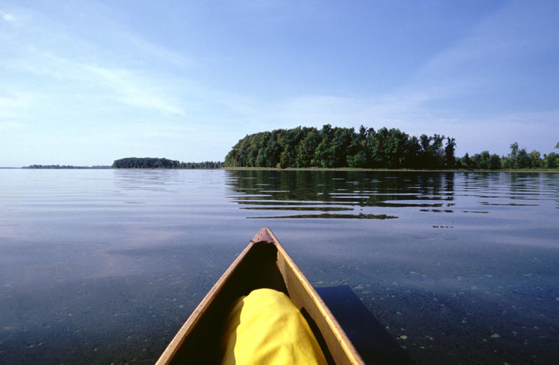
"Oh, that's a big bluff." Also note the spirogyra in the water.
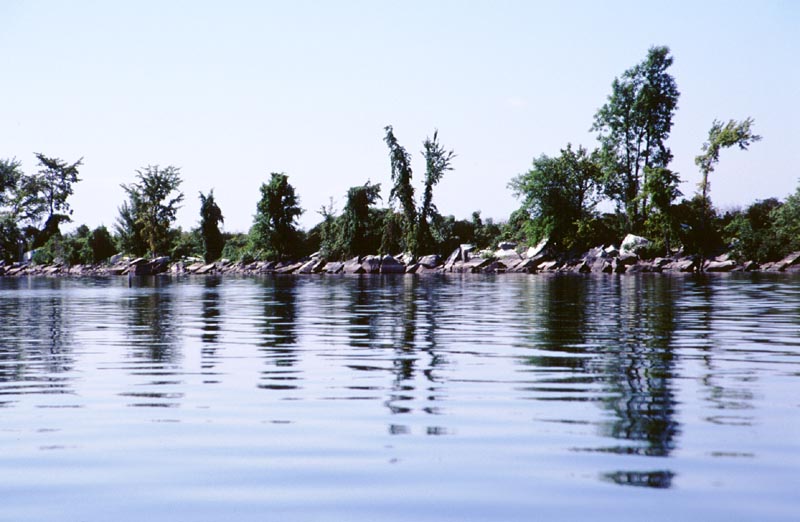
Another old railroad causeway, this one running from the southern end of North Hero Island to Grand Isle.
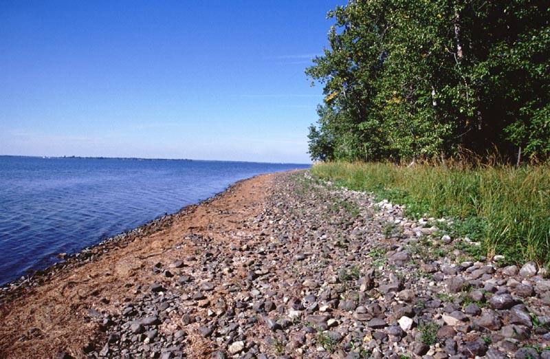
The pleasant beach along the western side of the Alburg Tongue.
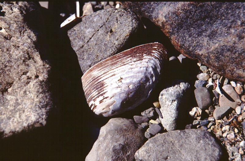
Shells along the beach.
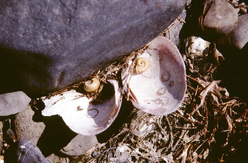
Snail shells inside clam shells.
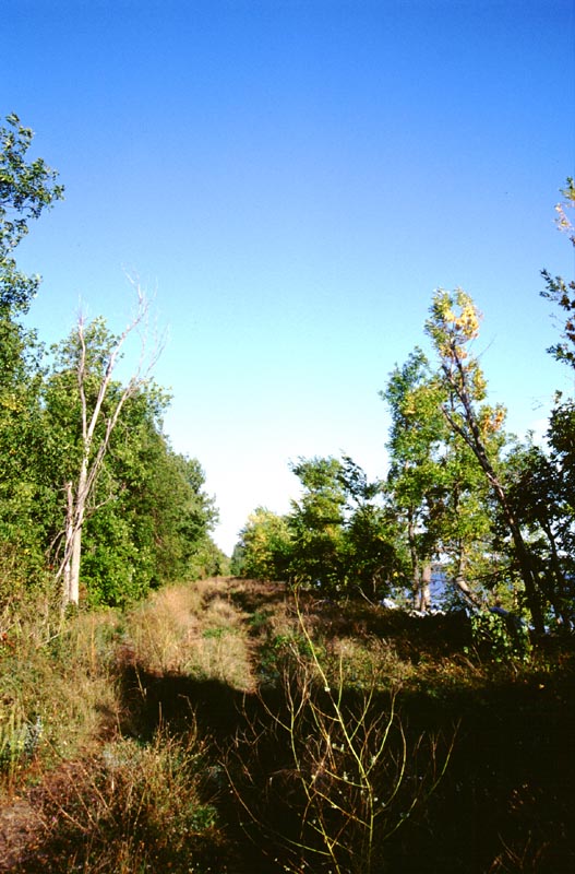
The dirt road atop the old railroad causeway running between Windmill Point and the town of Alburg.
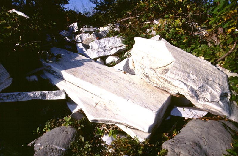
The causeway is made up of splendid marble rocks. I used this slanted one to travel up and down between the berm and the beach.
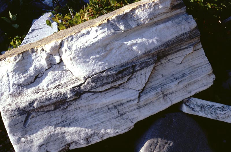
A cross-sectional view of one of the larger marble blocks.
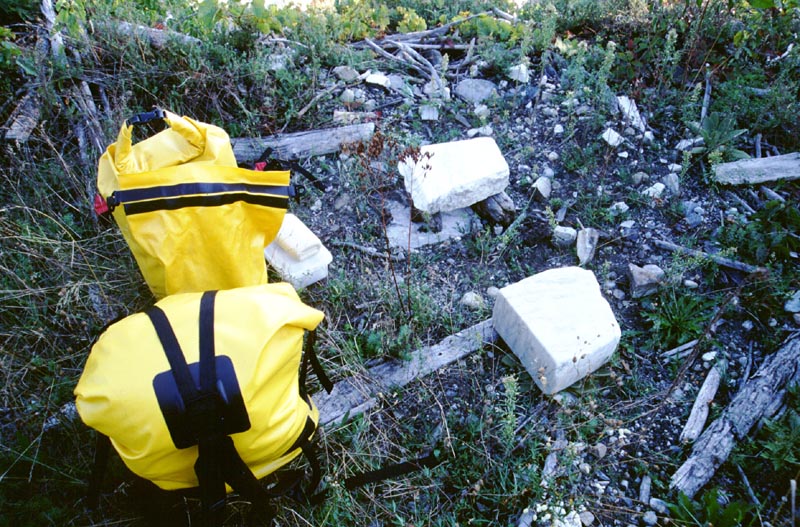
The area I'm using as my kitchen. I've placed marble blocks for use as a table and chair; later I added a larger one for a sideboard.
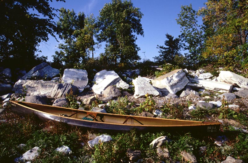
My canoe on the beach with the causeway behind it.
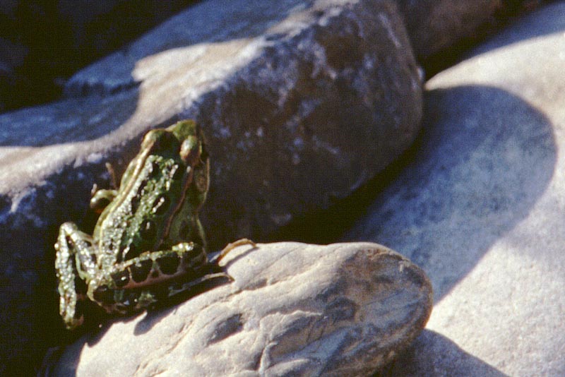
I saw many of these frogs throughout the entire trip. I checked a guidebook after the trip; I think they are northern leopard frogs.
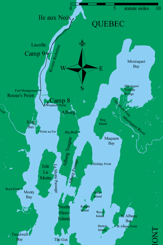
Map of Day 9, 20 September 2001.
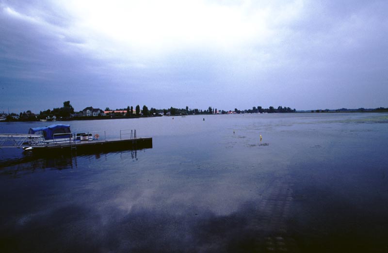
Looking across the river from the dock on Ile aux Noix.
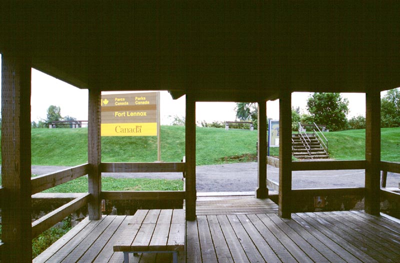
A pleasant wooden pavilion on the shores of Ile aux Noix.
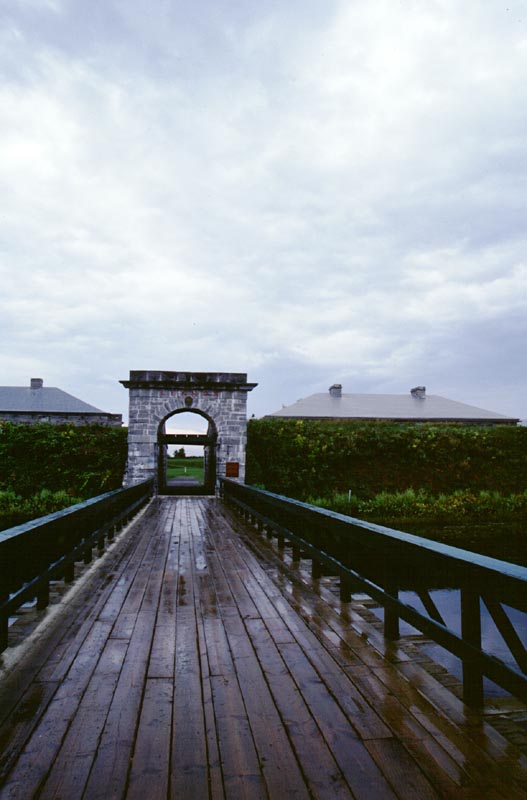
The main gate into Fort Lennox. Originally the walkway had a draw bridge.
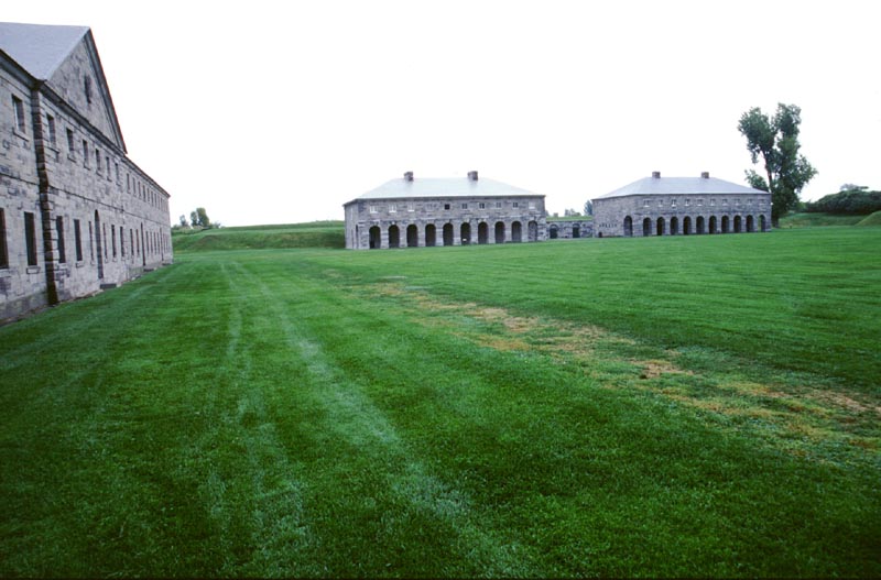
A view across the parade from the troops barracks to the officers' barracks.
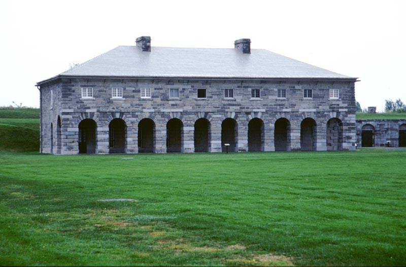
The officer's barracks.
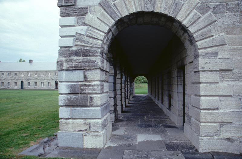
A side view of the arches.
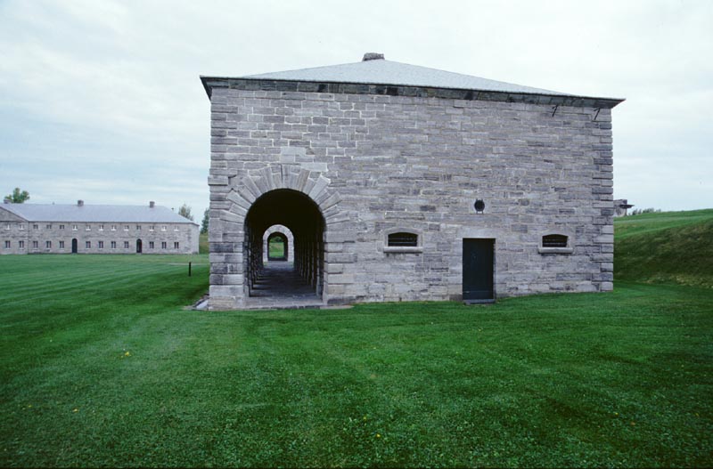
Another side view of the arches.
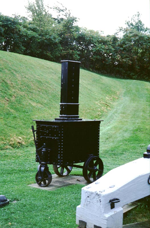
A hot shot furnace, used for heating cannon balls before they were fired.
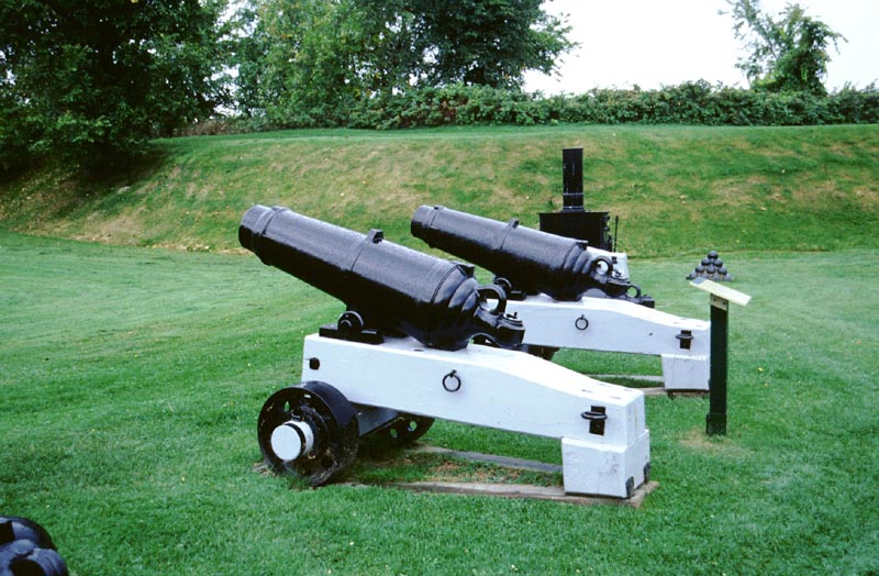
A few 32 pounders. These cannon would fire a 32 pound cannon ball.
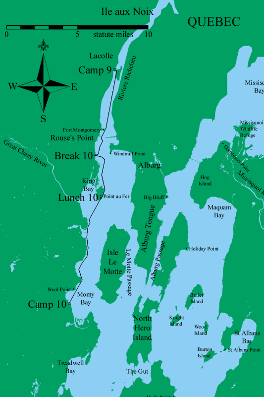
Map of Day 10, 21 September 2001.
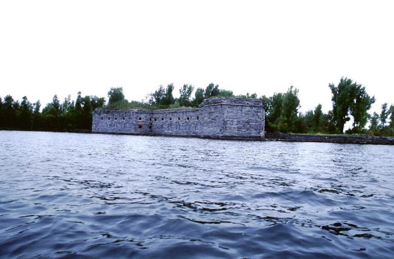
Fort Montgomery. This is the southern side.
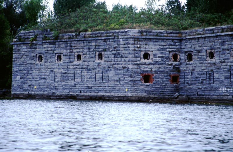
A closer look at Fort Montgomery.
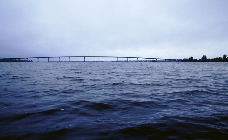
The highway bridge between New York and Vermont, seen from the north.
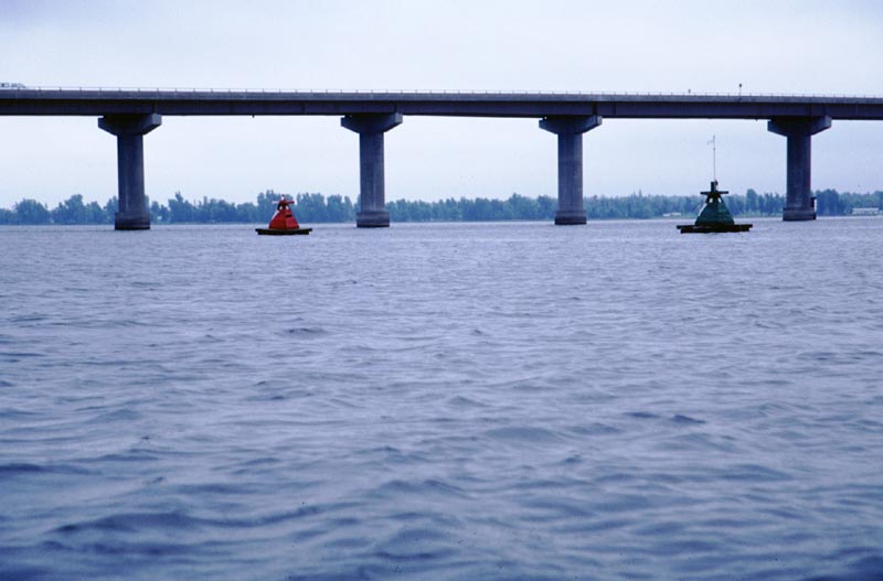
Strange buoys marking the entrance to the Rouse's Point harbor.
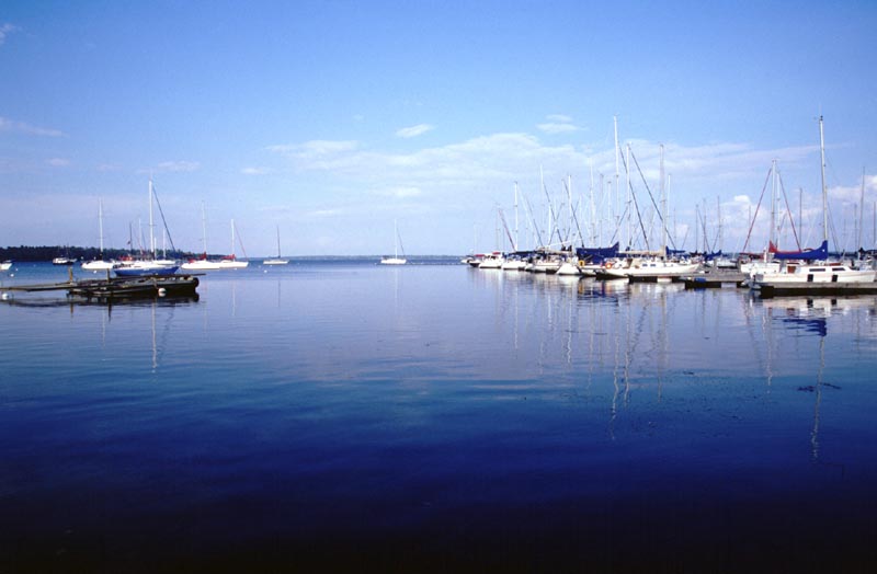
The lovely Gilbert Brook Marina.
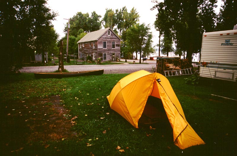
My campsite at Monty Bay. The wooden building in the background is the campground and marina offices.
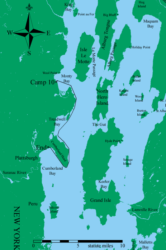
Map of Day 11, 22 September 2001.
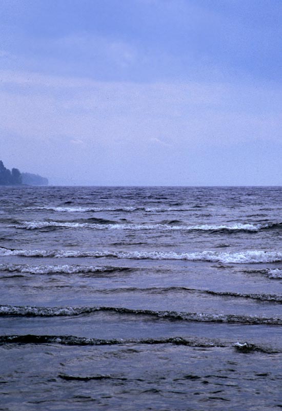
Breakers piling on to the shore at Cumberland Bay State Park. The photograph doesn't give a good sense of scale; they seemed huge.
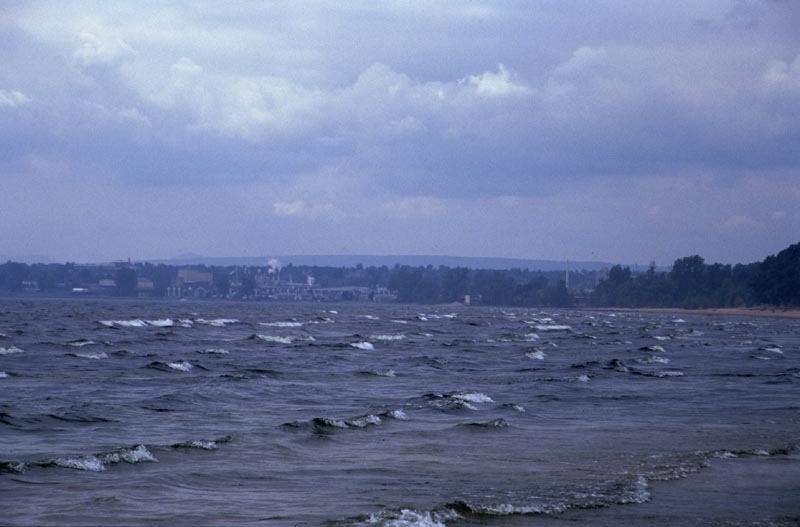
Another picture of the surf coming into Cumberland Bay State Park.
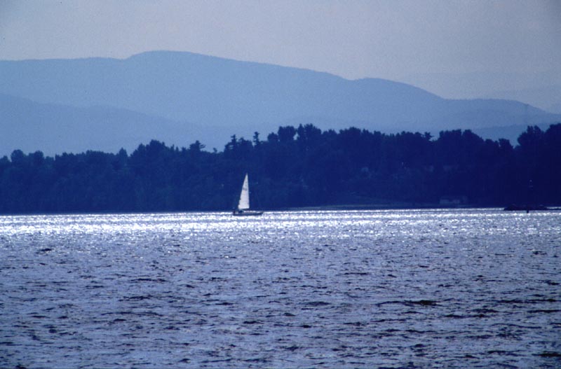
The sun came out briefly at the end.
About the Maps
I wanted to make a map of my trip. Since I had recorded my path using a GPS receiver, this didn't seem like it would be too hard. It proved more difficult than I expected.
The GPS receiver only has a finite amount of memory. It didn't have enough to save the complete track log of all 11 days. Each day I would reduce the track log to a set of 30 or so points. This gives a rough angular path, but it does preserve the basic idea of the route.
The route distances are also mildly suspect. The GPS records distances in three ways. There is a cumulative trip distance that is incremented whenever one's speed is greater than 1 mph. This is the distance I have reported in the journal. There is the distance of the route points (the set of 30 or so points for the day), which is often 2 to 5 % less than the trip distance. Finally, one can process the track log and compute the distance represented by the track. This is almost always larger than the route distance. As the trip distance is only incremented when one is travelling faster than 1 mph, I know it to be somewhat too small. Therefore, although I report a total trip distance of some 260 miles, this is the minimum. It could be 10 or 15 miles more.
Once I had transferred the route points into a computer, the next step was to plot them on a map. I wanted a map which ideally showed the same outlines of Lake Champlain as the navigational charts. The best I found for the portions of the lake in the United States were some land use maps published by the USGS (see here. These are 30 meter resolution raster maps that are presented as an Albers Equal-Area Projection using the GRS1980 Ellipsoid.
Map data for the Canadian portion of the trip proved vastly harder to obtain. I eventually settled for a vector map which showed a crude outline of the Richelieu River and Missisquoi Bay that I obtained from the GIS Data Depot. The outlines don't include islands or secondary rivers. The data file itself claimed to use the Clarke 1866 Ellipsoid, but without specifying the datum, conversion to the same coordinate system as the other data was questionable (plus the source data isn't as high quality).
I then wrote a program to generate a UTM projection of the region where I travelled, making a two color map representing land and water. The final maps are all in the WGS84 Datum. For each pixel in the final map, the coordinates of the pixel were first converted from UTM coordinates to either Albers Equal Area coordinates (in a different ellipsoid) or to Clarke 1866 coordinates. The source maps were then checked, giving preference to the USGS data in the places where there was overlap. For the USGS maps, the check merely ascertained if the selected point had the land-use specification of 'water'. For the Canadian maps, the check determined if the point was inside a closed polygon or not.
Once I had a map in UTM coordinates showing land and water, I ran another program I had written to add the GPS track data, complete with small marks wherever I had a waypoint (such as where I camped or where the locks are located). Lastly, I used Photoshop to add place names and to color the map.
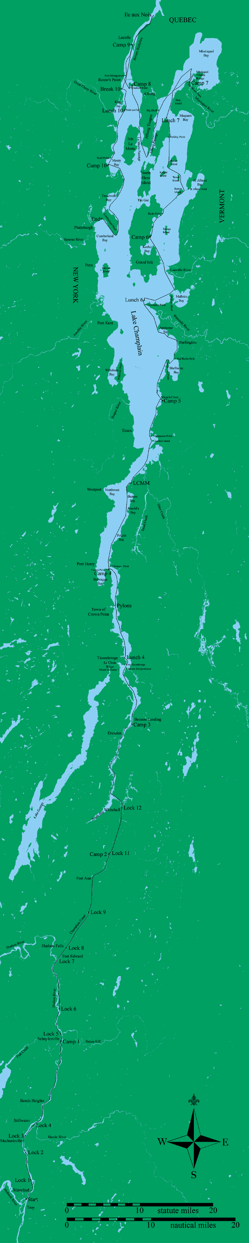
A map of the entire trip. This is a large GIF file, which some browsers may have trouble loading.
About the Photographs
I use a Nikon 6006 camera. I brought two lenses, a 24-120 mm 3.5-5.6 f zoom lens, and a 70-300 mm 4-5.6 f zoom lens. I also had a 2x teleconverter which drops off about two stops of light. Most of the photographs were taken with the 24-120 mm lens.
I used three types of film on this trip. My normal film is Kodak Elite Chrome 100. I also tried out some Kodak Ektachrome ES 100. In general, I didn't like this as well as the Elite, probably because it is more saturated. Lastly, I used one roll of Kodak 3200 speed black and white film.
I scanned the slides using a Minolta QuickScan 35 scanner. This doesn't have a very good dynamic range, and if the slide is the least bit dusty the scan doesn't come out very well. I scanned the black and white prints using a 600 dpi flatbed scanner, then scaled them to the size on the website. There are tricks to get better scans out of both scanners, but they are very time consuming and I haven't done them. Naturally, all photographs were scanned at a higher resolution that I have on the website.