
This journal is excerpted from the journal I kept on a canoe trip from Syracuse to Buffalo in September 2002.
All text and images are copyright 2002 by David Manthey. All rights reserved.
Preliminaries
My planned trip was to launch the canoe near Syracuse, halfway along the length of Onondaga Lake at a marina, leaving my car in a nearby parking lot. I would then canoe out to the Erie Canal, east to Three Rivers Junction, then turn around and head west to Tonawanda. If currents in the Niagara River permitted, I would canoe south to Buffalo and land there; if they did not, I would land in Tonawanda. Either way, I would put in at a marina, arrange to leave my canoe and gear for a while, and take an Amtrak train from Buffalo to Syracuse (either walking to the train station from Buffalo, or arranging a ride from Tonawanda). Once at the Syracuse train station, I would walk back to my car, drive back to Buffalo or Tonawanda, pick up the canoe, and take a leisurely drive home. On the drive back, I planned to stop at any sights I had seen from the canoe but wanted to see in greater detail or from another vantage.
The trip mostly followed this plan, excepting for some details near the end.
One might question the sanity of canoeing west on the Erie Canal. After all, it is upstream the entire way. It would have been vastly faster to travel in the other direction. Indeed, the most common comment I received from people while on the trip was that I was headed in the wrong direction. However, I view this as an extension of my trip on the eastern half of the canal, and feel it is important to travel outward from where I live. That, plus pure bull-headedness (Grandpa would have said either stubbornness or persistence) makes me want to do the harder of the two options.
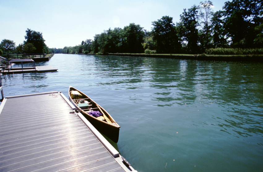
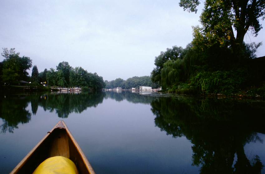
The accompanying photographs are a combination of those taken while canoeing and those taken on my way back from Buffalo. If it looks like the photograph was taken from land, it was most likely taken on my return. Click on any photograph for a larger version.
I left my apartment on Friday, 13 September, and camped at Green Lakes State Park near Syracuse. This would allow me an early start on Saturday. What follows is an excerpt from my journal of the trip.
Saturday, 14 September 2002 - Lysander, NY
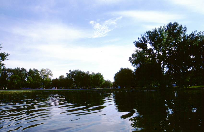
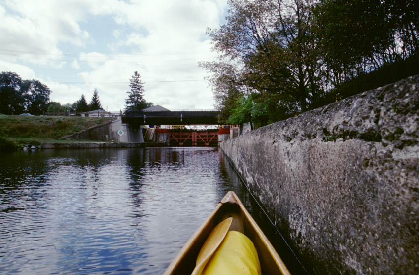
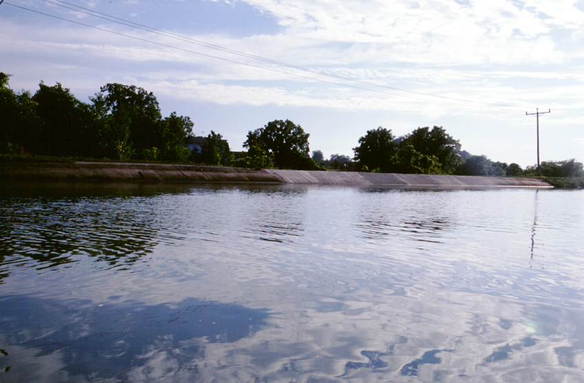
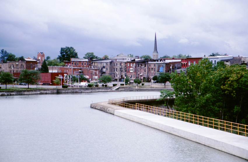
Up around 6:30, out of the campground 20 minutes later. Syracuse still proves astonishingly difficult to get around, even having been to my intended start point once before. I stopped at a diner for breakfast, then found my way to the Salt Museum on the shores of Onondaga Lake. The marina is located just a bit further along the shore, but it takes me 10 minutes to find the road that leads there. The marina has all manner of signs prohibiting parking and restricting its use. The harbormaster's office doesn't open until 10:00 a.m., and I don't see anyone or any place that will function as a substitute. I offload the canoe and all the gear, then move my car to the general parking lot opposite the museum. I hope it will be okay there.
I launch at 8:45. 134 miles to Buffalo as the crow flies; perhaps 200 by my route.
Despite being on a picturesque lake on a Saturday morning, next to a marina, no less, the only other boat that I see is a small single-sail sailboat making perhaps 2 knots. The near shore of the lake is a long park with a walking path and a bike path (two distinct paths with instructional signs on which people may use which path, reminiscent of the dissertation on German walkways in Three Men on the Bummel). Pedestrians and rollerbladers are using the paths in great profusion.
I wonder about the salinity of Onondaga Lake. Is it higher than normal due to the salt deposits in the area? Is it higher than normal due to the old industrial salt extraction processes? It doesn't taste salty.
It is around two miles to the northwestern outlet of the lake. Here I encounter a myriad of rowing shells. There is a huge rowing boathouse along the right side of the channel, with lots of boats launching and lots of people milling around. One four-man shell that is just getting started offers to race; I demur.
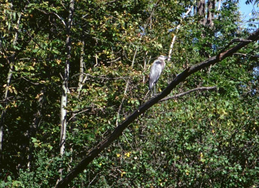
After going under a number of bridges, the channel forks around an island. I bear right. A short bit later and I join the Erie Canal -- here the Seneca River. There are all manner of pleasure craft on the canal. I pass the usual herons, Canada geese, and other fowl. I see a few oil tank farms.
A few miles to the east and the houses start in earnest. I wonder how far it is to Three Rivers Junction. I could check the charts, but it is more pleasant not knowing precisely. Two years ago when I canoed the eastern Erie Canal, I turned north into the Oswego Canal at Three Rivers Junction. By going there this time, I will have canoed the entire Erie Canal.
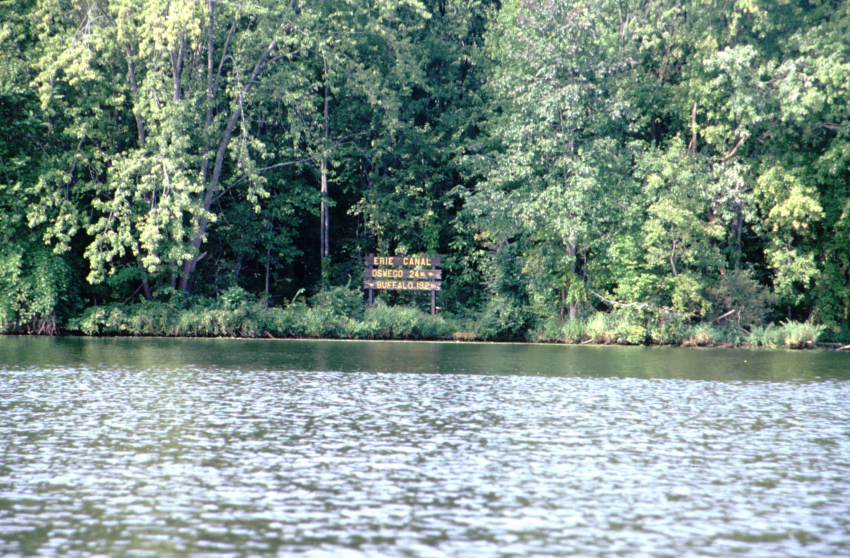
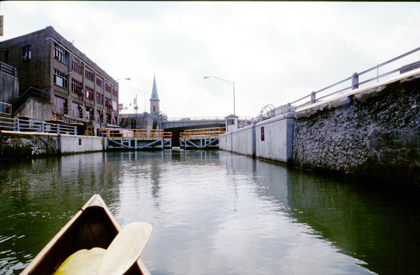
I pass under the bridge in Belgium, go by many more houses, and then spy the Canal Corporation boat Seneca. She's docked at the ratty terminal wall on the south side of Three Rivers Junction. I circle about in the junction, this time taking a photograph of the sign which reads, "Oswego 24, Buffalo 192." It is on the opposite side of the Oswego River as the sign I photographed last year for "Albany 170". I come about and head WEST. I've paddled 10 miles at this point.
I repeat the 6 1/2 miles to the channel for Syracuse. It goes quickly, as familiarity always accelerates the perception of my travels. There are quite a few boats out, headed in both directions. The area is too built up to get the rarer birds and animals. At the Syracuse junction, I proceed west. After a short jaunt, it begins to rain lightly. It isn't enough to be annoying, but it does chase the camera into the dry bag and prevent me from changing the charts.
I have two chart books; one from NOAA that contains the official New York State charts of the canal, and a 'cruising guide' which lists marinas and places of theoretical interest. Both are large and clumsy for a canoe, and both are in a single plastic chart case. I can only see one page of each book, and this only covers 5 or 6 miles of the canal. Changing the page involves unsealing the chart case, extracting the book, turning the page, reinserting the book, getting the excess air out of the chart case, and resealing the chart case (all while either maintaining way, or at least not crashing into anything).
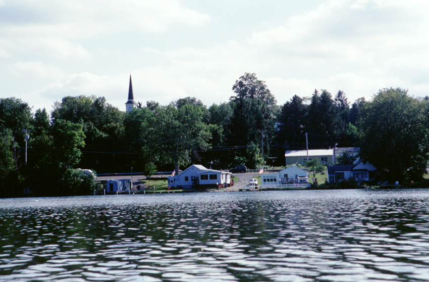
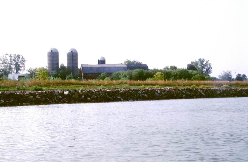
The scenery is mostly rich houses. Not more than a few percent of them show any sign of life. Huge yards, all manner of water toys, but no people. It is a Saturday, so work should not be the excuse. In addition to the houses, occasionally there are farms and marshy areas. The farms appear to be principally corn.
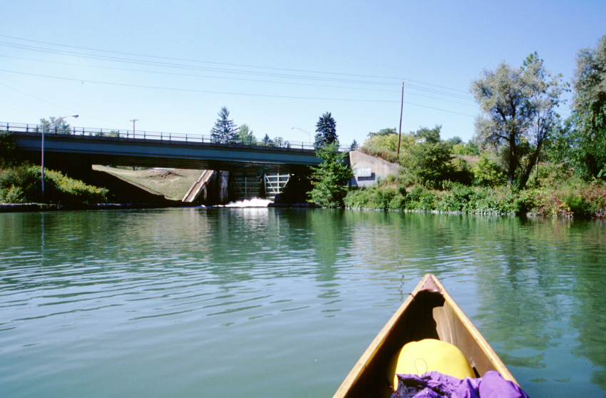
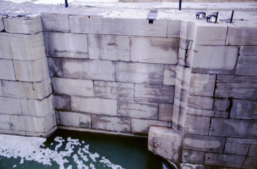
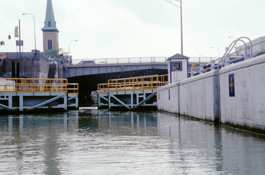
Just as I am wondering when I'll reach the first lock of my trip, I round a bend and see the lower lock wall. Tied to the wall is an astonishing number of boats. I've reached Baldwinsville, and the town is having a harbor festival. Despite the rain, people are walking around, music is playing, and boats are warping in and out. Here are people.
I sound my tin horn; the boaters along the wall don't think it is loud enough. I sound my air horn. The lockmaster arrives, dumps the lock, and lets me in. While in the lock chamber, I become cold -- there has been a constant rain for some time now. My hands are cramping as I paddle out. Action soon corrects the problem. The upper side of Baldwinsville reminds me of Amsterdam (the one on the Mohawk River, not the one in the low countries).
The rain abates when I am three or four miles from the lock. The scenery has changed to pleasant woodland, some posted no trespassing, other spots unlabelled. It being close to 5 p.m., I decide to look at the charts for a camping site.
The charts show a KOA campground half a mile ahead. As I've noted in the past, the Cruising Guide often has items misplaced. Inexcusable, in my opinion. This is no exception; it is an extra half mile before I see a row of picnic tables and fire rings along the right bank. I land.
The place looks vacant, but a one third mile walk finds a few rows of RVs and the campground office. I get the site where I landed my canoe. The price is high ($21), and the campground is currently without potable water due to well problems. I am given a gallon jug of drinking water. I return to my campsite and fix dinner.
As I am eating my pork and pease and writing in the journal, a couple walks by. I talk with them a bit, and they invite me to come by their camper and sit around their fire. Shortly thereafter, the heavens again open, and I dive into the tent. When the rain has lightened a bit, I go for a brief walk. On the way back, I stop by the couple's camper and enjoy their company for a spell. They are from Ontario, and are just completing a two week tour of the eastern end of both countries.
Mileage: 28.6 miles. Time en route: 8.3 hours. Distance to Buffalo: 123 miles direct / 172 miles expected.
A note about mileage. Years ago I read some of Zebulon Montgomery Pike's journals. They had been annotated with footnotes by someone, which occasionally elaborated on one of Pike's references, but more often criticized his daily mileage. Using my own trip as an example, I list a daily mileage of 28.6 miles. The critic would assert that I had gone no more than 11.9 miles, which is the straight line distance between my launch point and my camp. He would then rail about how 28.6 miles is grossly inflated, ignoring that I physically canoed the stated distance. This is the difference between the physicist's 'work' and the common man's 'work' -- if a man moves a ton of earth 5 feet to the left and then back to its original place on the right, no net work has been done, but the man is still tired. I will continue listing Pike distances, and not net distances for my trip mileage.
 |
 |
 |
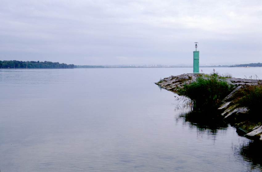 |
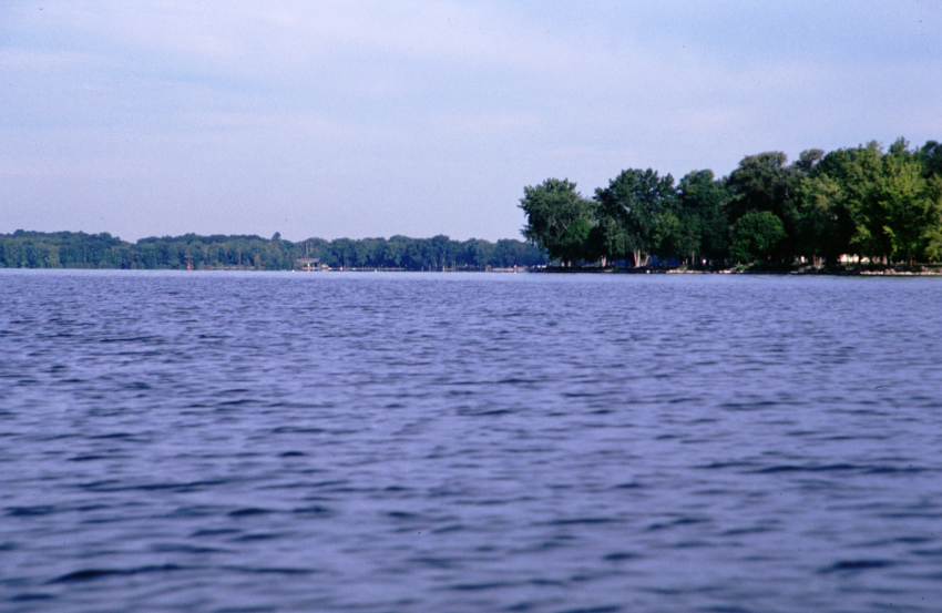
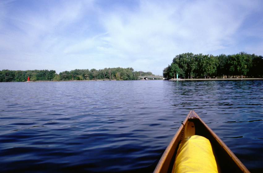
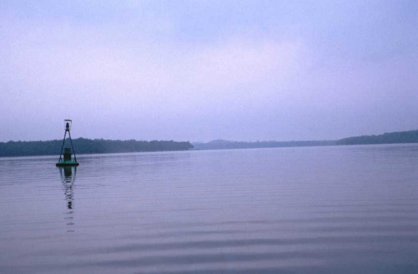
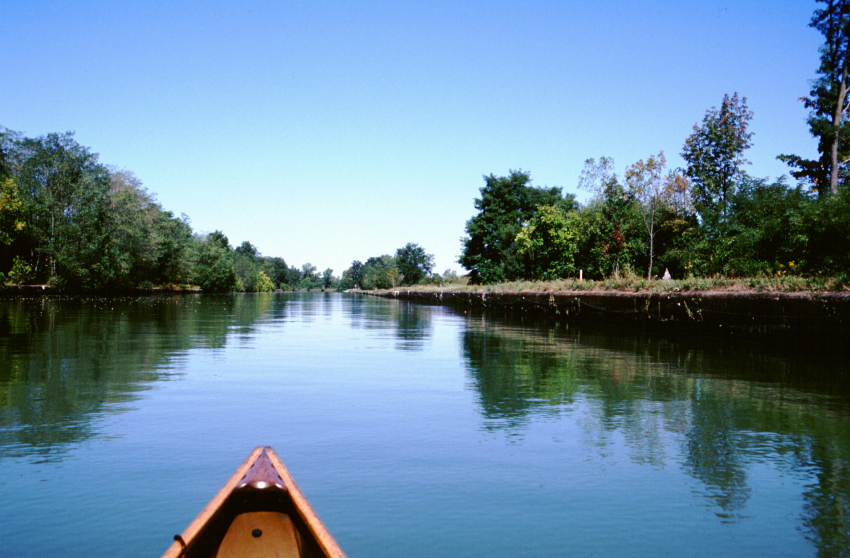
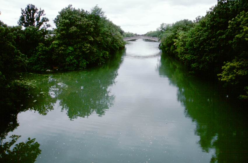
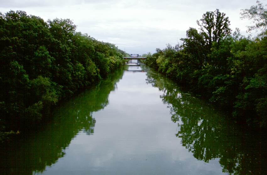
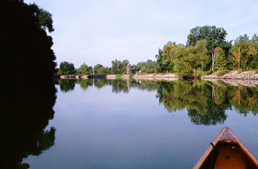
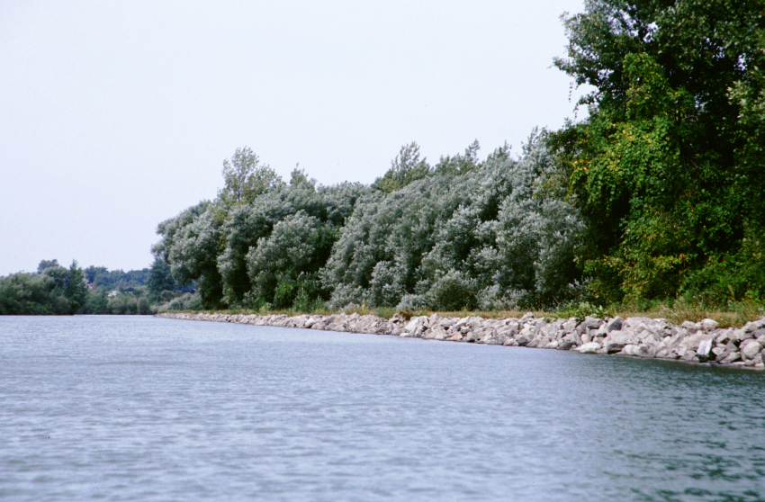
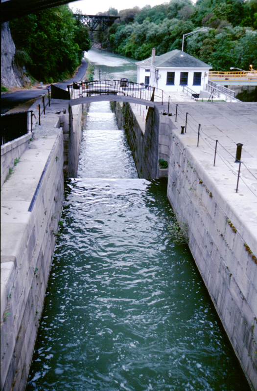
| My starting point. This is a park and marina area halfway along the northern shore of Onondaga Lake. | A view down the lake. The right shore is a continuation of the park. | Approaching the channel out of the lake. | Looking back up the lake with Syracuse in the far distance. |
 |
 |
 |
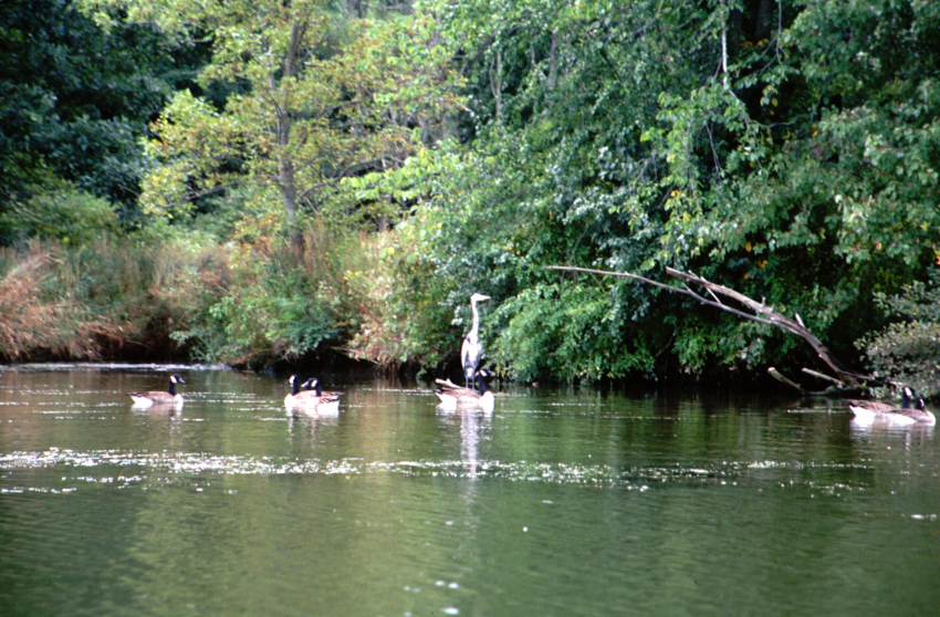 |
| A tank farm just east of the junction between the Syracuse channel and the Erie Canal. | The Seneca tied up at Three Rivers Junction. | A sign for Buffalo, 192 miles away. | Geese and heron along the canal. |
Sunday, 15 September 2002 - Lock E-26
It began raining heavily around 5:30 in the morning. I waited an hour, then got up, and took my time breaking camp. I launched at 8 in light rain. The entire day would end up being overcast or raining.
I don't feel much like writing, so today's entry will be brief.
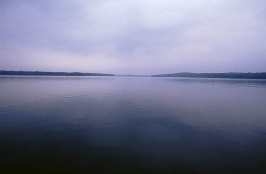
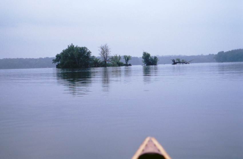
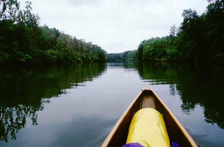
I passed many farms, including two with cows wading along the edge of the canal. I passed one house that had a sculpture of a stalwart little elephant on the bank -- as far as whimsical sculptures go, this has been one of my favorites. I canoed across Cross Lake, which was misty and scenic. I saw perhaps 10 boats all day, half of which were people fishing. I passed many rich houses and a few poor ones.
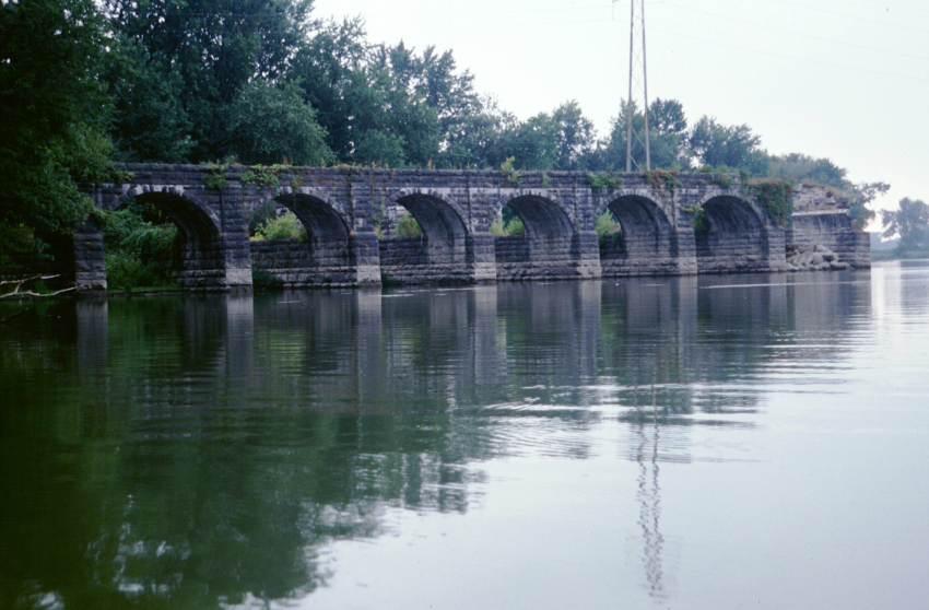
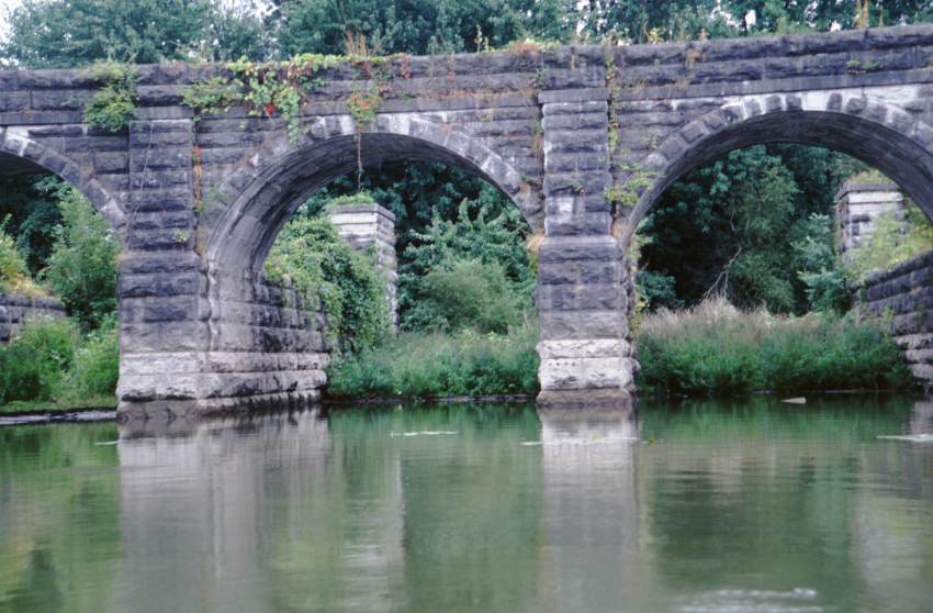
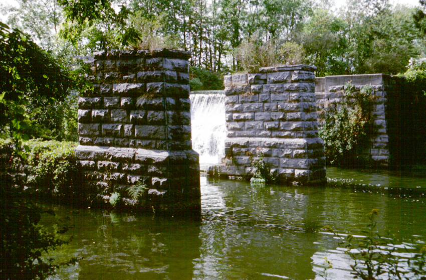
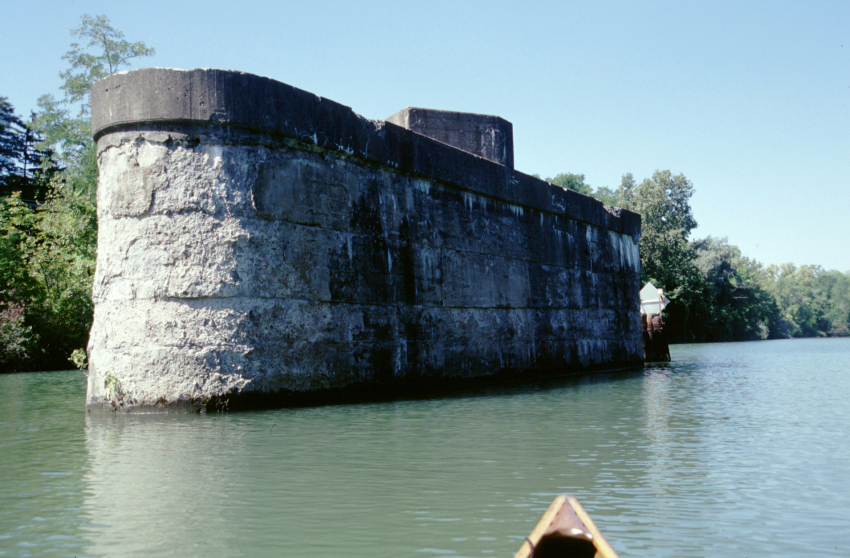
The canal meanders through the Montezuma Wildlife Refuge. It is fantastic, with lush vegetation and myriad fowl (and rain). Also, I pass by the remains of the Richmond Aqueduct, which is quite attractive in an engineering manner.
Around 22 miles from my day's starting point, I reached the Cayuga Canal. I had an offer to visit someone, but instead I pushed on. It would have been an 8 mile detour, and probably would have cost me half a day. At this point in the trip, I wanted to keep moving.
I locked through Lock E-25 in good cheer and not too wet. Then the rain became very heavy. By the time I had covered the six miles to Lock E-26, I couldn't have been wetter if I had been swimming. I took out above the lock and am now camped on its grassy verge.
I pitched my tent, got three quarts of clean water from the friendly (as always) lockmaster, ate dinner, and retired to the comparative dryness of the tent. I don't think I have ever seen my tent this wet before -- the inner walls are beaded with water. Everything is damp or wet. At least the dry bags work, and I sit in dry clothing.
Distance travelled: 29.8 miles / 58.4 miles total. Time en route: 9.5 hours / 17.8 hours total. Distance to Buffalo: 102 miles direct / 142 miles expected.
 |
 |
 |
 |
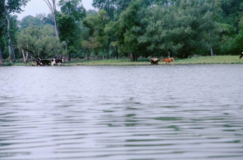 |
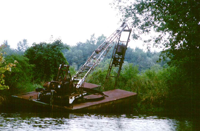
| Cross Lake. | Small Island in Cross Lake. | Looking up Cross Lake. | A seemingly abandoned crane barge. | Cows along the canal. |
 |
 |
 |
 |
 |
| The Montezuma Wildlife Refuge. | Remains of the Richmond Aqueduct. | A closer look at some of the arches. | The canal between Lock E-25 and Lock E-26. | My campsite at Lock E-26. |
Monday, 16 September 2002 - Lock E-30
Rain during the night, amounting to around 1/2 inch after I retired to my tent. It stopped from 1 a.m. to around 5, then resumed with great fury, stopping around 6:15. Up and launched by 7:50.
The first few miles were very grey and overcast. Extremely quiet on the water -- no boats, few birds, almost nothing moving. Bridges and bends in the canal occur often enough that it is never dull; additionally, there is the intrinsic beauty of the scenery.
I notice that I am heading directly toward 43�N 77�W for a few miles. Soon the canal wanders away, never getting within 3 miles of the confluence. If it had been closer, I might have claimed an attempt. Of course I knew the canal wouldn't pass very close, but it is still enjoyable to imagine the scenario. [See the Degree Confluence Project for details on this oddly pleasant hobby.]
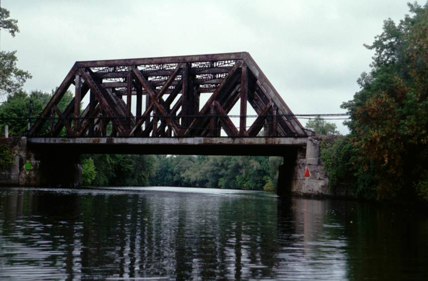
Occasionally I have seen abandoned barges and other boats. Strange. There are also stout railroad bridges capable of holding four tracks. For a while I run alongside a rail corridor. I count two trains of 150 plus cars each, one of containerized freight and one of empty stock cars.
Lock 27 comes and goes. At Lock 28A, I have to wait for an exiting boat -- the first time this trip. Lock 28A has the maintenance headquarters for the Canal Corporation. Indeed, all markers and buoys near it are ship shape and Bristol fashion.
Between the two locks I pass the town of Lyons. It has a marvelous looking park. Now I have noted many parks called Lyons Park. Who are they named after? Is there any connection to this town?
When I lock through Lock 28B, I tell the operator that I'll likely stop at a park in Palmyra. It has become positively sunny. My speed isn't so great due to a persistent headwind, the constant current, and long lock times. I am considering a shorter day.
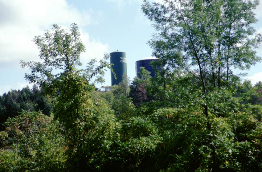
There are some interesting water tanks or silos on a hill. I try to determine what one says. It transpires to read "Wayne County", which was much less exciting that the words I was trying to fit to "Wa-- Co--".
Some of the trees have clusters of dark berries. I wonder what kind they are, and if the are edible. "What is this, and can I eat it?"
As noted earlier, the Cruising Guide is somewhat off. In this case, it is in regards to the Palmyra terminal. The NOAA charts have ended, though, so the Cruising Guide, flawed as it is, is all I have. The Palmyra terminal is an attractive dock and yacht basin with a nice boardwalk up to the town. It would be a tolerable place to camp, but it is not yet 5, and I push on.
Just before Lock 29 there is a park. This is the Palmyra-Macedon Aqueduct Park, which has the remains of another old canal aqueduct. I stop and take on some rusty drinking water. I am in need of water, though I'm not sure that this is better than filtering and iodizing water. A middle-aged woman fishing at the park expresses surprise at doing something as foolish as canoeing to Buffalo.
I proceed, locking through Lock 29. This lockmaster feels I should get a phone or a radio, though he heard my horn just fine.
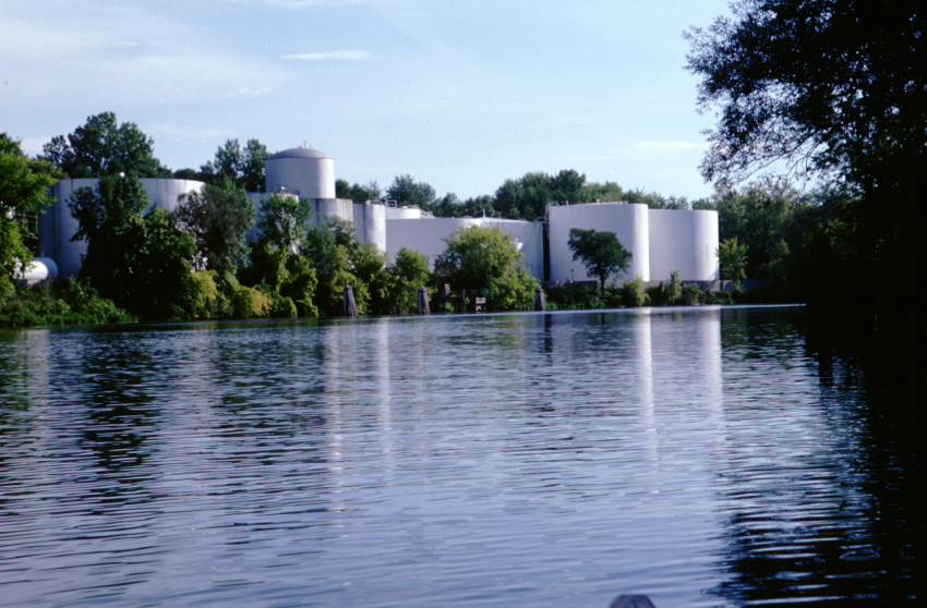
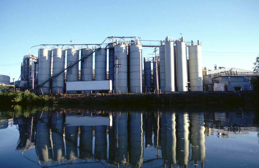
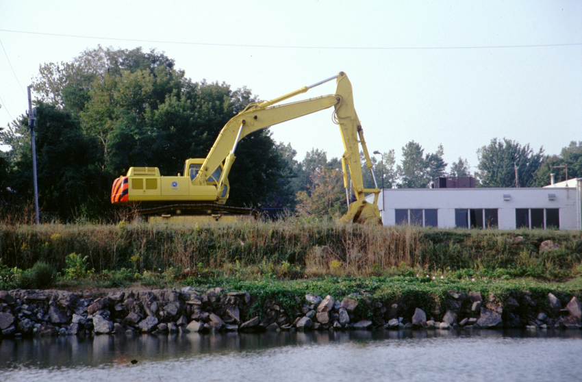
Between Lock 29 and Lock 30 is a huge chemical plant. I take some photographs of a small part of it.
They are working on Lock 30. Since they want to grease some gear work, they fill it very slowly; it takes almost half an hour to fill. I stop above the lock to camp. I misunderstand the lockmaster, and instead of paddling a ways around a spit of land to a boat launch, I take out and lug my gear a quarter mile. Ugh.
Camp is an almost dry affair. The lock has better water than the rusty liquid I have, and I am able to sup and sort gear without the hindrance of rain. I am a bit sunburned, but otherwise feel pretty good.
Distance travelled: 30.3 miles / 88.7 miles total. Time en route: 10.7 hours / 28.5 hours total. Distance to Buffalo: 79 miles direct / 112 miles expected.
 |
 |
 |
 |
 |
| The scenic canal. | A very wide railroad bridge. This has four tracks crossing it. | A Wayne County water tank. | Awaiting Lock E-28B. | A few houses along the Widewaters area. |
 |
 |
 |
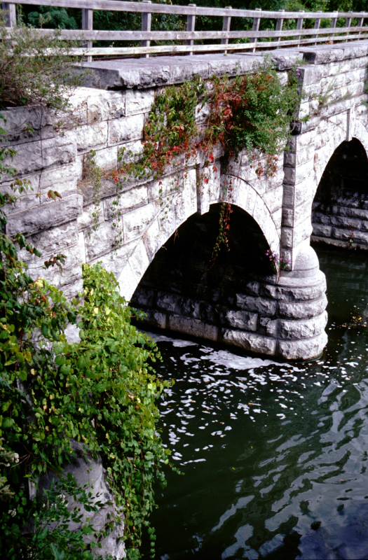 |
 |
| A heron in a tree. Herons are very common along the canal. | Chemical films plant near Palmyra. | Remains of the Palmyra Aqueduct. | Another view of the Palmyra Aqueduct. | Vegetation just above Lock E-30 in the evening sun. |
Tuesday, 17 September 2002 - Greece Canal Park
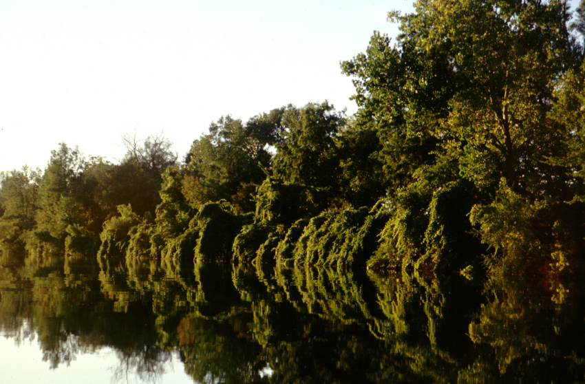
An 8:00 launch. The mist is rising on the canal, which makes it very pretty. It also means that the tent fly is very wet. Everything else is somewhat drier. For the entire day, one side or the other of the canal has a "Canalway Trail", which is a lovely bicycle / pedestrian path with a fair amount of use.
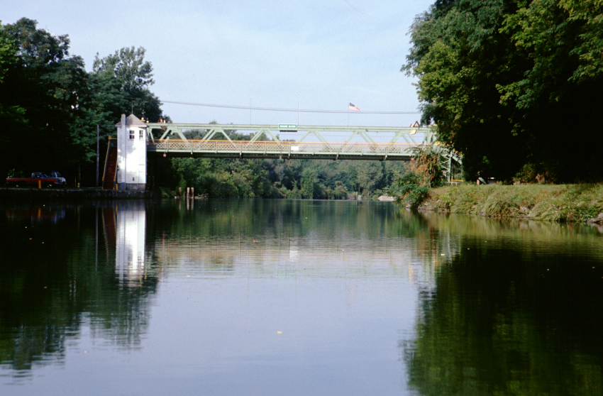
I am between wooded banks, quite sylvan and comfortable. There are never so many ducks. After 8 miles I come to the town of Fairport. It is aptly named, with a lovely terminal wall, shops directly on the town docks, and idyllic homes along the sides.
The canal meanders, sometimes heading south, sometimes north, and almost always west. There is a sharp bend south at Fairport, followed by a pleasant chunk of suburbia (not the norm), then a swing west. I see road signs for Rochester (the next city) and Greece (my expected evening destination). Both sides of the canal become park-like.
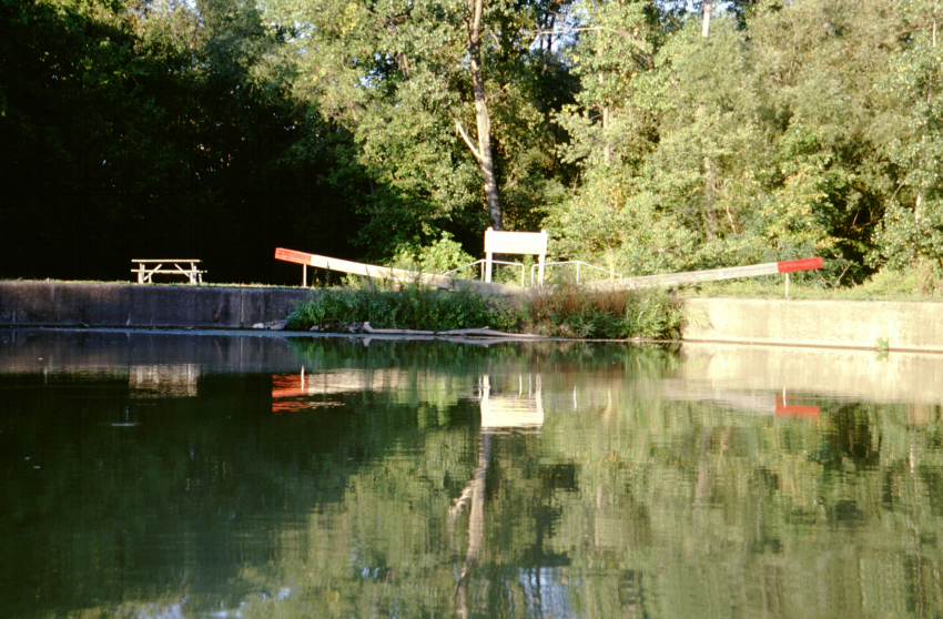
After another mile or so, I stop at a small dock labelled "No boat tie-ups". It is the Great Embankment Park. The canal trail runs atop a 70 foot high berm which supports the canal above its surroundings. Although a pleasant picnic spot, the canal trail doesn't give a great view of the embankment. I talk with an old man who is resting there, then proceed.
Pittsford is another canal town. I'm tempted to tie up for an ice cream, but a rented houseboat is thrashing about, effectively using up the entire terminal wall. I continue.
Here I reach Lock E-32 (there is no Lock E-31). I sound my horn and am locked through. I am warned that the next lock may be very slow due to their inspection. This is some big state inspection of the locks; the lockmasters at all of the locks are fretting over it. I push on. All day I have been pushing against the wind (and the current).
I arrive at Lock E-33 and wait. And wait. And wait. In the hot sun. And wait some more. After an hour or more, they lock through a boat going in the opposite direction. They start to close the gates (I'm invisible behind a bridge). I scoot forward and call out. They let me in with the gates half closed. They are the most abrupt of any locktenders I have dealt with, almost brusque. As I am exiting, the lockmaster sees the boat name Dog Sally. She waves and calls out with delight. All is good.
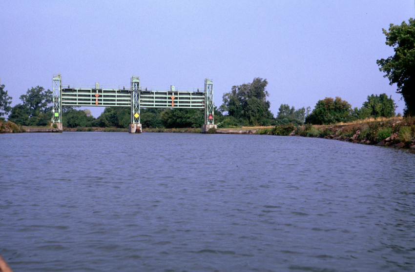
It is a long four miles to Rochester and the Genesee River. The river is guarded on each side by double guard gates -- two in a row, not side by side. There is a whole chain of lovely foot bridges across the canal. The Genesee River is placid and sedate. I take some photographs as I cross.
Shortly after leaving the Genesee River, I pass under the flight path to the Rochester airport. The air is clean and clear, and the sun at a favorable angle. As airplanes come in on their final approach, they are limed in light, showing off their features magnificently. I've not seen planes look better while in the air.
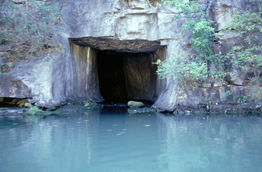
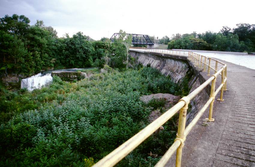
West of Rochester, the canal goes through a rock cut. It is narrow and deep. Very cool. There are strange stone culverts and flumes feeding streams and waste water into the canal.
It is getting late due to the enormous lock times. I pass an old lock for some other canal (Junction Lock). Although it would make a tolerable campsite, I push on. I end up stopping at the Monroe County / Town of Greece Canal Park dock. There is a park caretaker reloading an information signboard with maps of the park. He can't officially grant me permission to camp, as the park is actually state land, but he approves of the idea.
Until dark, all manner of pedestrians go by. I greet several passing dogs, including one that had been swimming. I end up talking with a mother and a lad in a stroller for some time. They are out for their evening walk. She asks motherly questions; how do I keep clean; what do I eat; how do I contact my family?
Distance travelled: 28.8 miles / 117.5 miles total. Time en route: 10.5 hours / 39.0 hours total. Distance to Buffalo: 60 miles direct / 84 miles expected.
 |
 |
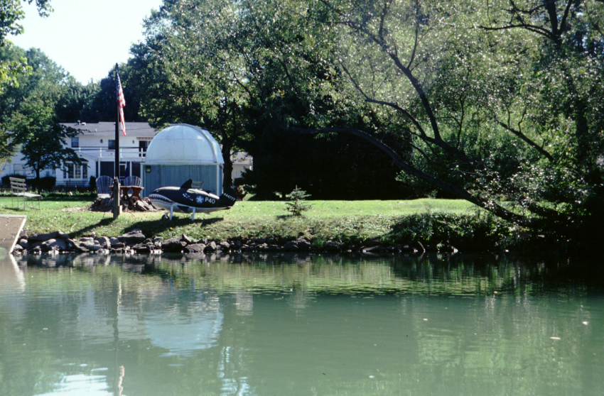 |
 |
 |
| Locomotives on a siding. | Approaching the Fairport lift bridge. | A strange observatory and plane-like object in a home's yard. | Approaching a set of guard gates. For whatever reason, I always like guard gates. | The canal along the Great Embankment. |
 |
 |
 |
 |
 |
| Tied up a Great Embankment Park. | The Great Embankment viewed from below. | An interesting old bridge abutment. | Waiting for Lock 32 to finish emptying. | In Lock 32. |
 |
 |
 |
 |
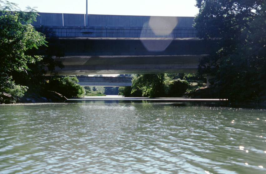 |
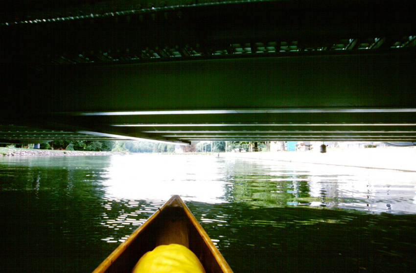
| The double guard gate on the east side of the Genesee River. | Pleasant and attractive foot bridges over the Genesee River. | The Erie Canal viewed from one of the bridges in Genesee Park. | Another view of the canal from a foot bridge. | A view underneath some of the highway bridges near Rochester. |
 |
 |
 |
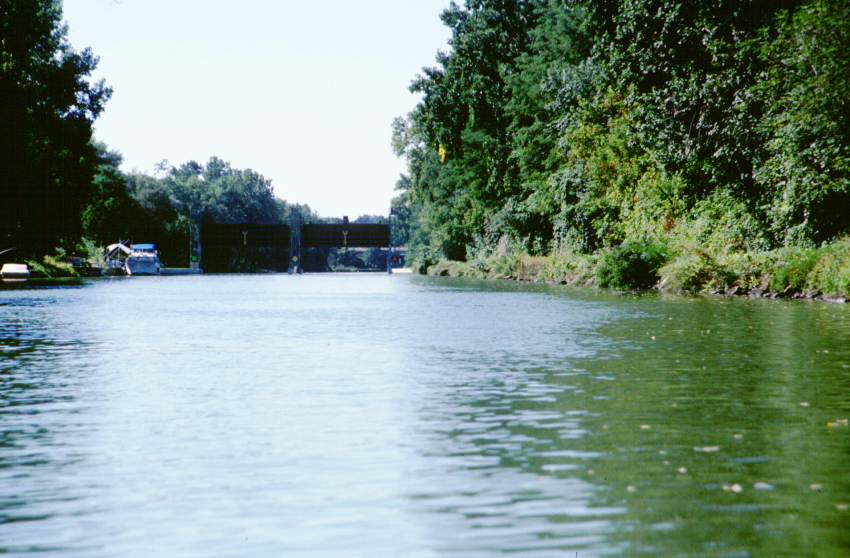
||
| The Erie Canal and Genesee River junction. | A stone culvert in the rock cut west of Rochester. | Junction Lock, leftover from the old Erie Canal. |
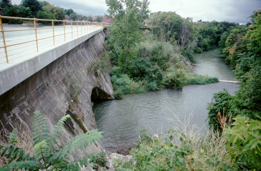
Wednesday, 18 September 2002 - Medina Terminal Wall
A huge day. My longest distance ever. Launched at 7:00, and on my way. The winds were variable, but light and no more contrary than fair.
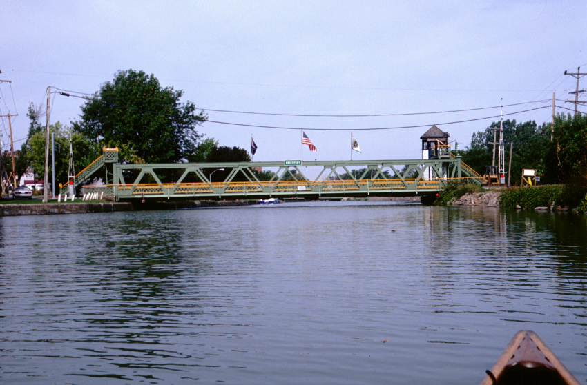
In short order I pass through Spenserport, another tranquil canal town. Here I began to encounter lift bridges more frequently (the first was at Fairport). So far I have been able to slip beneath them, sometimes while seated normally, but more often by sitting on the bottom of the canoe. One of the bridges is up, as some surveyors are doing something there.
The canal is often above the level of the surrounding land. This gives more or less of a raised feeling depending on the amount of trees right alongside the embankment. The pleasant canal trail continues on one side officially, but often on both sides. The countryside smells of apples -- this is orchard country. The aroma makes me wish for the tasty fruit New York is known for.
Occasionally there are wide basins. I don't know their depth, but they look like good moorings or barge assembly areas.
As I am near one lift bridge, a man standing next to a car with a kayak on its roof calls out. He asks if there is a boat launch nearby. I plead ignorance. He asks me where I put in, and I get to answer, "Syracuse".
Brockport is an old-fashioned looking town, with some great brick buildings. The side of one building has an advertisement for Ivory soap. SUNY Brockport follows. The canal view is nothing special. This is followed by a succession of farmland and bridges, pleasant and scenic, but more of the same.
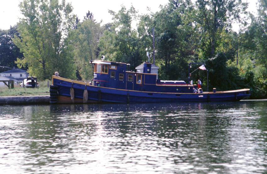
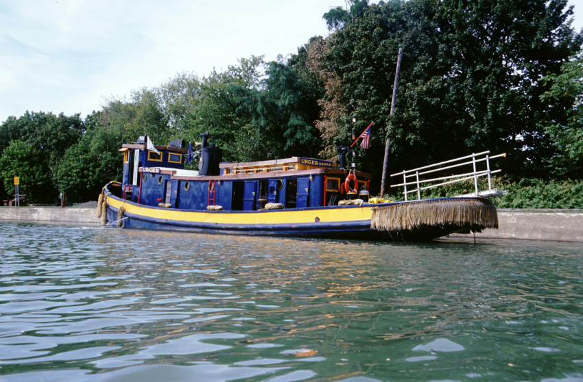
As I am approaching the town of Albion, I see the Urger coming up behind me. She has requested the first of two lift bridges to be raised, so I get to watch a bridge in action (and to pass under an open bridge). I speak the Urger briefly, then continue on beneath the next lift bridge. The Urger is an old tugboat owned by the New York State Canal Corporation. She is kept trim and working and is used as an educational display for school children and adults. I have spoken her before on the Hudson River and on the Mohawk River.
Also present in Albion is a tour boat called the Emita II. She passed me just to the west of the Syracuse junction and is on her way back to the east. I wave to the passengers. Based on their conversation, they don't recognize me or my boat as someone they have seen before.
I am hot and in need of using the necessary. I stop at the Albion boat launch, which isn't what I hoped for -- no facilities other than a few picnic tables. I had contemplated making this my day's end, but (a) it is before 4 p.m., (b) it is right along a road, and (c) it is across the road from a large prison, complete with razor-wire. I push on, knowing that it means a long day.
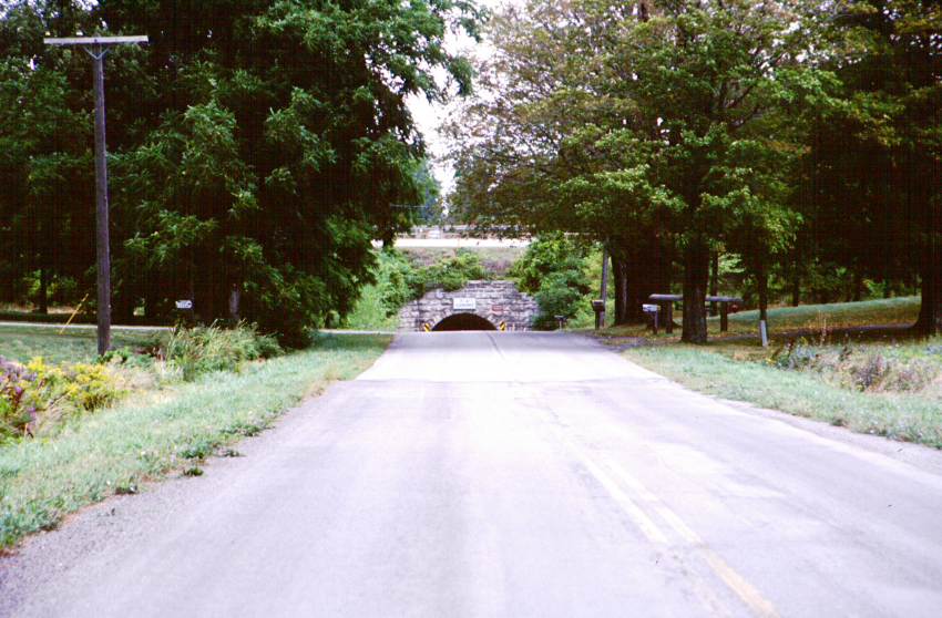
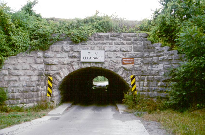
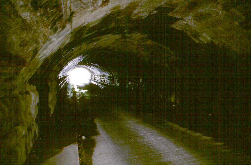
With the sun in my eyes, I pull the next 7 miles to the Medina boat launch. En route I cross over Culvert Road, the only road which goes under the canal. There isn't much to see from my vantage point.
The Medina boat launch is pleasant, even if it has no water supply or privy. It is right at a guard gate. Once again I am within hearing of a shooting range (the other one was near the KOA I stayed at on the first night). I've supped, but not set up camp yet, as I figured I would use the dying light to write.
Distance travelled: 34.4 miles / 151.9 miles total. Hours en route: 11.0 hours / 50.0 hours total. Distance to Buffalo: 33 direct / 50 expected.
 |
 |
 |
 |
 |
| One of the many weirs used to regulate the amount of water in the canal. | The bank has a nice bicycle path along it. | The Washington Street lift bridge, raised. | Another weir, this one without the railed foot bridge above it. | The eastern Brockport lift bridge. |
 |
 |
 |
 |
 |
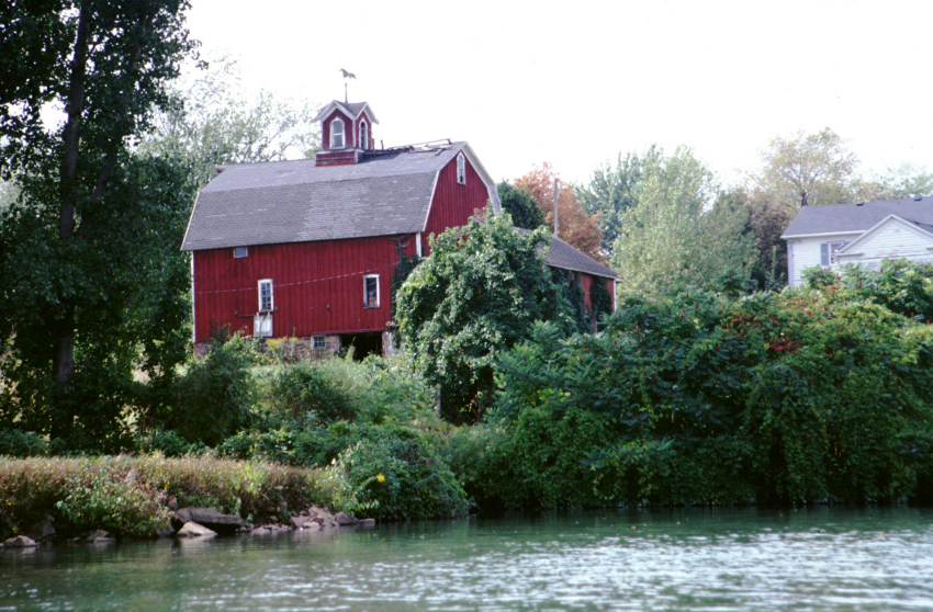
| This type of tree was very common from here until Buffalo. | Passing underneath a lift bridge. "Low bridge, everybody down." | A barn along the canal. | The tugboat Urger pulling in to Albion. | Some fantastic cloud reflections above Culvert road. |
 |
 |
 |
 |
|
| Approaching Culvert Road. | The culvert isn't all that large. | Underneath the Erie Canal. | A Canal Corporation back hoe somewhere near Medina. |
Thursday, 19 September 2002 - Amherst Boat Launch
A big, fantastic day.
Launched at 7:30. The wind is from the west today. This, plus a very noticeable current, verging on over 1 mph, makes for a slow travel day. Before long I pass over Oak Orchard Creek with its attendant waterfall, then arrive in Medina's little harbor.
As per my usual policy, I like to put a mile or so under my keel before eating breakfast. Right above the small-boat-friendly docks of Medina, I see a restaurant. I dock, tie up, Flemish my lines, and walk up the ramp and across the short swath of pavement to the Canal Cafe. Right away I know it will be good -- it's filled with old men harassing everyone (myself included). It is tasty and shockingly inexpensive.
With a good breakfast under my belt, I smile in the teeth of the wind and current. Medina rolls by, as does more farmland and a few small towns.
A hawk wheels above me, turning on the wind. He is close enough I can see his eyes, his head turn (incredible neck muscles), and his pinion feathers flair. The wing shape shifts a tiny bit and he arcs away.
I serenely paddle along the pastoral canal. I wave to the few people on the bike path. I watch a tractor go over one of the many one-lane steel-decked bridges that span the canal. I admire the artful placement of a bench outside someone's house. I examine the fish swimming in the canal, some of which occasionally break the surface of the water with a splash.
Midmorning, the Urger overtakes me. She hails and asks how it is that I have stayed ahead of her. This being an especially strong current and wind moment, where I am pulling with vigor and still barely holding 2 mph, I respond, "I go faster -- that must be it." She continues on by.
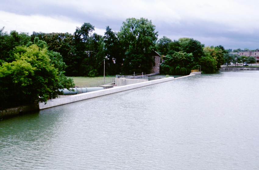
Around 2 p.m. or so, I arrive at the public marina at the eastern end of Lockport. I was hoping that the ice cream stand across the road would be open, but no such luck. I keep pulling. The current is tough here.
After the second of two lift bridges, I again see the Urger. She is tied up at the canal maintenance building. She's staying here for a duration, then returning to Albany. The crew is busy working on her, but I joke with them that I stay ahead because they are always lounging around. She bids me well, and I her, and I proceed.
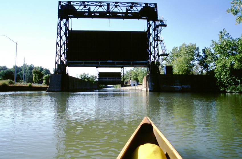
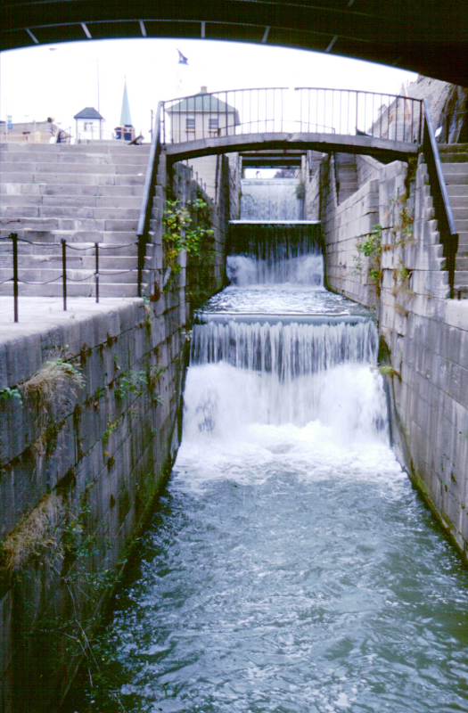
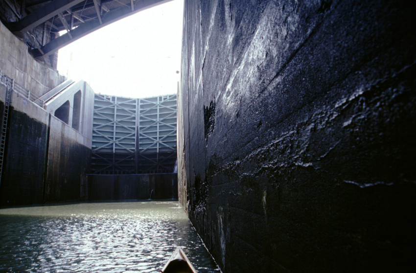
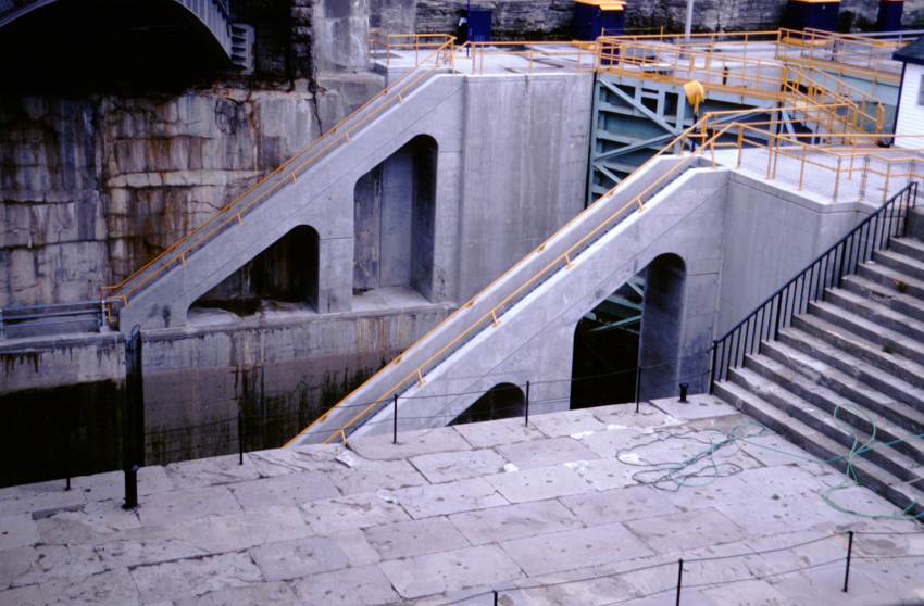
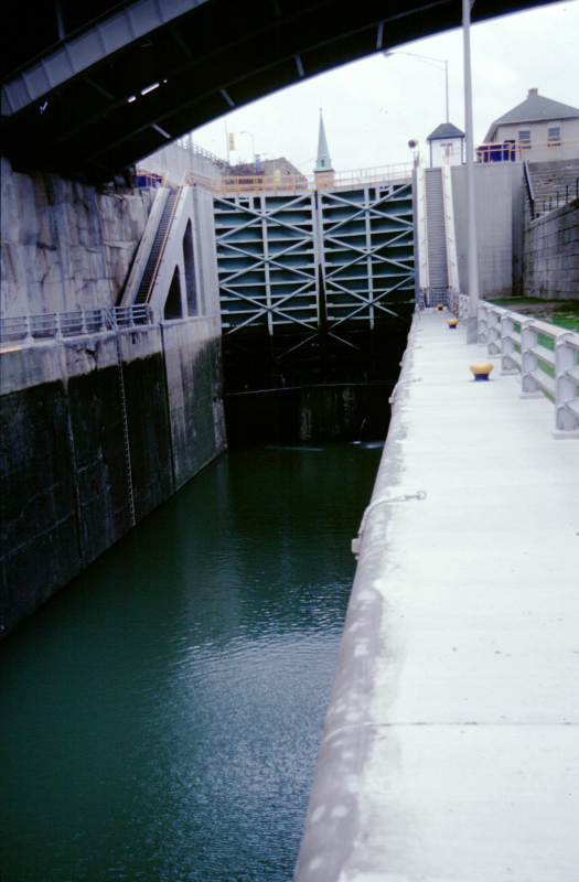
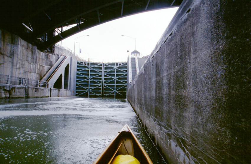
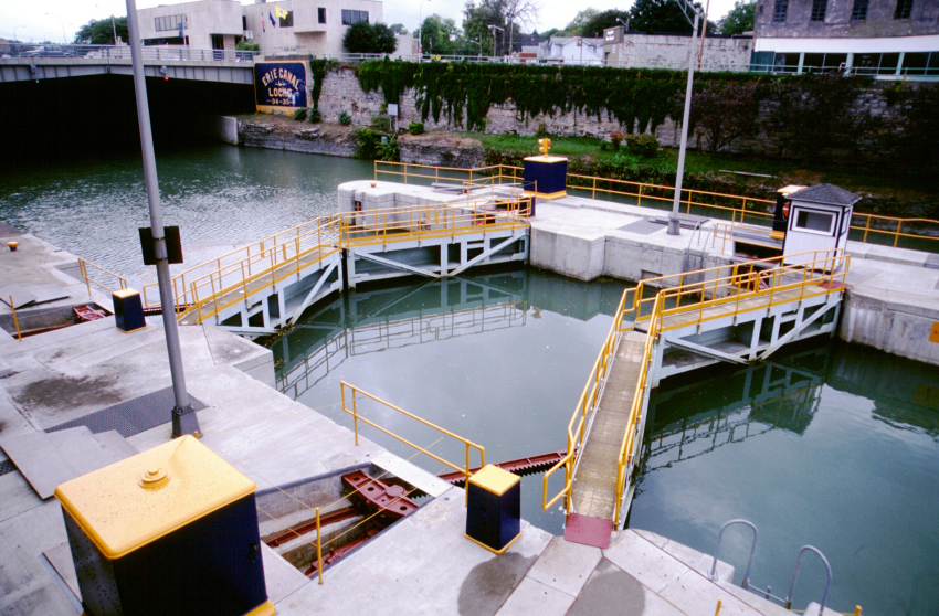
There is Lock E-34. I sound my horn; almost instantly the gates open. In I go. At times, I doubt if I can still experience wonder. Then something like this occurs. Wow!
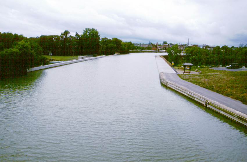
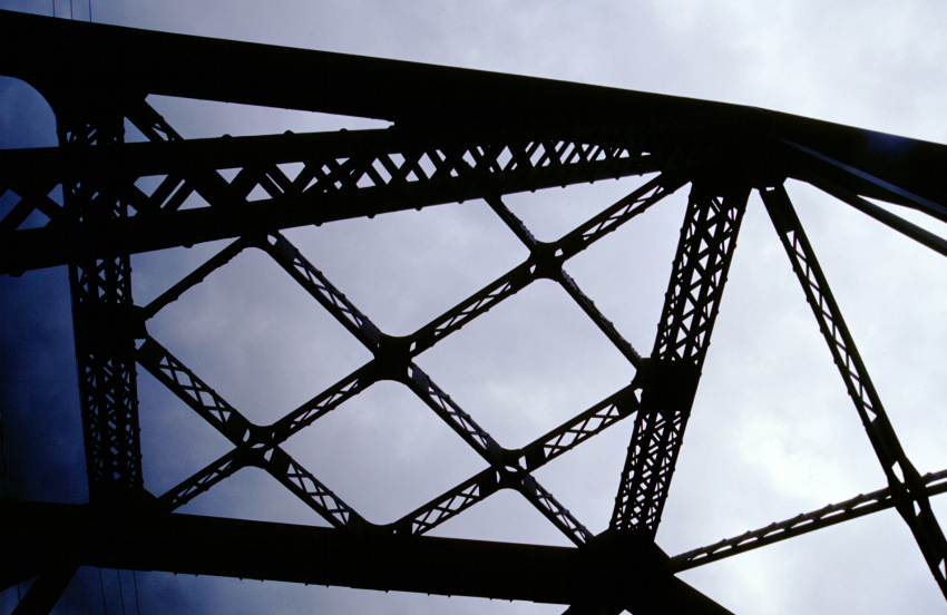
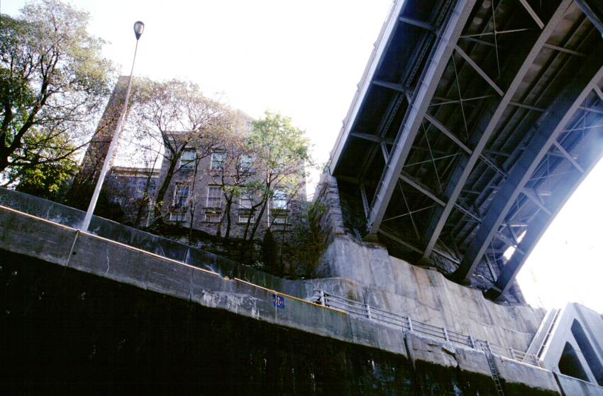
Standing firmly on a concrete sill, the common gate between Lock 34 and Lock 35 stretches upward 50 feet above me. The lock is tucked beneath an awesome bridge, with riveted metal supporting trusses curving upward from the embankment. Robust yet graceful concrete arches support the stairs for the lock, and gangways and railings line the lock chamber. The whole of the lock is trimmed in crisp Canal Corporation yellow and blue. High up near the bridge, a stone edifice stands against the sky. At its feet, probably 80 feet or more straight up, trees grapple a precarious hold on more stone. Above it all is blue sky and scudding white clouds.
The lockmaster appears a-way up there. He signals that it will be 10 minutes before the lock closes, as they are waiting for eastbound boats. I use my painter to moor to a lock line, then take photographs and marvel at the sights. This view, right here, is why Lockport is considered the jewel of the canal system.
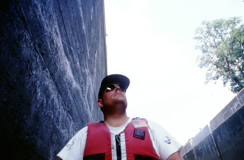
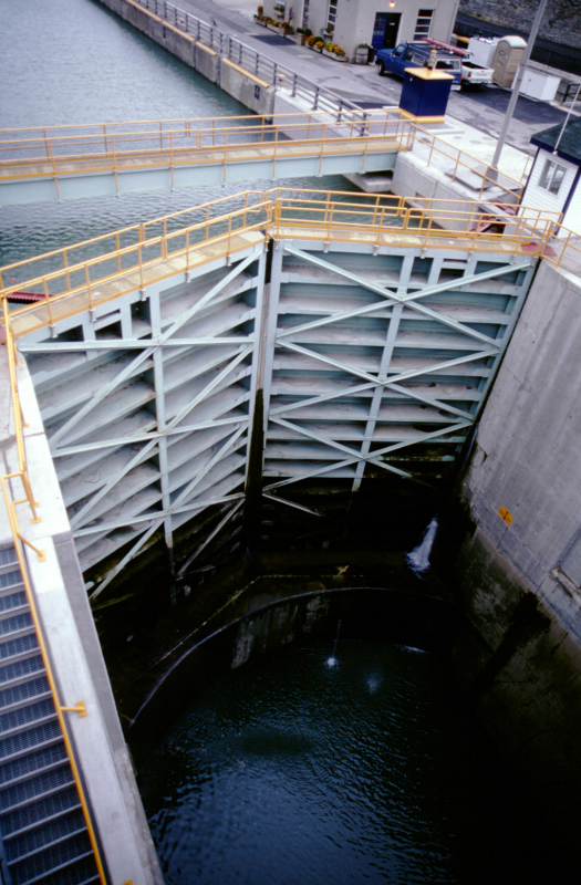
Then, lock time. This is the most turbulent lock I have been in to date, but it also has the nicest mooring lines to compensate. The lines are secured below as well as above, which means that holding on to them prevents being tossed too far from the wall. The doors open, and I trade places with two eastbound boats. The doors close, and up I go again.
The lockmaster chats with me briefly as the lock finishes filling. He recommends some campsites -- they are all a long pull ahead. And onward!
I immediately pass beneath a great arched bridge. It supports buildings and streets. The truss work gleams wondrously. Another more common bridge, and I'm in a canal cut through rock. I dig against the current, overfull with delight.
I pass an eastbound homemade-looking houseboat called the Becky Thatcher. She passed me going the other way just before Rochester. The couple aboard waves. I think it is a splendid name for the style and appearance of the boat.
Houses again appear. The canal joins Tonawanda Creek, but it still flows east (and I still work against the current). The light fades. I see the Amherst Boat Launch. It is dusk. I land. I stand for 20 minutes just glorying in the day.
It is now very late. I've supped, pitched camp, and filtered water. Some stars are out.
Distance travelled: 28.8 miles / 180.7 miles total. Time en route: 11.7 hours / 61.7 hours total. Distance to Buffalo: 11 miles direct / 21 miles expected.
 |
 |
 |
 |
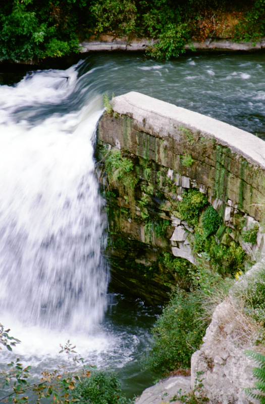 |
| The canal as it passes over Oak Orchard Creek. | The weir on the southern side of the canal that feeds into the creek. | The north side of the culvert containing Oak Orchard Creek. | The canal embankment supporting it over the creek. | A waterfall a short ways below the culvert. |
 |
 |
 |
 |
 |
| Looking through the superstructure of a one-lane bridge just to the east of Oak Orchard Creek. | The fair harbor of Medina. This was one of the nicest for a canoeist. | The Middleport guard gate. | One of the many farms along the canal. | An interesting tree. |
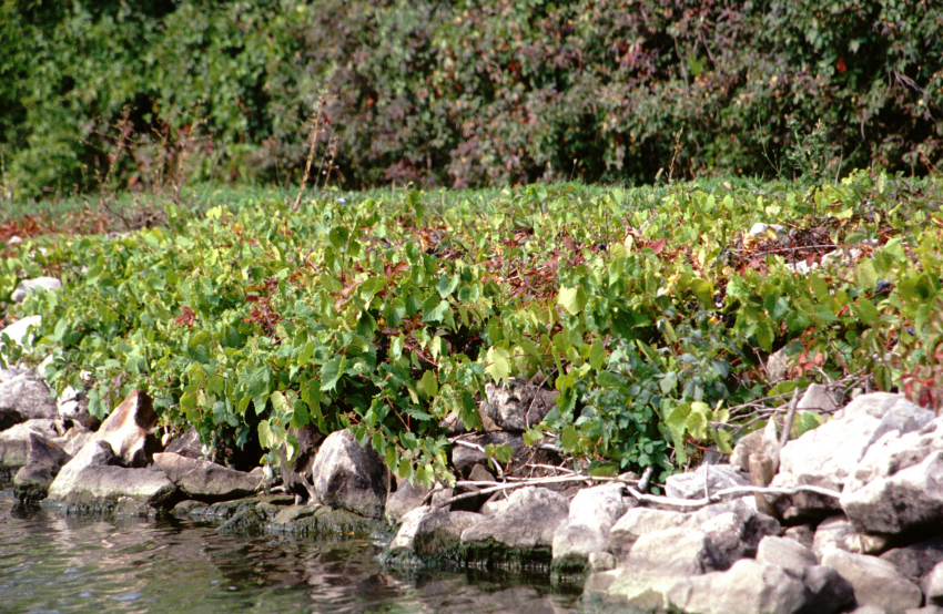 |
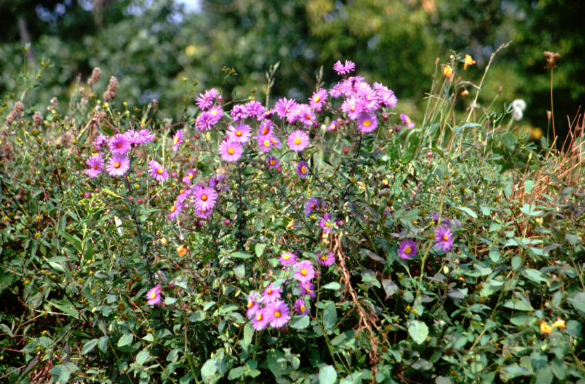 |
 |
 |
 |
| There were many wild grapes growing along the canal. They were fairly sour. | There were also many flowers. | An abandoned railroad bridge in Lockport. | Approaching the lower gates of Lock E-34. | To the north of the current locks in Lockport are the remains of one of the sets of five locks from the 19th century canal. |
 |
 |
 |
 |
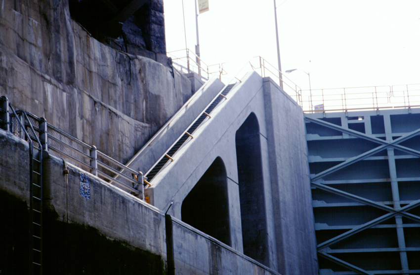 |
| Another view of the old Lockport flight of locks. | One of the cavities for an old lock gate. | In the fantastic Lock E-34. Unfortunately, the film doesn't have the dynamic range to show the true scene. | Looking up in Lock E-34. | One of the stairways leading between the top of Lock E-35 down to Lock E-34. |
 |
 |
 |
 |
 |
| A photo taken by setting the camera on the bottom of the canoe. | Looking down the mutual gate between Lock E-34 and Lock E-35. | The attractive stairways between the locks. | The Lock E-34 lock chamber. | The lock control booth at the eastern end of Lock E-35. |
 |
 |
 |
 |
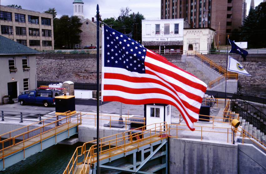 |
| In the now full Lock E-34. | In Lock E-35, waiting for the double upper gates to open. | Another view of the double upper gates. This is the only lock in the system that has double gates. | A look at the double gates from above. | Old Glory, the New York State Flag, and the Canal Corporation flag fly above every lock and lift bridge. |
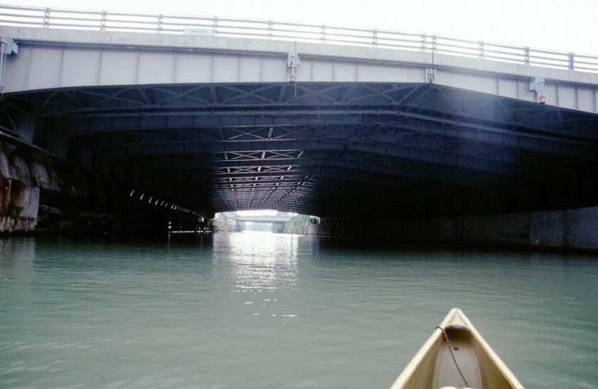 |
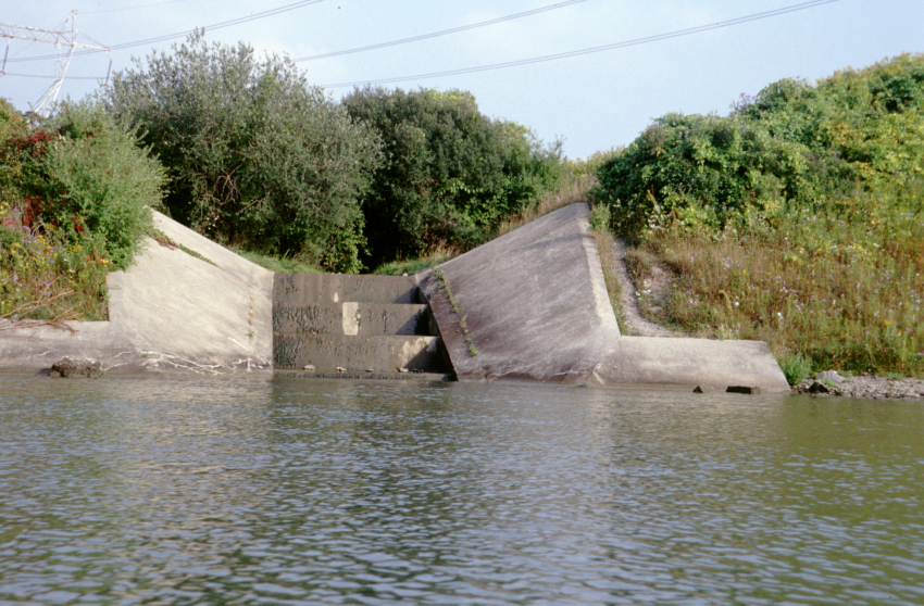 |
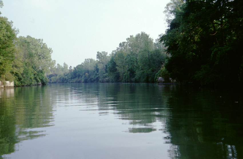 |
||
| Going underneath the large bridge just after the locks. | A stepped inflow area for a small stream on Tonawanda Creek. | Going west on Tonawanda Creek. |
Friday, 20 September 2002 - Buffalo, New York
Buffalo, after a fashion.
Up a little after 5 a.m. Was standing outside my tent, smelling the morning air and trying to judge the weather. Gradually, dozens or cars arrive in the parking lot. It was the University of Buffalo crew club, probably 100 people strong. They extracted boats, launched, and rowed off in both directions, all with a very limited amount of conversation with the anomalous canoeist. I spoke with one coach as he is embarking in a safety boat. He's never tried the Niagara River in a muscle powered boat, but gives directions to the Black Rock Canal.
I wait until the rowers have all dispersed onto the waters, then launch around 7:45. Within a quarter mile, it begins to RAIN. In good spirits I pull by 3 shells racing in the opposite direction. They look unpleasantly wet; I hope I look pleasantly so. A few minutes later and I pass three more returning shells.
The rain abates after half an hour, leaving a gallon of water in the canoe. Aside from my chart case no longer being waterproof, this was enjoyable. I mosey along the reverse-flowing Tonawanda Creek. There are numerous parks, boat launches, and houses. Only a few industrial buildings, though.
After boathouses become common along the creek, the water starts having an oily film on it. I wonder how much is due to recreational traffic or if it is from some industrial process. It is the only area that is visibly polluted (aside from the ever present bottled water bottles strewn along the canal). I know that the zebra mussels seen in the Seneca River and the lower locks of this trip are aided by some pollutants, but the oil slick is nasty.
A scent fills the air. It is like a cross between baking chocolate chip cookies and pancakes. I wonder what industry is generating it, and what they are baking.
I pass some sort of Christian campground or park. It has a strange bridge over a grassy area. It reminds me of the Bridge of San Luis Rey.
The town of North Tonawanda appears. I have been intending to stop to get a navigational chart and information on the currents of the Niagara River. The south side of the creek has a wooden dock, and above that there is a building labelled "Harbormaster's office". I tie up, extract myself, and wander up to the building. The harbormaster's office doesn't open until early afternoon, so I return from the otherwise nice harbor area and set off.
Next I stop at a marina just around the bend in the creek. The old coot who runs the place tells me that there is a 3 knot (mph?) current in some spot of the river, and an 11 current in some other, but that I should be able to make it. And no, he doesn't have charts; you can't miss the channel. Irked, I proceed.
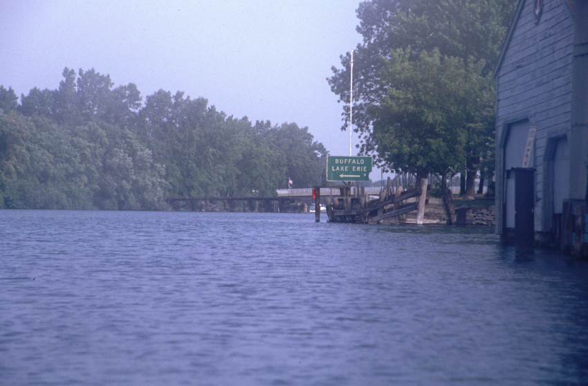
Almost immediately I reach the confluence with the Niagara River. There are signs for Buffalo and Lake Erie. Still doubting the wisdom of my actions, especially in the teeth of a southwesterly wind, I bear left. The Niagara is as broad here as the Hudson down near New Baltimore. The current is very noticeable, and varies as I travel.
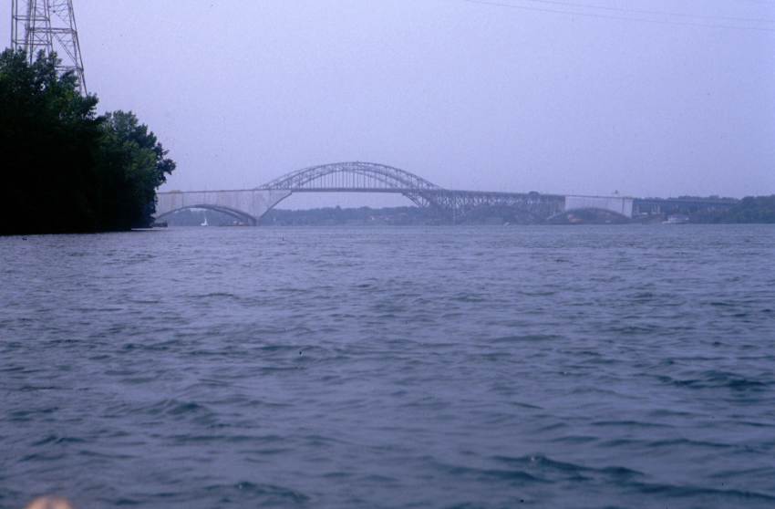
I pull 3 miles or so past the Grand Island Bridge. I often barely make 1 1/2 mph. At other times I reach nearly 3 mph. It is a choppy, lumpy seas, the exact likes of which I haven't plied before. The wind is generally off the bow, but veers around a bit to give full facial blasts. The bridge is being repainted, and reeks of toluene or some other solvent. A sign states that I am supposed to travel under the center arch of the span, but there the current is stronger there, so I proceed under a secondary arch. Around noon, I lay in to shore for a break.
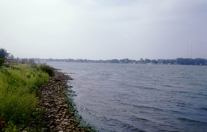
The Niagara River has become wider. In many ways it looks much like Lake Champlain.
The next stretch is around a cusp of land. I set out, struggling against current and wind. The entrance to the Black Rock Canal is miles away, and the wind is fierce. It takes me two hours to beat forward two miles. I take an immense time to pass a huge power plant. I hang off of the water discharge point for a least fifteen minutes before clearing it. There is a city boat launch just after the power plant, and I put in.
My shoulders are more tired from the last two hours than the last 6 days. I sit in the shade on some crabgrass and contemplate my options. On one hand, I have canoed the entire Erie Canal, shown myself proof against mighty current and wind, and evinced the capability to travel continuously for days on end. Prudence dictates that I should not continue. On the other hand, my pride will be hurt by not going the last few miles. I pace. I sit. My shoulders are tired. The wind flags only long enough to give me a ray of hope, the resumes. I decide against proceeding as I watch a forty foot boat slide backwards at a good clip before its skipper regains control.
I drag my things ashore and secure the canoe and my gear as best possible. I am admitting defeat by the current and wind. I take my canteen and small dry bag and set off towards Buffalo.
I know I have made the right decision as I have trouble walking into the wind. The first two and a half miles follow a pleasant "River Walk" with a good view of the Niagara River and its choppy water. I walk 5 plus miles, stare numbly at a faded transit map, and walk some more. Eventually, after a brief ride on a tram, I find the poorly labelled Amtrak station. This is the lesser of two Buffalo stations, and it is past its closing time. Disgustedly, I tramp back to the Greyhound Station. After far, far too much walking, I buy a ticket to Syracuse. I now wait for that dull mode of transport, the bus.
Distance travelled: 12.8 miles / 193.5 miles total / 8+ miles of walking. Time en route: 7.0 hours / 68.7 hours total / 2.5 hours walking. At Buffalo.
 |
 |
 |
 |
| A strange foot bridge along the north shore of the creek. | Heading into North Tonawanda. | A peculiar railroad drawbridge. | My canoe tied up in the North Tonawanda harbor. |
 |
 |
 |
 |
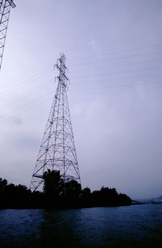
| Left turn for Buffalo and Lake Erie. | The Grand Island bridge. | Power transmission towers become more and more numerous as one heads west. | A place where I landed for a brief respite from the wind and current. |
There are so many details I have not mentioned. Seeing ospreys and eagles. The sting of the smell of wings outside the Anchor Bar in Buffalo. Circling vultures. The moon, both gibbous and full. Deer and conies. The haze when approaching Buffalo. The astonishing amount of wasted light at various campsites, especially the Amherst boat launch. The appearance of the canal through rock cuts. My photography malaise compared to previous trips.
Saturday, 21 September 2002 - Roving Home
The bus arrived in Syracuse 45 minutes late. By the time I was off of it, the time was close to midnight. As planned, though, it was only a three mile walk to the car. The walk was pleasant, mainly along grassy park lands. The car was as I had left it (plus a few spiders), and by 1 a.m. I was driving west.
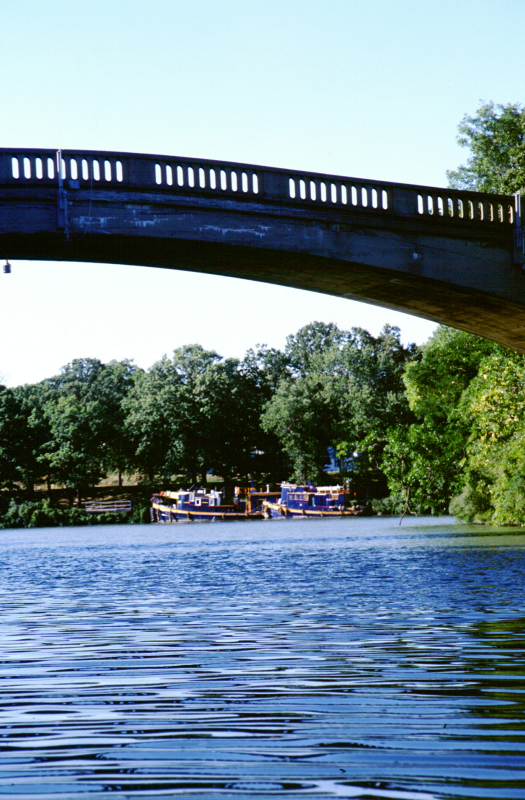
The drive back to Buffalo took 2 3/4 hours, partly due to stops to eat, take on water, etc. Humbling that 6 1/2 days of intense effort can be reduced to so little. Dog Sally was as I had left her. I loaded her up and returned east to a truck stop, where I slept until 7 a.m.
I drove home slowly, stopping at many places along the way. Lockport looks good in the early morning light. The cool building on the hill was the old city hall, but is now a restaurant. The Oak Orchard Creek aqueduct at Medina is impressive, but needs a vista cut through some of the vegetation. Culvert Road is narrower than I expected, but standing underneath the canal is neat. I drove through Brockport, but didn't stop. The bridges of Genesee Park in Rochester are quite mundane from the pedestrian's perspective. After some trouble I found my way to Great Embankment Park, which is no more exciting from below than from above. I ate lunch in Fairport. I spent some time in the Montezuma National Wildlife Refuge, then took the throughway to Syracuse, where I visited the northern end of Onondaga Lake.
I finished by eating dinner in Syracuse at a much-recommend place called Dinosaur's BBQ. There I had a huge portion of fantastic ribs. It was a very pleasant end to a good trip.
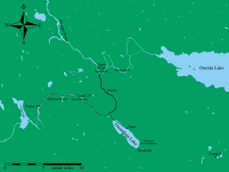
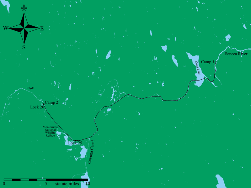
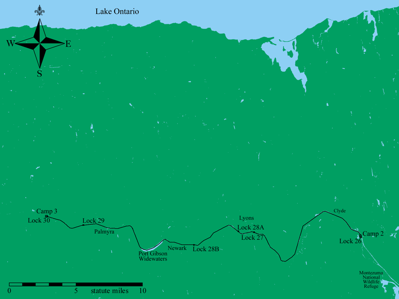
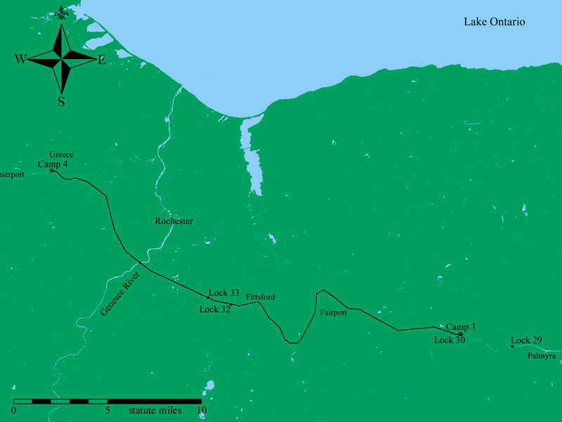
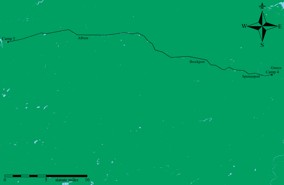
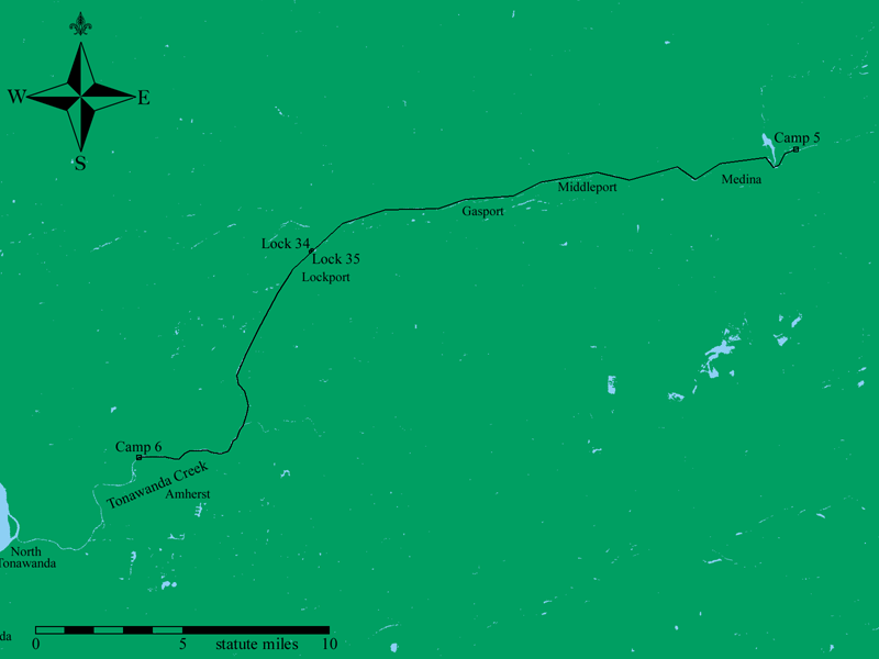
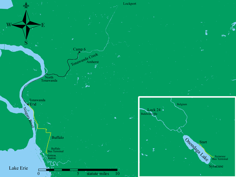
Map of the Trip
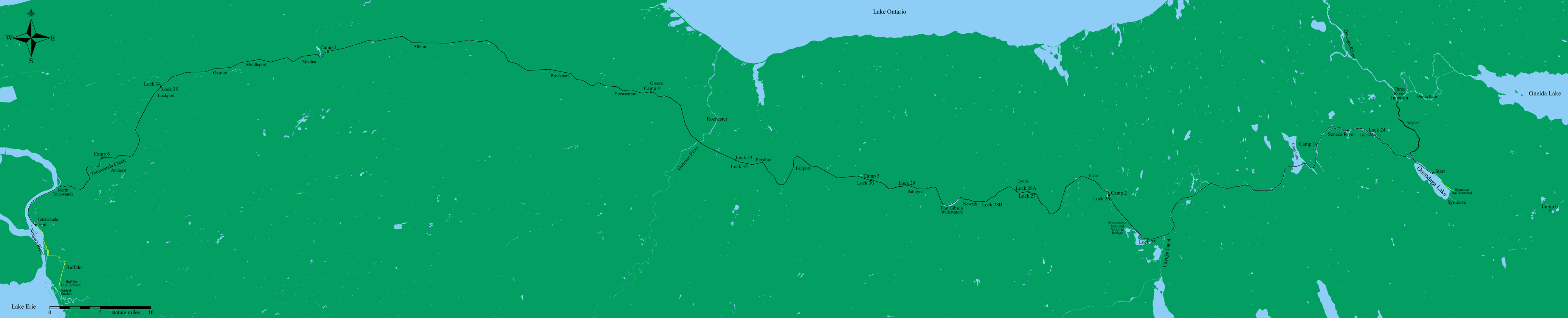
I carried a GPS receiver with me on my trip. I used it to record my travel path, and also as a speedometer and odometer.
The GPS receiver only has a finite amount of memory. It didn't have enough to save the complete track log of more than 2 days. Each day I would reduce the track log to a set of 30 or so points. In general, this is the track that is plotted, though I have manually corrected it where it cuts off significant bends in the canal.
The background land and water on the made is taken from land use maps published by the USGS (see here. These are 30 meter resolution raster maps that are presented as an Albers Equal-Area Projection using the GRS1980 Ellipsoid. For the brief portion of the land mass in Canada, I used a vector map obtained from the Medium Resolution Coastline data set using the NOAA Coastline Extractor.
I used a program I wrote last year to a UTM projection in the WGS84 Datum of the region where I travelled, making a two color map representing land and water. Once I had a map in UTM coordinates showing land and water, I ran another program I had written to add the GPS track data, complete with small marks wherever I had a waypoint (such as where I camped or where the locks are located). Lastly, I used Photoshop to add place names and to color the map.
All text and images are copyright 2002 by David Manthey.