
Sunday, 3 September 2000
The idea of canoeing to Oswego occurred to me a few weeks ago. The choice involved logistics, timing, and the shortest route to a Great Lake. I can start in Troy, so I only had to work out one end of the trip.
The logistics were put in place yesterday. My brother Daniel and I drove our separate vehicles to Oswego. I placed my car along the waterfront of the Oswego River in a parking area that might belong to a hotel or to a town park. I hope the car will be safe there. I then rode back with Dan. It feels very odd to 'abandon' one's vehicle some 180 miles from home.
Prior to travelling to Oswego, I dropped off the canoe and most of my supplies at my friend John's house. His garage accepted them willingly, and I informed him (and company) that I would depart Sunday morning before they were up. John's house is conveniently located right on the Hudson River, just south of the 112th Street bridge.
I had spent the last few weeks trying to obtain supplies for the trip. Some, like fenders for protecting the sides of my boat in locks, I had difficulty in getting but I had succeeded at the eleventh hour. Others, such as the flag and burgee, I never fully finished. Alas, I am flagless and my canoe is not marked with her name. The canoe is the Dog Sally. Obviously a personal choice. [Sally was a medium brown dog of no distinct breed and was my dear childhood companion. There are still times when I miss her company.]
This morning I awoke just before seven. I had a collection of stuff to bring to my canoe including things I had forgotten, perishables, and camera equipment. I loaded this into my old crummy backpack and my smallest dry bag and set out for John's place. This is a three mile walk through Troy.
The walk is kind of pleasant. Almost no one is up and about, it being early Sunday morning. The few people who are out are friendly - kind of odd, as usually people don't greet strangers around here. At last I reach John's, open the garage, and arrange my stuff. Some things, like the fenders, I have not used before and it takes some consideration in deciding what to do with them. I haul gear and canoe down to the river, and, without witnesses or fanfare, launch just before 9 a.m.
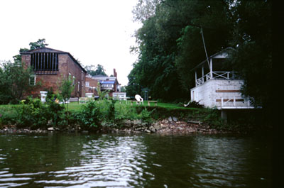
The pull up to Lock 2 is a familiar one. The canoe is the most heavily laden I have had it, and it behaves wonderfully. I pass the Waterford Terminal Wall. There are three or four boats pulled up, excluding a tug and barge left over from the Tugboat Roundup and an old metal tug that is being refurbished. One boat has people in it, and they ask if I am locking through. I agree that I am.
The air horn is powerfully loud - embarrassingly so; it is such a large noise for such a little boat. Lock 2 vents its water, then the gates clank open. I shoot in, deploy my fenders, and latch on to a hanging rope. The doors ratchet closed, and I don the work gloves I brought. There is a delay; I find out later that the lockmaster has to close the discharge gates and walk from one end of the lock to the other. The water starts to rise. There are minor currents which tug this way and that, but nothing strong. It takes several minutes to rise the 33 feet. Once the water stops, the doors upstream yawn open. I push off from the wall, centering my boat in the channel, and off I go.
Locks 3 through 6 come in short order. The passage between each is mildly different and always interesting. Between Lock 2 and Lock 3 there are old concrete arches covered in moss and verdure. Between others are long concrete quays. The locks differ as well. The walls of Lock 2 are pitted and worn. Those of Lock 3 are smooth and (relatively) clean. At every lock the lockmaster is very friendly.
I pass three other boats while in the Flight. [Locks 2 through 6 are called the Waterford Flight, and have the greatest rise in the shortest distance of any lock system in the world.] Above Lock 6 are two guard gates, both raised. I pass the third boat near Guard Gate 2, and I watch the gate clank down behind it. I'm not sure the point of having the gates. [I found out later that it is primarily to protect the locks from ice in the winter.]
I'm in familiar territory once again. I have the river comparatively to myself. There are only three boat trailers at the state boat ramp. I still don't know what other people do or why. The day is overcast, but not unpleasant, and there is almost no one boating. There are people fishing before the Route 9 bridge, and the south side of the island above the bridge is choked with plants - a far cry from my first voyage. [First water for my canoe was at this location. I put in at the fishing spot with no one around on a blustery day. I paddled on the south side of the island in a clear channel (too early in the season to have plants), then beat through heavy swells to return.]
Noon passes. It took over two hours to go through the Flight. I stroke past the various marinas, Route 87 and the Thaddeus Kosciusko bridge, houses, the long stretch near Vischer Ferry, and eventually the reach before Lock 7. It takes three hours to beat up to Lock 7. I am moving well, and time will show that I maintain 3 mph when not locking through.
Lock 7 is lined with people - cyclists, fisher-folk, walkers, couples. I sound my horn, which both opens the lock and attracts all the pedestrians. Lock 7 is shorter (has a smaller lift) than Locks 2 through 6, but it is still pretty tall. The railing above is lined with people, giving a very festive air to the proceedings. I talk with an old woman and a young man as the water rises. When the gates open, I scoot out, thanking the lockmaster and waving farewell to the crowd.
Again familiar waters but grown weedier since last time I was here. The weather is overcast but holding. I pass GE and Knolls, crossing into new water. Just as this occurs, I am passing a pontoon boat (I have seen around 30 boats today). A woman on the pontoon boat hails me, and shouts that they are having motor trouble. She then asks me to inform a marina a mile upstream of this. The marina is just before the Route 146 bridge. I talk to some men on one of the piers, passing the buck.
The old aqueduct is not very interesting; there just isn't much of it left. Beyond the bridge is a little park, sort of hidden behind the Boat House canoe shop. I press on past another marina. I am growing tired and looking for a place for the night. I stop at a state boat launch with a picnic table. It is next to a noisy road and a louder bar. I fix a supper of fried pork and potatoes.
While I am cooking my dinner, a pickup truck arrives. An older man and a dog get out of the truck. The man has some rolls which he throws out for the ducks. The dog and I become friends immediately. She's an old black dog with grey starting to show in her muzzle. She plays fetch with her master, lets me rub her head, and is very well behaved.
I talk with the man who says there is a clear spot on an island a half mile up river. I put out 45 minutes after I landed and set off upstream. A half mile puts me on a small point of land formed by a creek joining the river. It is not the described spot, but I am weary. I take out and set up camp.
I am opposite a large warehouse labelled 'Steel' which has bright lights shining all night. I can hear cars and trains, but at least no bars. I retire shortly, make a half-hearted attempt at maintaining my journal (I finish this day's entry on Tuesday), and sleep poorly.
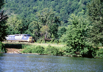
There are so many things I have failed to mention: the canal cruise ship which obviously nearly fills a lock but still has the cruise liner look to it; the waterfowl, including herons galore, ducks (mallard and other), brant, cormorants, loons, geese (both white and Canada), something I think was a woodcock, and many others; and the trains. A major train track parallels the canal. There are a few passenger trains plus freight of all descriptions. The two main lines are CSX and Union Pacific.
Total mileage: 22 miles.
Monday, 4 September 2000
Up and on my way by 7:30. I eat breakfast as I paddle. A few bass boats tore by just before I got under weigh. I don't see another boat until 11 a.m. I'm glad I stayed where I did for the night. The spot the man with the dog told me about was two miles further along the river. He did describe it perfectly, though.
Lock 8 arrives is short order (I taking that Polynesian viewpoint where the world moves and I remain still). It seems the policy to leave the locks full; they always have to empty them for me. Had I been a bit faster yesterday, I could have stayed at the Arrowhead Campground a couple of miles north of Lock 8.
I stop and use the head at Lock 9. The lock is undergoing some sort of extensive construction, making it very muddy. My sandals are mud-philic, far more so than one would expect for something advertised as being good in the water.
It begins to rain. It is never very hard, but it lasts most of the day. I don my rain jacket and proceed. I pass a powerful looking dredger, which has a strange auger at the bows. I see ducks. I pass very few boats, especially considering that it is Labor Day.
Lock 9 and Lock 10 saw me, so I didn't have to sound my horn. Lock 11 is otherwise. A woman lockmaster says the horn is quite strong.
Lock 12 has some strong cross currents in front of it. It is the first lock outside of the Flight which has been open before my arrival. I paddle vigorously, twisting and turning with the current, shooting into the lock chamber at speed. The lockmaster compliments me on my deft handling of the 'rapids'. He says most larger boats don't do so well.
It being close to 5 p.m., I was thinking of stopping at a state boat launch just upstream of Lock 12. The lockmaster tells me that there is a terminal wall four miles ahead and that I can camp there. I push on.
It is a long four miles, probably because I'm tired. The terminal wall is right beyond the bridge between Fultonville and Fonda. I take out at a dirt ramp and pitch my tent in the lee of the bridge embankment. It is an okay spot, aside from the echo off of the far bridge wall. Specifically, I get to hear the Fonda Motor Speedway announcer calling a demolition derby.
There is a large grassy area along the terminal wall. The wall itself is fairly tall and has a few NYS Canal Corporation boats tied up at it. There are picnic tables in the grassy area, and beyond that are buildings and maintenance vehicles. The entire area is surrounded by a chain link fence topped with barbed wire. A sign states that the gate is closed at 3:30. I'm here for the night, and no one will be bothering me.
I cook dinner on one of the picnic tables. Dinner consists of roast beef cubes and pasta. Still hungry, I also eat a few boiled eggs. I return to my tent and work on the journal until my flashlight batteries fail. I'm too tired to be bothered getting out the other flashlight.
Total mileage: 49 miles. Today: 27 miles.
Tuesday, 5 September 2000
A bit slow this morning. The river has mist rising, obviously caused by the water temperature being higher than the air temperature. It is a bit nippy, and I hesitate to get going.
Launched at 7:40. The steam rising is absolutely fantastic. The paddle up to Lock 13 was swift. I feel good despite the exertions of the past two days. At Lock 13 there is a boat in the lock. I wait, expecting it to leave.
The boat is a NYS Canal barge with a bucket dredge on it. The dredge operates a few times. I grow impatient and sound my horn. The people all get off the barge and wander into the lockmaster's building. I wait. A while later they all pile out again, all but the lockmaster boarding the barge. The lockmaster finally seems to notice me. The barge leaves upstream; the lock empties and opens. As I enter, the lockmaster says he did not hear my horn. Some 40 minutes after I reached the lock I am through.
A good pull gets me to the next lock. Just before reaching the lock, I stop at the state boat launch and use the head. At the lock, I again have to wait, this time for an eastbound boat that is overdue.
The day is sunny and hot, drying what is exposed in my boat (and doing nothing for anything in a dry bag). At some point I put on the sunscreen I brought. It is the Banana Boat brand specifically formulated for faces. It applies poorly to areas with hair, such as my arms and legs, clinging to the follicles instead of the skin. Sweat from my forehead trickles some of the sunscreen into my eyes, and I have a very bad reaction to it. I spend half an hour or more itching and sweating profusely.
I cut on the south side of Abeel Island, so far my sole deviation from the main channel. I often canoe outside of the navigation channel, but so far had not gone on the other side of any islands. The side trip affords more shade, plus is nicely scenic.
I stop in St. Johnsville, partly to see if I can find some batteries for my flashlight, and partly to check out the campground. I tie my small canoe to the floating dock and unsteadily walk to shore. Two men are sitting on lawn chairs outside the harbormaster's office. I've decided this isn't where I wish to camp. I ask them about batteries, and they direct me half to three-quarters of a mile to a drugstore. I walk there and buy batteries and a bag of potato chips.
Returned to my canoe, I proceed up to Lock 16. I'm tired, but better than yesterday. The lock is again slower than average, but the (as always) friendly lockmaster tells me that there is a grassy area next to Guard Gate 3 about three miles further upstream.
At this lock, the canal leaves the Mohawk River for the first time. The canal runs straight and true whilst the river meanders. I have seen perhaps ten boats all day. On the way to Guard Gate 3, I use my water filter to pump five quarts of water. The water filter is being recalcitrant.
7 p.m. finds me paddling underneath the guard gate. On the south are two guys having their own tailgate party out of a Ford Contour with loud raucous music blaring. I pull ahead a bit more and find a gravel ramp where I take out. It is close to the revelers, but not so loud here.
I make a nice camp. I cook and eat a dinner of hotdogs on a wall along the canal. To bed well after dark. Sleep comes easily.
Total mileage: 75 miles. Today: 26 miles.
Wednesday, 6 September 2000
A pleasant morning. I was under weigh around 7:45, a chosen slow start since I had a long day yesterday. Had I but known, I would have begun sooner.
The canal almost immediately rejoined the river. The Mohawk is pretty, and languidly flows by fields and forest (insert Smetana music here). A few miles up there is a floating dock for the Herkimer Home. Assumably, this was General Herkimer's house. A wide path was beaten through a cornfield to a pin-neat brick house. Too early for visitors, I'm sure. My camera remained unused in my bag.
Ahead lay Lock 17, highest lift in the system at 40 1/2 feet. This may not seem much more than 34, but water pressure being what it is, the lock is built differently. At the downstream end they have a vertical lift gate instead of the double swing gate.
When I first spot the lock, the lift gate is down. I can just make out the gate area (45 feet wide and 20 feet high above the water) in the mammoth concrete wall of the lock. As I approach, the gate lifts up behind the concrete wall and a sailboat gradually emerges. I watch the gate ratchet upward and the boat pull out. I wait to see if the gate will remain open for me. I paddle rapidly toward the lock.
The gate begins to close, steel beam after steel beam becoming visible. I sound my horn. Toot! Toot! Toot! I watch anxiously, paddling furiously. No lily dipping here, I've gone to the switch style so as to put on all speed, probably exceeding 7 mph. The gate seems to pause, then descends more, another steel beam visible, then another. I sound my horn again. Toot! Toot! Toot! I apply myself to my paddle. The gate pauses, dripping water, seemingly with scant room beneath it. A distant face at the top of the lock (way up there) beckons me in.
The gate is an expectant maw, slavering as the water drips from it. There is just enough clearance that I don't need to duck, though its massive brooding presence is enough to make me do so involuntarily. I shoot in as fast as I can go, veering over to the left (south) wall, as the right drips water viciously. The interior is dark and damp, a stark contrast from the bright sun outside that further enhances the belly-of-the-beast feel. As soon as I'm through, before I've even sheared to port, the gate descends with clanking.
The lock takes fifteen or more minutes to fill. Had I missed this cycle, I would have been delayed an hour. While in the lock chamber, I watch terns hover and dive for fish. If I wasn't actively fending my boat, I'd love to take photographs. My pulse gradually subsides as the water rises.
The upper end of the lock is anticlimactic - just regular swing gates. I exit, seeing three boats arrayed for entry. The largest is a huge ocean going cruiser that is pristinely ship-shape and Bristol fashion. A friendly man in her bow greets me enthusiastically. The canal swings around a rock outcropping, past a sluice for a dam, and alongside Moss Island and the town of Little Falls. The town of Little Falls is supposed to have an area geared toward canal trekkers. The tie-up is not small boat friendly, so I proceed.
The next lock again separates the canal and river. This section of the canal is a bit more interesting than the last with all sorts of birds.
The actual town of Herkimer comes and goes without notice. Where the canal and river rejoin there is a wall with many NYS Canal Corporation boats tied along it. I give it no notice, yet this was the one opportunity to visit the city. It would have amused me so to send Kathy a postcard from Herkimer. [Editor's note: Kathy is a woman I worked with who would always ask me to send her a postcard from places I visited. I never did, as I almost never send postcards at all. She is from Herkimer.]
I keep hoping that each town will have an ice cream stand within sight of the river, but no such luck. The town of Ilion has a nice area to tie up, but its only offer of interest is the Remington factory. Eliphalet's work is still going strong, and this would interest me on another day.
A long stretch I power through with vigor. I feel excellent. The day is clear and warm, and I have various shirts and my boots placed so that they will dry in the sun. Everything is dry, and I contemplate stopping and putting things away. But I don't.
Just before Lock 19, a forty foot cruiser comes screaming down the center of the canal, passing several boat lengths from me at excessive speed. No deviation for other traffic (me). Huge wake. Although I maneuver, I end up taking a wave over my bow and about a gallon of water in my boat. This is the worst wave I have ever met, and it is principally disappointing because it rewets my shirts and boots.
The lockmaster at Lock 19 offers to let me camp there (it is a little before 5 p.m.). My guide shows a campground another mile up, and so far I have only gone 21 miles. I decline the offer and tell the lockmaster that I will press on. He offers again, saying that if I don't like what I see I can come back.
Above the lock there is a dredger and crew at work. The river has all sorts of tiny flecks of flotsam in it. I talk with one of the guys rigging piping as I travel and as he is walking down the floating pipes, then I press on.
No sign of Elmtree campsites. They must not abut the water. I decide that, failing something better, I will push through Utica and stay at a state boat launch. Utica has a lock leading to its harbor with a sign indicating that I've done 7 miles since Lock 19. I'm cruising.
I see the first other muscle powered craft on this trip, and it is a canoe. A woman has an old duck hunting canoe, the kind with foam sponsons. She sits in the bow seat facing astern with her legs draped over the thwart. She hails me, "Where did you put in?"
I respond, "Troy."
She is at first increduluous, then impressed. I find it almost impossible to slow down to her speed. Even when I barely paddle, Dog Sally just wants to go forward. The woman says she wouldn't trust the state boat ramp, and that she feels less-savory people frequent it. She also tells me that Lock 20 has a nice park.
I power on to Lock 20, arriving around 7:20. I'm completely spent and don't bother locking through. I drag my gear, canoe, and self up the north wall with the aid of a small floating platform. I pitch my tent, making supper concurrently. I wolf down my supper. Lock 20 has a lovely park with nice restrooms and lots of grassy space. I chose well, if late. My tent is pitched at the bottom of a hill with the lock steps leading up on the west, a steep embankment on the north, and water on the southeast. It is relatively isolated and quite pleasant. The only people I see are the lockmaster and a man from a sailboat tied far down the southern wall, both of whom wave to me from a distance.
Abed, far too late. My shoulders, arms, and hands throb with my pulse as I lay on my sleeping pad. It is both a neat and disturbing sensation. My body is supplying all necessary oxygen so that the muscles can continue.
Total mileage: 106 1/2 miles. Today: 31 1/2 miles.
Thursday, 7 September 2000
A slow start. I'm in the water by 8:30, whereupon I have to lock through. This is followed by 18 miles of pure canal. There are some variations, but I can see people's gripe with canals.
I put in to Rome for lunch. Rome has a clean, well-built public dock that handles small boats well, plus a long wall for barges and large boats. Tied up to the wall is the boat Sea Turtle. This is the second time I have passed her (and she has passed me twice). A man is at work stripping varnish from the wood trim. I talk with him briefly. The tugboat Governor Roosevelt passed me twice today, once in each direction. On the upstream passage she was pushing a barge. This barge plus another and the tug herself are all at the Rome wall. The Governor Roosevelt warps out as I'm climbing up off the dock.
I sit in the shade of a tree and eat my lunch. A local couple has a neat little folding table and has just finished their own lunch. They speak briefly with the tugboat's crew, then walk by me as they are preparing to leave the park. I have a pleasant chat with them, and learn that there aren't any ice cream shops near by.
One thing I failed to mention in yesterday's entry - the cane seat of my canoe is pulling out at the aft side. It is really a faux caning, with a piece of prewoven cane inserted into the seat and held in with a quoin. Today it is uncomfortable; I must do something about it.
Just beyond the Rome park, the Mohawk River and the Erie Canal go their separate ways for the last time. The Mohawk empties into the Erie along a broad dam or sill. Five or six miles along the Erie Canal is the height of land. It is all downstream for the rest of the trip. Conversely, it means that it has been all upstream to this point. Many people have suggested that I'm doing this trip in the more difficult of the two directions.
Lock 21 arrives at long last, open, ready, and waiting. I lock through to the delight of two cyclists who look on. I think they are primarily interested in the lock, and only mildly interested that it is a canoe that is using it. Lock 22 appears in short order. I am tired and wish to make a brief day of this, but I push on in hope of a campground.
The canal empties into Oneida Lake. According to the cruising guide, theoretically there is a campground on the way between Lock 22 and the lake. There is a sign, but the area looks like rows of mobile homes to me, so I continue. At the mouth of the canal, I meet a kayaker. Again, it is hard to slow down. He doesn't know anything about the campgrounds that I don't, but he tried to be helpful.
I pull out into the lake and head south along the shore to Verona Beach State Park. This has a long shallow sand beach visible from quite a distance. I land at the first possible spot, lug everything to the unoccupied corner campsite, and pitch my tent. I talk with a woman from Florida who tells me that the campground office is quite some distance away across a huge parking lot. I watch the sun set.
I walk to the office (which is surprisingly far away) and pay $17.50 for my campsite. This is the first fee of the trip, excepting to buy batteries. When I arrive at the campground office there are two men with a few boys from Pennsylvania driving into the campground. They have stopped to pay for their site, and the woman in the office tells them that the beach has been closed due to the city of Oneida dumping raw sewage into the lake a week previous. They lament this. They also comment that New York State roads are simply better than Pennsylvania roads; not surprising, as NYS has an excellent DOT.
I wish to procure some duct tape to aid in fixing my canoe seat, and I ask the woman at the office where I can find a store. She directs me to one, implying that it is relatively close to my campsite (but outside of the park), whereas my campsite is relatively far from the office. I walk to the dreadful convenience store, where I buy a miniscule roll of duct tape, some more fig newtons, and a can of soup.
The soup is lousy, a bad sign as I am hungry. The tape is barely sufficient (only because it was used along with some from my emergency kit) to rig a temporary seat for my canoe. I turn in around 10:00.
Total mileage: 131 miles. Today: 24 1/2 miles.
Friday, 8 September 2000
Launched by 7:45. There is a northerly wind which sometimes has an eastern component. This means that the swells are occasionally from the side and more often from the starboard quarter.
Oneida Lake is long and, I find, kind of dull. It does not have the islands of Lake George nor the farms along Champlain. Primarily there are summer residences. I vaguely follow the southern shore of the lake, touching (figuratively) at the points.
There are fishing boats out, plus a few speed boats. In the afternoon I see a few cruisers. The day remains hazy and threatening rain. This gives a strange close-horizon sensation, so that there is no land visible in many directions and fishing boats are impossibly large to be at the edge of visibility.
My arms and hands are very tired today, more so than yesterday. I resolve to camp early, hopefully at Lock 23. I pause often, which I have never done at all hitherto today.
The sky grows dark. The sky grows light. I keep my weather eye open, but no storm is approaching. Time passes. I find this lake duller than the canal.
The lake has algae (spirogyra) problems. This ranges from flecks in the water at the eastern end to what looks to me to be chunks of raw sewage (but hopefully is just algae mats) at the western end. I never appreciated just how distasteful algae bloom could be. It makes paddling less enjoyable.
At long last, the Interstate 81 highway bridge appears, signalling the end of the lake. The algae is at its worst here. I cruise under this and one other bridge, tying up at the town park. The park was built with good intentions but has not been maintained. The wall I tie to is the wrong height and scratches the flank of my boat. The porta-john is disgustingly filthy, almost to the point of nauseating me. I beat a hasty retreat from the dreadful park. I am left with a sour opinion of Oneida and Brewerton.
Now in the Oneida River, the algae is less bad. The shore is lined with big ugly modern houses. By 4:45 I reach Lock 23 and lock through. Lock 23 has a nicely manicured park. I pitch my tent at the far western end and sit on the seawall writing.
A lean black dog is wandering about. I offer her my hand, but she cowers. She stops cowering after I remove my hat, then she hesitantly approaches, then we're buddies. She's mildly skunky and clearly in need of some TLC. I pet her for a while, then attempt to write. She comes back for more, thrusting her head between my body and arm. Of course I can't refuse. Eventually a voice is heard and she slinks off. Poor girl.
I spend some time talking to the lockmaster. He is a nice guy who, in addition to locking through boats, also does the maintenance (mechanical and general), groundskeeping, etc. around the lock. They have some seasonal employees as well. The lock gates operate on all of 8 hp motors, and the water gate valves use 5 hp each. I wish we still built new things the way things were done in the Age of Achievement.
As I begin to fix my supper, a Canadian couple walks by. They came on the sailboat Perce Neige, named after the flower which blooms through the snow. They took 10 hours to sail across Lake Ontario, but still seem impressed by my 7 hour paddle across Oneida Lake.
I write in my journal by light of one of the lock lights until my hand is tired, then go to sleep.
Total mileage: 156 miles. Today 25 miles.
Saturday, 9 September 2000
Rain during the night. The canoe has 1/2" of water in it when I get up. I do everything except roll the thermarest and strike the tent, and it begins to rain again. I wait until the worst has passed, then strike the very wet tent and set out at 9:15. The canoe had accumulated another 1 1/2" of water during that time. The extra rest was good, though I did nothing worthwhile during it.
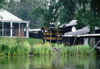
The river down to Three Rivers Junction is lined with ritzy but not especially nice houses. The six miles to the junction pass in the rain; it is mostly a pleasant downpour. It lets up at the junction. Three Rivers Junction is anticlimactic considering it has the greatest volume of traffic within the whole canal system. The terminal wall is low and rundown. There is a sign saying "Erie Canal, Albany 170 miles. Oswego 24 miles." There is another sign for Buffalo, but I don't recall its mileage.
Two swift miles bring me to the town of Phoenix. Phoenix is the most boat-friendly town I've seen to date, with many businesses positioned so that the boater can easily get to them from the town's wall.
As I'm waiting for Lock O-1, a small powerboat with two men and two women careens at low speed into the wall where I was attempting to stay on station. I move off to the mid channel to avoid them. They clearly have little idea what they are doing, but are cheerful and friendly while incompetently tying up their boat. Once their antics subside, the lock opens its gates and lets me in.
The Oswego locks are quieter than the Erie locks, which might just be an AC/DC issue. Generally, the Erie Canal has older DC motors to operate the gates and valves, while the Oswego canal has newer AC motors.
I'm all the way through Lock O-3 in Fulton (another boat-friendly town) by 5:00 p.m. The lockmaster suggests that I might find a bad campsite at the end of his breakwater wall along the dam output. I press on. I pass a lot of houses, a few boats heading upstream, a very talented waterskier, and a few islands. One of the islands is Battle Island, theoretically part of a state park. The mainland part of the park looks to be a golf course. Although I could have camped on the island, I don't because there is too much activity (fishermen, boats, waterskiing) near it.
6:40 finds me already at Lock O-5 (there is no Lock 4 on the Oswego River). I have to wait ten minutes for the lockmaster, as he can't hear my horn above the hydroelectric power plant next door. After he lets me into the lock and begins draining it, we decide that my best camping option is the town of Minetto's park just above the lock. He refills the lock without letting me out, then reopens the upstream gates.
The town park is undergoing an improvement project. The cruising guide confidently claims all manner of nonexistent facilities, all to be ready in September 2000. I take out at the very shabby boat ramp, pitch my tent alongside a white building owned by the canals, and walk across the street to sit on the bench in front of town hall.
Last night the gasket on my stove's fuel bottle broke. I had just replaced the gasket before this trip so that I wouldn't have an old worn gasket. I don't feel like fooling with it (I probably could have improvised), so dinner ends up being nuts and Gatorade purchased at a local mini mart. The mini mart is the only grocery in town from my short random walks, and is quite popular until it closes at 9 p.m.
Total mileage: 181 1/2 miles. Today: 25 1/2 miles.
Sunday, 10 September 2000
Up and packed early, but I wait until 8:30 to launch because the mists are too thick to allow safe navigation. Locked through with almost no delay, then heading down the final stretch of river.
This is a pleasant area with houses of all qualities. There is only a single fisherman out. I watch the gulls and terns ripping apart dead fish, and generally enjoy myself. Paddling is not much effort.
Lock 6 has just released a boat, so I don't have to wait or signal. I talk to the lockmaster about my trip so far. He clearly radios ahead to Lock 7. Lock 7 is manned by an older fellow, who is delighted with my trip. He asks what gave me the idea to canoe from Troy to Oswego, and I state that it is the closest route to a Great Lake. He takes a couple of photographs of me, and tells me of a woman from Fulton who did much the same trip a few years ago, apparently in two stages and with a mild amount of support. I am thrilled to have some attention.
Lock 8 follows on the heels of Lock 6 and Lock 7. Again, the lockmaster has already heard that I've come from Troy. I get her to take some photographs of me with my own camera before lowering the water. There are several people working at the lock, and they all wave as I depart. Lake Ontario is in sight.
Oswego harbor is choked with fishing boats, all trolling for salmon. I see the third other muscle-powered boat of the trip, a row boat being rowed backwards (with the rower facing forward). Strange. I thread my way through the fishing boats, going faster than some and slower than others. I avoid a boat with a fish on a line, then head out.
Past the last breakwater. Past the lighthouse. Past the last navigation buoy. Lake Ontario beckons. I take a few photographs, then come about to return.
Total mileage: 190 miles. Today: 8 1/2 miles.
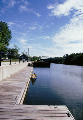
My put-in spot on the Hudson River.
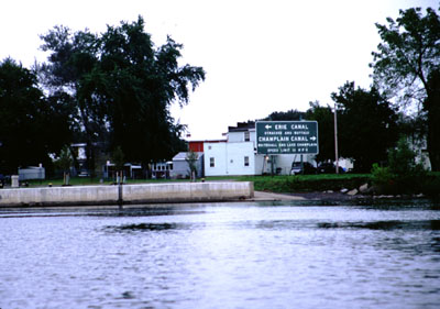
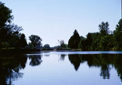
The sign where the Mohawk River and the Erie Canal head west, the Hudson River and the Champlain Canal head north, and the Hudson River flows south to Troy, Albany, and ultimately New York City.
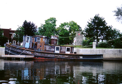
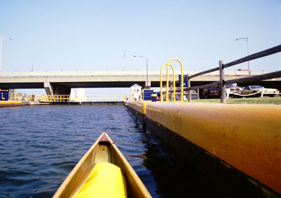
An old metal tugboat that is being refurbished, tied up along the Waterford Terminal just below Erie Canal Lock 2.
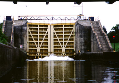
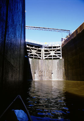
Lock 2, closed and venting water. The water level is being dropped to let me in. I'm directly beneath an old railway bridge.
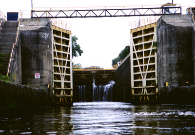
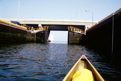
Lock 2 opening.
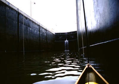
The interior of Lock 3. Different locks look different. Lock 2 had pitted concrete; Lock 3 had smooth concrete.
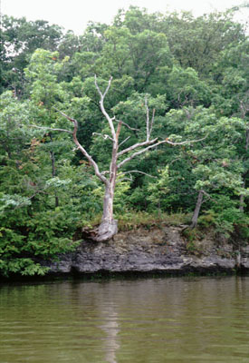
A tree along the shore of the Mohawk River, somewhere near GE.
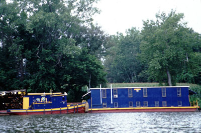
A NYS Canal Corporation tugboat and living-quarters barge. These were tied up just downstream of a dredger.
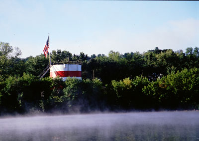
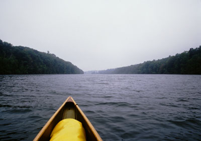
Mist rising from the Mohawk River as seen from the Fonda Terminal Wall.
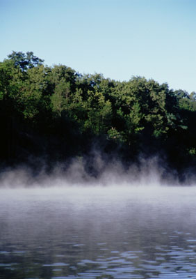
More mist rising from the Mohawk.
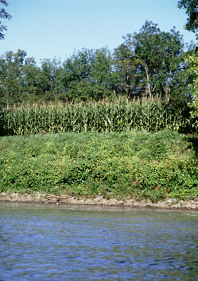
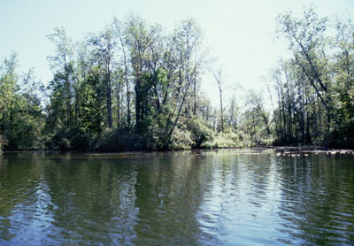
One of the many fields along the river.
Lock 13. Many locks had flood control dams that are not used for hydroelectric power. This one was typical in their construction.
A freight train along the highly used rail corridor.
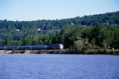
An Amtrak train. I saw three or four of these during the day.
A section of the Erie Canal. Here it is a different channel than the Mohawk River.
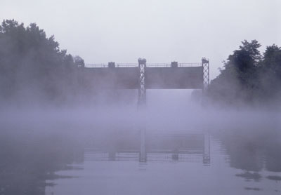
Mists rising in front of Guard Gate 3. It is wonderful to canoe through the mists.
The inside of the mammoth Lock 17.
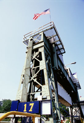
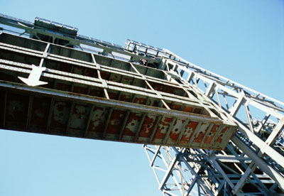
The superstructure of Lock 17 used to raise the lift gate. Taken after my trip on the way home.
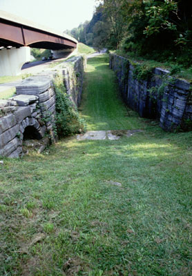
One of the locks used on the Erie Canal in the 1800s. This is located near Lock 17.
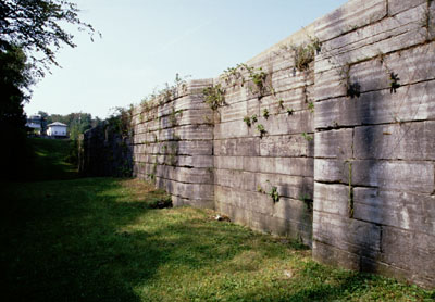
The wall of one of the old locks. This is the section where the lock gate fit in.
The attractive town of Little Falls.
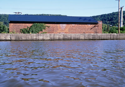
A brick building along the channel in Little Falls.
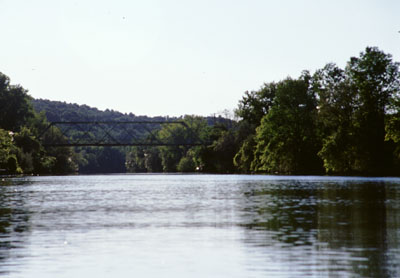
One of the Guard Gates. For some reason I really enjoy the view of items as I canoe under them.
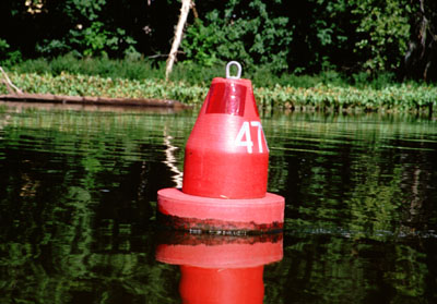
No, this is not buoy 47. All red buoys have even numbers.
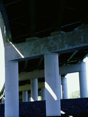
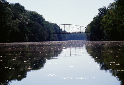
The Interstate 90 bridge near Herkimer.
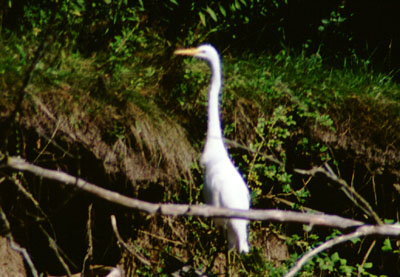
I saw many of these birds.
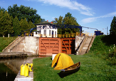
My delightful campsite at Lock 20. This was my favorite camping spot of the trip.
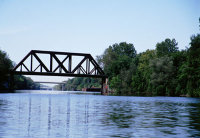
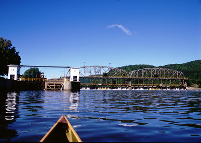
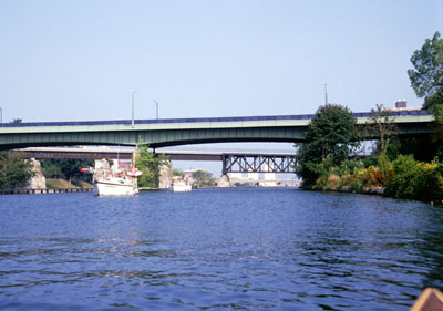
Bridges as I approach the city of Rome.
My canoe, the Dog Sally, tied up at the dock in Rome. Barges are visible in the background.
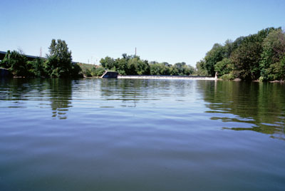
This is where the Mohawk River departs from the Erie Canal for the last time, just west of the Rome park.
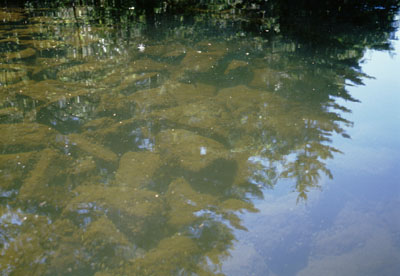
When the sun was high, I could see into the waters of the canal, which would show verdure covered rocks, small shellfish, schools of fish, and aquatic plants.
The height of land along the Erie Canal. This is the creek that supplies the water for this region.
Approaching Lock 21, the first lock that I will descend.
A bridge across the Oneida River. I enjoyed the reflections of the support beams in the water.
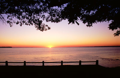
Sunset on Oneida Lake, as seen from Verona Beach State Park.
The tripods appeared on the horizon causing terror and consternation. Wait, that's a different story. The shores of Oneida Lake principally were lined with vacation homes. It isn't very scenic, especially with algae bloom.
Three Rivers Junction, where the Oswego Canal separates from the Erie Canal. Only 24 more miles to Lake Ontario.
The Oswego River.
I've just locked through Lock O-7. Several boats are passing me to get in.
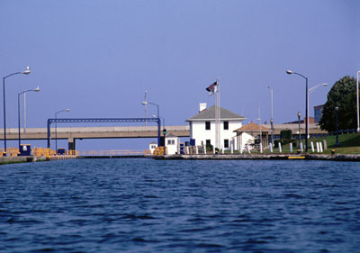
Lock O-8, the last on my trip. Lake Ontario is visible in the background.
The inside of Lock 8 with the water level up.
A photograph of me taken by the lockmaster of Lock 8.
The inside of Lock 8 with the water level down.
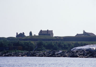
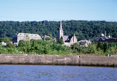
Fort Ontario, visible on a bluff to the east of where the Oswego River empties into the harbor.
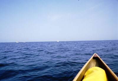
Lake Ontario and a limitless horizon.
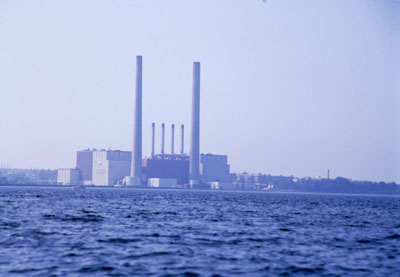
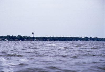
A power plant on the shores of the lake, viewed from outside of the harbor's breakwater.
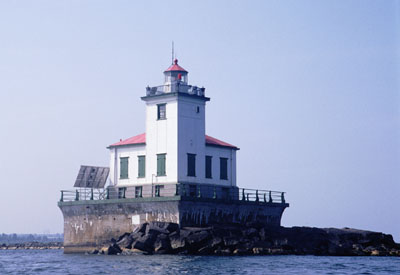
The Oswego lighthouse, seen as I return to the harbor.